world.wikisort.org - India
Pachora is a town and a municipal council in Jalgaon district in the Indian state of Maharashtra. It sits on the banks of the Hivra River. It includes 25 wards with 25 members of Nagarpalika. Pachora has a large rural infrastructure with 95 gram panchayats which is the largest in any other tehsil place in Maharashtra. The Central Pachora is under Jalgaon Lok sabha Constituency.[1]
Pachora | |
|---|---|
town | |
 Pachora Location in Maharashtra, India | |
| Coordinates: 20.67°N 75.35°E | |
| Country | |
| State | Maharashtra |
| District | Jalgaon |
| Government | |
| • Type | Municipal council |
| • Body | Pachora Municipal Council |
| Elevation | 261 m (856 ft) |
| Population (2011) | |
| • Total | 59,609 |
| Languages | |
| • Official | Marathi |
| Time zone | UTC+5:30 (IST) |
| PIN | 424201 |
| Telephone code | +91(02596) |
| Vehicle registration | MH-19 |
| Lok Sabha Constituency | Jalgaon |
| Vidhan Sabha Constituency | Pachora |
This article needs additional citations for verification. (January 2022) |
Demographics
According to the 2011 census, population of Pachora was 2,55,000.[2] Pachora Census Town hosts over 32787 houses.
The population of children aged of 0-6 is 40, which is 18.96% of the total. The female sex ratio is .758 against a state average of .929. The Child Sex Ratio is around .739 compared to the Maharashtra state average of .894. The literacy rate is 84.67%. The male literacy is around 83.9% while female literacy rate is 81.65%.
History
Pachora Municipal Council was established on 1 April 1947. Pachora grabbed a Vidhan-Sabha Constituency in 1952.
Administration
The Council is authorized to build roads within Census Town limits and impose taxes on properties coming under its jurisdiction.
Economy
Pachora has an agricultural economy. Its major crops are cotton, banana, maize, jowar, and bajara. The city has other businesses like gold and cloth markets. The primary livelihood is the cultivation of bananas and bajara.
Festivals
Pachora has many historic temples. The Panchaleshwar temple was bui by the Pandavas during their stay. It is said that Draupadi a.k.a. Panchali was a ardent devotee of Lord Shiva, she expressed her will to build a temple for Shiva.
In Rath Galli, Balaji Mandir Temple is about 250 years old. Every year, its festival is celebrated and is called mela (fair) of 'Balaji Rath Yatra'. A 50-foot-high wooden Rath of Balaji Maharaj is pulled in its nearer specific route. Yatra starts in the morning and continues into the night. On KakanBardi hill, the fair ("Khandoba") has been celebrated for the last 800 years since the temple was constructed. This temple is situated on the top of a hill, 4 km from Pachora. It is also known as "Jai Malhar".
Pachora has two prominent temples, one of Goddess Kaila Mata Mandir (Bhadgaon road) and the other of Jagdamba Devi Mandir (Rath Galli). In both temples, during "Navratri Utsav", the holy program of Dandiya is celebrated for the 9 days of Navratri.
Transport
Rail
Pachora is on the main line track of the central railway. It is 50 km from Jalgaon District station and 72 km from Bhusawal Junction. It is three hours from Nasik Road railway station and 6 hours from Mumbai.
Pachora–Jamner railway is a narrow-gauge branch line that connects Pachora to Jamner which is nearer to Ajanta Caves.[3] The railway line was constructed by Shapoorji Godbole and Co. The Pachora to Pahur section was opened up in 1918 and the rest of the sections in 1919. On termination of the contracts with the former Great Indian Peninsula Railway Company, the line was brought under direct State management with effect from 1 July 1925.[4]
Road
Pachora sits on state highway Nagpur-Pune and Nagpur-Surat. It is on the main state road network of state. It is 48 km from Jalgaon & 90 km from Dhule & 210 km From Nasik.
Air
Jalgaon Airport is the nearest airport (approximately 50 km).
Gallery
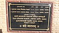 Hutatma Smarak Pachora
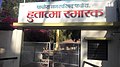 Martyr Memorial


See also
- Pachora Junction
- Pachora Vidhansabha Constituency
- Pachora Municipal Council
- Ajanta Caves
References
- Pachora Municipal Council. "Pachora Municipal Council Info". Retrieved 13 November 2015.
- Pachora Population. "Population of Pachora". Archived from the original on 12 May 2013. Retrieved 13 November 2015.
- PJ Narrow Gauge Train. "Pachora to Jamner Narrow Gauge Train". Retrieved 13 November 2015.
- PJ Narrow Gauge Train. "Pachora to Jamner Narrow Gauge Train". Retrieved 13 November 2015.
Jalgaon district topics | ||
|---|---|---|
| History |
|  |
| Tehsils | ||
| Lok Sabha constituencies |
| |
| Vidhan Sabha constituencies |
| |
| Towns and villages |
| |
| Places of interest |
| |
| Authority control |
|
|---|
На других языках
[de] Pachora
Pachora ist eine Stadt im indischen Bundesstaat Maharashtra. Die Stadt liegt am Ufer des Flusses Hivra.- [en] Pachora
Другой контент может иметь иную лицензию. Перед использованием материалов сайта WikiSort.org внимательно изучите правила лицензирования конкретных элементов наполнения сайта.
WikiSort.org - проект по пересортировке и дополнению контента Википедии