world.wikisort.org - India
Kishorpura is a patwar circle and village in ILRC Nimera in Phagi Tehsil in Jaipur district, Rajasthan. Kishorpura is also a patwar circle for nearby villages, Beer Ramchandrapura, Bimalpura, Mohanpura Rajawatan, Ramchandrapura and Lakhawas.
Kishorpura | |
|---|---|
village | |
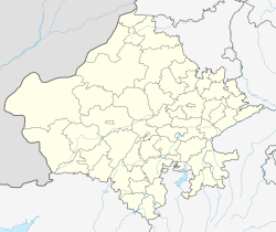  Kishorpura Location in Rajasthan, India  Kishorpura Kishorpura (India) | |
| Coordinates: 26.46085°N 75.57117°E | |
| Country |  India |
| State | Rajasthan |
| District | Jaipur |
| Talukas | Phagi |
| Area | |
| • Total | 2.92 km2 (1.13 sq mi) |
| Elevation | 383 m (1,257 ft) |
| Population | |
| • Total | 806[2] |
| • Density | 276/km2 (710/sq mi) |
| Languages | |
| • Official | Hindi |
| Time zone | UTC+5:30 (IST) |
| PIN | 303005 |
| Telephone code | 911430 |
| ISO 3166 code | RJ-IN |
| Lok Sabha constituency | Ajmer |
| Vidhan Sabha constituency | Dudu[3] |
| Distance from Phagi | 35 kilometres (22 mi) South (land) |
| Distance from Malpura | 46 kilometres (29 mi) North-East (land) |
In Kishorpura, there are 110 households with total population of 806 (with 50.74% males and 49.26% females), based on 2011 census.[1] Total area of village is 2.92 km2. There is one primary school and one post office in Kishorpura village.
References
- Census India Archived 2008-01-08 at the Wayback Machine
- "populationofindia.co.in". www.populationofindia.co.in.
- "Archived copy" (PDF). Archived from the original (PDF) on 5 October 2010. Retrieved 23 October 2013.
{{cite web}}: CS1 maint: archived copy as title (link)
Places adjacent to Kishorpura, Phagi | ||||||||||||||||
|---|---|---|---|---|---|---|---|---|---|---|---|---|---|---|---|---|
| ||||||||||||||||


Текст в блоке "Читать" взят с сайта "Википедия" и доступен по лицензии Creative Commons Attribution-ShareAlike; в отдельных случаях могут действовать дополнительные условия.
Другой контент может иметь иную лицензию. Перед использованием материалов сайта WikiSort.org внимательно изучите правила лицензирования конкретных элементов наполнения сайта.
Другой контент может иметь иную лицензию. Перед использованием материалов сайта WikiSort.org внимательно изучите правила лицензирования конкретных элементов наполнения сайта.
2019-2026
WikiSort.org - проект по пересортировке и дополнению контента Википедии
WikiSort.org - проект по пересортировке и дополнению контента Википедии