world.wikisort.org - India
Kaveripakkam is a town panchayat in Ranipet district in the Indian state of Tamil Nadu.
This article needs additional citations for verification. (June 2016) |
Kaveripakkam | |
|---|---|
Town | |
| Nickname: Kaveripauk | |
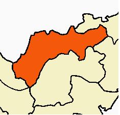
 Kaveripakkam Location in Tamil Nadu, India | |
| Coordinates: 12.901667°N 79.463889°E | |
| Country | |
| State | Tamil Nadu |
| Region | Ranipet |
| District | Ranipet |
| Talukas | Nemili |
| Elevation | 160 m (520 ft) |
| Population (2011)[1] | |
| • Total | 14,583 |
| Languages | |
| • Official | Tamil |
| Time zone | UTC+5:30 (IST) |
| PIN | 632 508 |
| Telephone code | 04177 |
| Vehicle registration | TN-73 |
| Lok Sabha constituency | Arakonam |
| Vidhan Sabha constituency | Sholinghur |
| Other Languages | Telugu, Urdu |
Demographics
As of the 2011 India census,[2] Kaveripakkam had a population of 14,583. Males constitute 50% of the population and females 50%. Kaveripakkam has an average literacy rate of 72%, higher than the national average of 59.5%: male literacy is 79%, and female literacy is 64%. In Kaveripakkam, 9% of the population is under 6 years of age.
Attractions
Kaveripakkam has a lake built by King Nandivarman III of Pallava dynasty. This place was called 'Kavithapakkam' during the reign of the Pallavas. Recent excavations have unearthed 16th century artifacts such as pottery materials and burnt clay products. These artifacts are now displayed at Government Museum in Vellore.
Kaveripakkam lake is the second largest lake in Tamil Nadu. This lake irrigates more than 30 villages.
Location
On the northern banks of the Palar River, Kaveripakkam is a town in Ranipet District of Tamil Nadu. This town, also known as Kaveripak, is 10 km east of Walajapet and 30 km from Kanchipuram.
Kaveripakkam is about 100 km west of Chennai, 40 km east of Vellore and 28 km west of Kanchipuram. Kaveripakkam has more than 50 small villages around the town. Kaveripakkam is the entry town of Vellore Dist
Politics
This town is part of the Sholingur (state assembly constituency) and Arakkonam (Lok Sabha constituency).
Economy
Plantain is the most predominant crop in Kaveripakkam followed by rice and sugarcane. Banana fruit and banana tree products are very famous all over the district and state. Till about 70/80 years back betel leaves and Agathi leaves used to be grown in abundance.
Transport
Kaveripakkam is 40 km from Vellore and 78 km west of Chennai International Airport. The nearest rail access points are Walajah Road Junction Railway Station and Sholinghur Railway Station.
- Nearest airport: Chennai
- Nearest seaport: Chennai
- Nearest railway station: Sholingur (Banavaram), Walaja Road
- Nearest railway junction: Katpadi, Arakonam
- Buses via Chennai to Vellore, Chennai to Arcot, Chennai to Thirupathur, Chennai to Ambur, Chennai to Gudiyatham as well from Tambaram and Kanchipuram will go via Kaveripakkam.
Education
Colleges
- Matheri Teachers Training Institute
- Kaveripakkam College of Arts & Science
- Shri Sapthagiri Institute of Technology
Schools
- Government Boys Higher Secondary School
- Government Girls Higher Secondary School
- Saraswathi Vidhyalaya Matric Higher Sec School, kaveripakkam
- Swamy Vivekananda Vidyalaya Matric School
- Bharathidhasanar Matric Higher Sec School
- Vedavalli Vidhyalaya Hr.sec school, Bagaveli
- SunBeam Matric Higher Sec School & SunBeam(CBSE) Sr.Sec.School, Sumaithangi
- Anne Marie Matric Hr.Sec. School, Thiruparkadal
- Golden Growth Vidyalaya CBSE
Notable residents
- Ariyanatha Mudaliar, the Prime Minister of Krishnadevaroya was born in Kaveripakkam.[citation needed]
- Vasuki, the wife of Tamil poet-philosopher Valluvar.[3]
- K.V.Sambandam M.A.B.L, Administrator General and Official Trustee, formerly District Court Judge
References
- "Census of India 2011: Data from the 2011 Census, including cities, villages and towns (Provisional)". Census Commission of India. Archived from the original on 16 June 2004. Retrieved 1 November 2008.
- "Census of India 2001: Data from the 2001 Census, including cities, villages and towns (Provisional)". Census Commission of India. Archived from the original on 16 June 2004. Retrieved 1 November 2008.
- G. Devaneya Paavaanar (2017). திருக்குறள் [Tirukkural: Tamil Traditional Commentary] (in Tamil) (4 ed.). Chennai: Sri Indhu Publications. pp. 32–33.
| Taluks by revenue division |
|  | ||||
|---|---|---|---|---|---|---|
| Revenue blocks |
| |||||
| Cities and towns |
| |||||
| Villages |
| |||||
Другой контент может иметь иную лицензию. Перед использованием материалов сайта WikiSort.org внимательно изучите правила лицензирования конкретных элементов наполнения сайта.
WikiSort.org - проект по пересортировке и дополнению контента Википедии