world.wikisort.org - India
Durg district is a district situated in Chhattisgarh, India. The district headquarters is Durg. The district covers an area of 2,238 km². As of 2011 it is the second most populous district of Chhattisgarh (out of 18), after Raipur.[1]
This article uses bare URLs, which are uninformative and vulnerable to link rot. (August 2022) |
Durg district | |
|---|---|
District of Chhattisgarh | |
 Mahadev Temple, Deobaloda | |
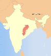
 Durg district Location in Chhattisgarh | |
| Country | |
| State | Chhattisgarh |
| Division | Durg |
| Headquarters | Durg |
| Tehsils | 3 |
| Government | |
| • Lok Sabha constituencies | 1 |
| Area | |
| • Total | 2,238 km2 (864 sq mi) |
| Population (2011) | |
| • Total | 17,217,948 |
| • Density | 7,700/km2 (20,000/sq mi) |
| Time zone | UTC+05:30 (IST) |
| Major highways | NH6 |
| Website | durg |
The district is home to two important religious sites. The principal Hindu temple, the Ganga Maiyaat Jhalmala, Jain shrine of Uwasaggaharam Parshwa Teerth at Nagpura (near Durg), attract pilgrims from all over India. The Langurveer Mandir is one and only Hindu Temple Devoted to God Langoorveer in India situated in Durg.
The town of Bhilai is home to the Bhilai Steel Plant.
The present collector of Durg is Dr. Sarveshwar Narendra Bhure.[2]
Geography
Durg is surrounded by the following districts:
1. Bemetara to the north
2. Balod to the south.
3. Raipur to the east.
4. Dhamtari to the south east
5. Rajnandgaon to the west.
Municipal corporation
- Bhilai Charoda Municipal Corporation
- Bhilai Municipal Corporation
- Durg Municipal Corporation
- Risali Municipal Corporation
Municipal council
Nagar panchayat
- Patan
- Dhamdha
- Utai
Cities in Durg
Towns in Durg
Demographics
According to the 2011 census, Durg district has a population of 3,343,872,[1] roughly equal to the nation of Uruguay[4] or the US state of Connecticut.[5] This gives it a ranking of 100th in India (out of a total of 640).[1] The district has a population density of 319 inhabitants per square kilometre (830/sq mi).[1] Its population growth rate over the decade 2001-2011 was 18.95%.[1] Durg has a sex ratio of 988 females for every 1,000 males,[1] and a literacy rate of 79.69%. After bifurcation, the district had a population of 1,726,948. Scheduled Castes and Scheduled Tribes made up 14.26% and 5.88% of the population respectively.[1]
Languages
At the time of the 2011 Census of India, 58.89% of the population in the district spoke Chhattisgarhi, 25.02% Hindi, 2.82% Telugu, 2.68% Odia, 2.24% Marathi, 2.08% Bhojpuri, 1.29% Bengali and 1.25% Punjabi as their first language.[6]
Vernaculars spoken include Chhattisgarhi and written in the Devanagari script.
References
- "District Census Handbook: Durg" (PDF). censusindia.gov.in. Registrar General and Census Commissioner of India. 2011.
- http://durg.gov.in
- "Table C-01 Population by Religion: Chhattisgarh". censusindia.gov.in. Registrar General and Census Commissioner of India. 2011.
- US Directorate of Intelligence. "Country Comparison:Population". Archived from the original on 13 June 2007. Retrieved 1 October 2011.
Uruguay 3,308,535 July 2011 est.
- "2010 Resident Population Data". U. S. Census Bureau. Archived from the original on 19 October 2013. Retrieved 30 September 2011.
Connecticut 3,574,097
- "Table C-16 Population by Mother Tongue: Chhattisgarh". www.censusindia.gov.in. Registrar General and Census Commissioner of India.
External links
- Official website
- Durg district gazetteer Hindi दुर्ग-दर्पण
На других языках
[de] Durg (Distrikt)
Durg ist ein Distrikt im indischen Bundesstaat Chhattisgarh.- [en] Durg district
[ru] Дург (округ)
Дург (англ. Durg) — округ в индийском штате Чхаттисгарх. Образован в 1906 году. Административный центр — город Дург. Площадь округа — 8549 км². По данным всеиндийской переписи 2001 года население округа составляло 2 810 436 человек. Уровень грамотности взрослого населения составлял 75,6 %, что выше среднеиндийского уровня (59,5 %). Доля городского населения составляла 38,2 %. В 1973 году из части территории округа был образован округ Нандараджгаон.Другой контент может иметь иную лицензию. Перед использованием материалов сайта WikiSort.org внимательно изучите правила лицензирования конкретных элементов наполнения сайта.
WikiSort.org - проект по пересортировке и дополнению контента Википедии
