world.wikisort.org - Germany
Tharandt (German: [ˈtaʁant] (![]() listen)) is a municipality in Saxony, Germany, situated on the Weißeritz, 9 miles southwest of Dresden.
listen)) is a municipality in Saxony, Germany, situated on the Weißeritz, 9 miles southwest of Dresden.
Tharandt | |
|---|---|
Town | |
 | |
 Coat of arms | |
Location of Tharandt within Sächsische Schweiz-Osterzgebirge district 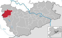 | |
 Tharandt  Tharandt | |
| Coordinates: 50°59′0″N 13°34′51″E | |
| Country | Germany |
| State | Saxony |
| District | Sächsische Schweiz-Osterzgebirge |
| Municipal assoc. | Tharandt |
| Subdivisions | 7 |
| Government | |
| • Mayor (2020–27) | Silvio Ziesemer[1] |
| Area | |
| • Total | 71.22 km2 (27.50 sq mi) |
| Elevation | 214 m (702 ft) |
| Population (2020-12-31)[2] | |
| • Total | 5,416 |
| • Density | 76/km2 (200/sq mi) |
| Time zone | UTC+01:00 (CET) |
| • Summer (DST) | UTC+02:00 (CEST) |
| Postal codes | 01737 |
| Dialling codes | 035203 |
| Vehicle registration | PIR |
| Website | www.tharandt.de |
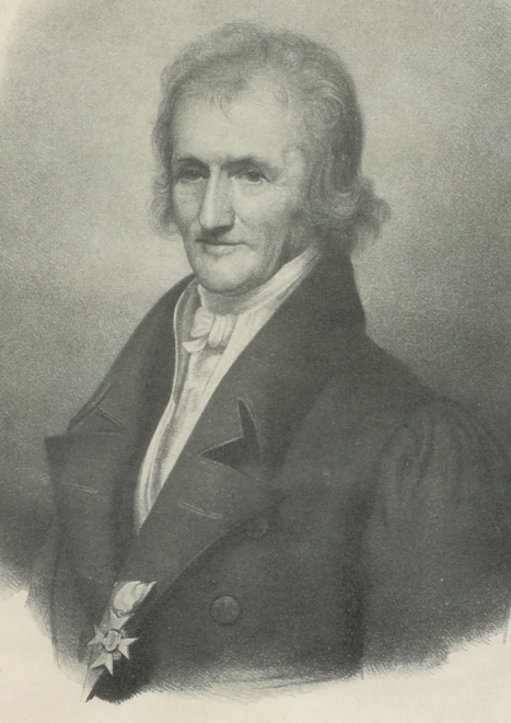
It has a Protestant Church and the oldest academy of forestry in Germany, founded as the Royal Saxon Academy of Forestry by Heinrich Cotta in 1811,[3] together with its arboretum, the Forstbotanischer Garten Tharandt. In 2002, a severe flood destroyed many of the academy buildings and the library, including some of its more-than-500-year old books. The academy was rebuilt and today has about 650 students and is famous for its long traditions of educating students from all over the world in (tropical) forestry, resource management and sustainable land use.
In the early 20th century, Tharandt was a favorite summer resort of the people of Dresden, one of its principal charms being the magnificent beech woods which surround it.[3]
Personalities connected to the town
- Sidonie of Poděbrady (died 1510 in Tharandt), Duchess of Saxony, wife of the Duke Albrecht the Boldheart
- Johann Wolfgang von Goethe (1749–1832), poet, theater director, naturalist, art theorist and statesman; he visited Heinrich Cotta several times from 1811
- Friedrich Schiller (1759–1805) was in the town in 1787
- Heinrich Cotta (1763–1844), forestry scholar, lived in Tharandt since 1811, where he was director of the Royal Saxon Forestry Academy.
- Carsten Egeberg Borchgrevink (1864 – 1934), Anglo-Norwegian polar explorer and a pioneer of modern Antarctic travel, attended the Royal Saxon Forestry Academy (1885–88)
References
- Wahlergebnisse 2020, Freistaat Sachsen, accessed 10 July 2021.
- "Bevölkerung des Freistaates Sachsen nach Gemeinden am 31. Dezember 2020". Statistisches Landesamt des Freistaates Sachsen (in German). June 2021.
- One or more of the preceding sentences incorporates text from a publication now in the public domain: Chisholm, Hugh, ed. (1911). "Tharandt". Encyclopædia Britannica. Vol. 26 (11th ed.). Cambridge University Press. p. 726.
Towns and municipalities in Sächsische Schweiz-Osterzgebirge district | ||
|---|---|---|
|  | |
Authority control | |
|---|---|
| General | |
| National libraries | |
| Other |
|
This Sächsische Schweiz-Osterzgebirge location article is a stub. You can help Wikipedia by expanding it. |
На других языках
[de] Tharandt
Tharandt ist eine Kleinstadt im sächsischen Landkreis Sächsische Schweiz-Osterzgebirge. Sie entstand in ihrer derzeitigen Ausdehnung durch den Zusammenschluss der Gemeinden Kurort Hartha, Pohrsdorf und der Stadt Tharandt im Zuge der sächsischen Gemeindegebietsreform am 1. Januar 1999,[2] ist Sitz der Verwaltungsgemeinschaft Tharandt und liegt an der Wilden Weißeritz bzw. am Tharandter Wald, südwestlich von Freital (5 km) und Dresden (13 km), östlich von Freiberg (18 km), südlich von Meißen (22 km) sowie nordwestlich von Dippoldiswalde (12 km).- [en] Tharandt
[ru] Тарандт
Тарандт (нем. Tharandt) — город в Германии, в земле Саксония. Подчинён земельной дирекции Дрезден. Входит в состав района Вайсериц. Подчиняется управлению Тарандт. Население составляет 5434 человека (на 31 декабря 2010 года). Занимает площадь 71,22 км². Официальный код района 14 2 90 440[1].Другой контент может иметь иную лицензию. Перед использованием материалов сайта WikiSort.org внимательно изучите правила лицензирования конкретных элементов наполнения сайта.
WikiSort.org - проект по пересортировке и дополнению контента Википедии