world.wikisort.org - Germany
Sauensiek is a municipality in the district of Stade, Lower Saxony, Germany.
Sauensiek | |
|---|---|
Municipality | |
Location of Sauensiek within Stade district 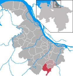 | |
 Sauensiek  Sauensiek | |
| Coordinates: 53°23′N 9°36′E | |
| Country | Germany |
| State | Lower Saxony |
| District | Stade |
| Municipal assoc. | Apensen |
| Subdivisions | 3 |
| Government | |
| • Mayor | Rolf Suhr (CDU) |
| Area | |
| • Total | 31.37 km2 (12.11 sq mi) |
| Elevation | 36 m (118 ft) |
| Population (2020-12-31)[1] | |
| • Total | 2,530 |
| • Density | 81/km2 (210/sq mi) |
| Time zone | UTC+01:00 (CET) |
| • Summer (DST) | UTC+02:00 (CEST) |
| Postal codes | 21644 |
| Dialling codes | 04169 |
| Vehicle registration | STD |
| Website | www.sauensiek.de |
Location
The Litberg, the highest point in the district of Stade, lies within the municipality of Sauensiek. It has a height of 65 metres above sea level and has been designated as a protected area.
History
Sauensiek belonged - as to its government - to the Prince-Archbishopric of Bremen, established in 1180.[2] In religious respect, however, Sauensiek formed part of the Roman Catholic Diocese of Verden until after 1566 its incumbent bishops lost papal recognition, except of a last Catholic bishop from 1630 to 1631, respectively.[2] In 1648 the Prince-Archbishopric was transformed into the Duchy of Bremen, which was first ruled in personal union by the Swedish Crown - interrupted by a Danish occupation (1712–1715) - and from 1715 on by the Hanoverian Crown. The Kingdom of Hanover incorporated the Duchy in a real union and the Ducal territory became part of the new Stade Region, established in 1823.
References
- Landesamt für Statistik Niedersachsen, LSN-Online Regionaldatenbank, Tabelle A100001G: Fortschreibung des Bevölkerungsstandes, Stand 31. Dezember 2020.
- Michael Schütz, „Die Konsolidierung des Erzstiftes unter Johann Rode“, in: Geschichte des Landes zwischen Elbe und Weser: 3 vols., Hans-Eckhard Dannenberg and Heinz-Joachim Schulze (eds.) on behalf of the Landschaftsverband der ehemaligen Herzogtümer Bremen und Verden, Stade: Landschaftsverband der ehemaligen Herzogtümer Bremen und Verden, 1995 and 2008, vol. I 'Vor- und Frühgeschichte' (1995; ISBN 978-3-9801919-7-5), vol. II 'Mittelalter (einschl. Kunstgeschichte)' (1995; ISBN 978-3-9801919-8-2), vol. III 'Neuzeit' (2008; ISBN 978-3-9801919-9-9), (=Schriftenreihe des Landschaftsverbandes der ehemaligen Herzogtümer Bremen und Verden; vols. 7–9), vol. II: pp. 263–278, here pp. 270seq. ISBN 978-3-9801919-8-2.
Towns and municipalities in Stade (district) | ||
|---|---|---|
|  | |
Authority control | |
|---|---|
| General |
|
| National libraries | |
This Stade (district) location article is a stub. You can help Wikipedia by expanding it. |
На других языках
- [en] Sauensiek
[ru] Зауэнзик
Зауэнзик (нем. Sauensiek) — коммуна в Германии, в земле Нижняя Саксония.Другой контент может иметь иную лицензию. Перед использованием материалов сайта WikiSort.org внимательно изучите правила лицензирования конкретных элементов наполнения сайта.
WikiSort.org - проект по пересортировке и дополнению контента Википедии