world.wikisort.org - Germany
Michendorf is a municipality in the Potsdam-Mittelmark district, in Brandenburg, Germany.
Michendorf | |
|---|---|
Municipality | |
 Coat of arms | |
Location of Michendorf within Potsdam-Mittelmark district 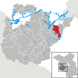 | |
 Michendorf  Michendorf | |
| Coordinates: 52°18′N 13°01′E | |
| Country | Germany |
| State | Brandenburg |
| District | Potsdam-Mittelmark |
| Subdivisions | 6 Ortsteile |
| Government | |
| • Mayor (2019–27) | Claudia Nowka[1] |
| Area | |
| • Total | 68.51 km2 (26.45 sq mi) |
| Elevation | 45 m (148 ft) |
| Population (2020-12-31)[2] | |
| • Total | 13,278 |
| • Density | 190/km2 (500/sq mi) |
| Time zone | UTC+01:00 (CET) |
| • Summer (DST) | UTC+02:00 (CEST) |
| Postal codes | 14552 |
| Dialling codes | 033205 |
| Vehicle registration | PM |
| Website | www.michendorf.de |
Geography
Michendorf lies in a vast wooded area about nine kilometers south of Potsdam. The civil parishes ("Ortsteile") Fresdorf, Stücken and Wildenbruch lie in the Nature-Park Nuthe-Nieplitz. In the south the town adjacent to the Great Seddiner Lake and to the west by the Lienewitzer lakes.
The municipality is composed by Michendorf itself and fivecivil parishes. Population statistics are as of December 31, 2011:[3]
- Fresdorf (293)
- Langerwisch (1,823)
- Michendorf (4,237)
- Stücken (492)
- Wildenbruch (1,845)
- Wilhelmshorst (3,103)
Demography
 Development of population since 1875 within the current Boundaries (Blue Line: Population; Dotted Line: Comparison to Population development in Brandenburg state; Grey Background: Time of Nazi Germany; Red Background: Time of communist East Germany)
 Recent Population Development and Projections (Population Development before Census 2011 (blue line); Recent Population Development according to the Census in Germany in 2011 (blue bordered line); Official projections for 2005-2030 (yellow line); for 2017-2030 (scarlet line); for 2020-2030 (green line)


|
|
|
History

During the Division of Germany (1945–90), Michendorf was in East Germany,[5] although only a few kilometers from West Berlin. The Michendorf rest stop was the last stop in East Germany for travelers driving into West Berlin, and a popular spot for East and West Germans to meet up with friends and family who lived on the other side of the Berlin Wall. Despite efforts by the Michendorf historical society, the rest stop was demolished in 2008.[6]
Notable residents
- Otto Böckel (1859–1923), politician notorious for exploiting anti-Semitism as a political issue, died in Michendorf.[7]
- Karin Hübner (1936–2006), actress who grew up in Michendorf.[8]
- Gerit Kling (born 1965), actress who grew up in Michendorf.
- Kurt Kreuger (1916–2006), actor, was born in Michendorf, although he grew up in Switzerland.[9]
- Bernhard Seeger (1927–1999), author, lived and worked in Michendorf.[10]
References
- Landkreis Potsdam-Mittelmark Wahl der Bürgermeisterin / des Bürgermeisters, accessed 2 July 2021.
- "Bevölkerung im Land Brandenburg nach amtsfreien Gemeinden, Ämtern und Gemeinden 31. Dezember 2020". Amt für Statistik Berlin-Brandenburg (in German). June 2021.
- (in German) Information from official website of Michendorf
- Detailed data sources are to be found in the Wikimedia Commons.Population Projection Brandenburg at Wikimedia Commons
- Marc Fischer (June 30, 1990). "E. GERMANS SAY 'AUF WIEDERSEHEN' TO LIFE AS THEY KNOW IT". Washington Post. Retrieved March 19, 2017.
- "End of the Road for Historic Rest Stop". Spiegel Online. July 17, 2008. Retrieved March 19, 2017.
- Sabine Dietzsch (September 21, 1997). "Otto Böckel". Archiveschule Marburg. Retrieved March 19, 2017. (in German)
- Peter E. Müller (July 31, 2006). "Karin Hübner (1936-2006)". Die Welt (The World). Retrieved February 11, 2017. (in German)
- "Kurt Kreuger, 89, Actor in Many War Films, Dies". New York Times. July 31, 2006. Retrieved March 19, 2017.
- "Ortsteil Stücken" [Areas of the Village]. Michendorf official website. Archived from the original on December 31, 2016. Retrieved March 19, 2017. (in German)
See also
- Michendorf–Großbeeren railway
Towns and municipalities in Potsdam-Mittelmark | ||
|---|---|---|
|  | |
This Brandenburg location article is a stub. You can help Wikipedia by expanding it. |
На других языках
[de] Michendorf
Michendorf ist eine amtsfreie Gemeinde[2] im Osten des Landkreises Potsdam-Mittelmark in Brandenburg südlich von Potsdam. Die heutige (Groß-)Gemeinde entstand 2003 durch den gesetzlich festgelegten Zusammenschluss der sechs amtsangehörigen Gemeinden des von 1992 bis 2003 existierenden Amtes Michendorf.- [en] Michendorf
[ru] Михендорф
Михендорф (нем. Michendorf) — коммуна в Германии, в земле Бранденбург.Другой контент может иметь иную лицензию. Перед использованием материалов сайта WikiSort.org внимательно изучите правила лицензирования конкретных элементов наполнения сайта.
WikiSort.org - проект по пересортировке и дополнению контента Википедии