world.wikisort.org - Germany
Edertal is a municipality in Waldeck-Frankenberg in northern Hesse, Germany.
Edertal | |
|---|---|
Municipality | |
 Coat of arms | |
Location of Edertal within Waldeck-Frankenberg district 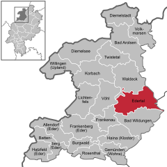 | |
 Edertal  Edertal | |
| Coordinates: 51°10′N 09°06′E | |
| Country | Germany |
| State | Hesse |
| Admin. region | Kassel |
| District | Waldeck-Frankenberg |
| Government | |
| • Mayor (2018–24) | Klaus Gier[1] (Ind.) |
| Area | |
| • Total | 115.72 km2 (44.68 sq mi) |
| Elevation | 226 m (741 ft) |
| Population (2020-12-31)[2] | |
| • Total | 6,230 |
| • Density | 54/km2 (140/sq mi) |
| Time zone | UTC+01:00 (CET) |
| • Summer (DST) | UTC+02:00 (CEST) |
| Postal codes | 34549 |
| Dialling codes | 05623, 05621 |
| Vehicle registration | KB |
| Website | www.edertal.de |
Geography
Location
Edertal lies roughly 30 km in a straight line southwest of Kassel. It is on the north and northwest edges of the Kellerwald range and stretches to the south shore of the Edersee and south and southwest of its dam. It lies at the eastern edge of the Kellerwald-Edersee National Park, a small part of which is inside municipal limits.
The community of Edertal is crossed by the river Eder, the biggest body of flowing water in the community, from northwest to southeast. Into this empties the Wesebach at the constituent community of Giflitz. The Affolderner See, which is found within municipal limits, is another reservoir used as lower reservoir for the Waldeck Pumped Storage Station (one of Germany's largest hydro power stations) and for recreation.
On the whole, hydroelectric use at the Edersee is also well developed.
Neighbouring communities
Edertal borders in the north on the town of Waldeck, in the east on the towns of Naumburg (Kassel district) and Fritzlar (Schwalm-Eder-Kreis), in the south on the town of Bad Wildungen, and in the west on the town of Frankenau and the community of Vöhl (all three in Waldeck-Frankenberg).
Constituent communities
In Giflitz is the community's administrative seat. With the neighbouring centre of Bergheim to the northeast, it forms the heart of the community and, accordingly, a lower centre in the Regional Plan (in terms of Walter Christaller's Central Place Theory).
The community of Edertal consists of the following centres:
|
|
|
Bringhausen was one of three villages that originally stood where the Edersee is now. It was relocated to higher ground early in the 20th century.
Geology
The area belongs to the foothills of the Rhenish Slate Mountains. Outcrops here are mainly shale and greywacke.
Politics
Municipal council
Edertal's council is made up of 31 councillors, with seats apportioned thus, in accordance with municipal elections held on 26 March 2006:
| SPD | 14 seats |
| CDU | 9 seats |
| FWG | 5 seats |
| FDP | 3 seats |
Note: FWG is a citizens' coalition.
- Elections in March 2016:[3]
- CDU: 6
- SPD: 10
- Greens: 3
- FDP: 3
- FW: 6
- WIR: 3
Mayor
In November 2012 Klaus Gier (independent) was elected the new mayor.[4]
References
- "Ergebnisse der letzten Direktwahl aller hessischen Landkreise und Gemeinden" (XLS) (in German). Hessisches Statistisches Landesamt. 5 September 2022.
- "Bevölkerung in Hessen am 31.12.2020 nach Gemeinden". Hessisches Statistisches Landesamt (in German). June 2021.
- "Ergebnis der Gemeindewahl am 6. März 2016". Hessisches Statistisches Landesamt. April 2016.
- "Klaus Gier mit 54,5 Prozent gewählt – Video".
External links
- Edertal at Curlie
Towns and municipalities in Waldeck-Frankenberg district | ||
|---|---|---|
 | ||
Authority control | |
|---|---|
| General | |
| National libraries | |
На других языках
[de] Edertal
Edertal ist eine an der Eder gelegene Gemeinde im nordhessischen Landkreis Waldeck-Frankenberg. Überregional bekannt ist die Gemeinde durch den Edersee und den Naturpark Kellerwald-Edersee, der den Nationalpark Kellerwald-Edersee einschließt. In Bezug auf diesen trägt die Gemeinde seit dem 21. Februar 2019 die amtliche Zusatzbezeichnung Nationalparkgemeinde.[2]- [en] Edertal
[ru] Эдерталь
Эдерталь (нем. Edertal) — коммуна в Германии, в земле Гессен. Подчиняется административному округу Кассель. Входит в состав района Вальдек-Франкенберг. Население составляет 6576 человек (на 31 декабря 2010 года).[1] Занимает площадь 115,72 км². Официальный код — 06 6 35 009.Другой контент может иметь иную лицензию. Перед использованием материалов сайта WikiSort.org внимательно изучите правила лицензирования конкретных элементов наполнения сайта.
WikiSort.org - проект по пересортировке и дополнению контента Википедии