world.wikisort.org - Germany
Bad Kohlgrub is a German municipality in the district of Garmisch-Partenkirchen, in Bavaria. It lies 12 kilometres (7.5 mi) west of Murnau am Staffelsee and 8 kilometres (5.0 mi) north of Oberammergau, and is connected to both by the Ammergau Railway.
Bad Kohlgrub | |
|---|---|
Municipality | |
 Bad Kohlgrub from the northeast | |
 Coat of arms | |
Location of Bad Kohlgrub within Garmisch-Partenkirchen district 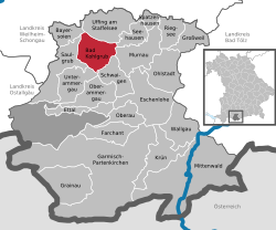 | |
 Bad Kohlgrub  Bad Kohlgrub | |
| Coordinates: 47°40′N 11°03′E | |
| Country | Germany |
| State | Bavaria |
| Admin. region | Oberbayern |
| District | Garmisch-Partenkirchen |
| Government | |
| • Mayor (2018–24) | Franz Degele[1] (FW) |
| Area | |
| • Total | 32.66 km2 (12.61 sq mi) |
| Elevation | 828 m (2,717 ft) |
| Population (2020-12-31)[2] | |
| • Total | 2,878 |
| • Density | 88/km2 (230/sq mi) |
| Time zone | UTC+01:00 (CET) |
| • Summer (DST) | UTC+02:00 (CEST) |
| Postal codes | 82433 |
| Dialling codes | 08845 |
| Vehicle registration | GAP |
| Website | www.bad-kohlgrub.de |
Skiing facilities include 4 ski lifts, 4 pistes and 30 kilometres (19 mi) of cross-country skiing trails.[3] A chairlift (opened 1954[4]) south of the town leads up to the Hörnlehütte below the summit of the Hörnle mountain (1,547 metres/5,075 ft).[5]
Transport
The municipality has two railway stations, Bad Kohlgrub and Bad Kohlgrub Kurhaus, on the Ammergau Railway.
References
Wikimedia Commons has media related to Bad Kohlgrub.
Wikivoyage has a travel guide for Bad Kohlgrub.
- Liste der ersten Bürgermeister/Oberbürgermeister in kreisangehörigen Gemeinden, Bayerisches Landesamt für Statistik, accessed 19 July 2021.
- "Tabellenblatt "Daten 2", Statistischer Bericht A1200C 202041 Einwohnerzahlen der Gemeinden, Kreise und Regierungsbezirke". Bayerisches Landesamt für Statistik (in German). June 2021.
- "Bad Kohlgrub Ski Resort Guide". snow-forecast.com. Retrieved 1 September 2012.
- "Hörnle chairlift". Ammergauer Alpen GmbH. Archived from the original on 10 February 2013. Retrieved 1 September 2012.
- BY 7: Ammergebirge Ost, Pürschling. Hörnle (Map). 1:25000. Alpenvereinskarte Bayerische Alpen. Deutscher Alpenverein. 2009.
Towns and municipalities in Garmisch-Partenkirchen (district) | ||
|---|---|---|
 | ||
Authority control | |
|---|---|
| General | |
| National libraries | |
| Other |
|
This Garmisch-Partenkirchen district location article is a stub. You can help Wikipedia by expanding it. |
На других языках
- [en] Bad Kohlgrub
[ru] Бад-Кольгруб
Бад-Кольгруб (нем. Bad Kohlgrub) — коммуна в Германии, в земле Бавария.Текст в блоке "Читать" взят с сайта "Википедия" и доступен по лицензии Creative Commons Attribution-ShareAlike; в отдельных случаях могут действовать дополнительные условия.
Другой контент может иметь иную лицензию. Перед использованием материалов сайта WikiSort.org внимательно изучите правила лицензирования конкретных элементов наполнения сайта.
Другой контент может иметь иную лицензию. Перед использованием материалов сайта WikiSort.org внимательно изучите правила лицензирования конкретных элементов наполнения сайта.
2019-2026
WikiSort.org - проект по пересортировке и дополнению контента Википедии
WikiSort.org - проект по пересортировке и дополнению контента Википедии