world.wikisort.org - France
Vieux-Vy-sur-Couesnon (French pronunciation: [vjø vi syʁ kwɛnɔ̃], literally Vieux-Vy on Couesnon; Breton: Henwig-ar-C'houenon; Gallo: Vioez-Vic) is a commune in the Ille-et-Vilaine department in Brittany in northwestern France.
Vieux-Vy-sur-Couesnon
Henwig-ar-C'houenon | |
|---|---|
Commune | |
 The church in Vieux-Vy-sur-Couesnon | |
Location of Vieux-Vy-sur-Couesnon  | |
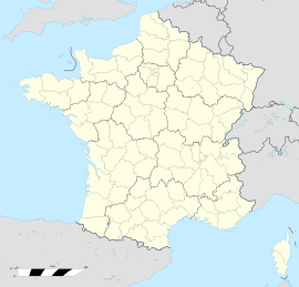  Vieux-Vy-sur-Couesnon 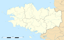 Vieux-Vy-sur-Couesnon | |
| Coordinates: 48°20′33″N 1°29′18″W | |
| Country | France |
| Region | Brittany |
| Department | Ille-et-Vilaine |
| Arrondissement | Rennes |
| Canton | Val-Couesnon |
| Government | |
| • Mayor (2020–2026) | Pascal Dewasmes[1] |
| Area 1 | 21.56 km2 (8.32 sq mi) |
| Population | 1,245 |
| • Density | 58/km2 (150/sq mi) |
| Time zone | UTC+01:00 (CET) |
| • Summer (DST) | UTC+02:00 (CEST) |
| INSEE/Postal code | 35355 /35490 |
| Elevation | 22–107 m (72–351 ft) |
| 1 French Land Register data, which excludes lakes, ponds, glaciers > 1 km2 (0.386 sq mi or 247 acres) and river estuaries. | |
Geography
Vieux-Vy-sur-Couesnon is located on the Couesnon River 33 km northeast of Rennes and 35 km (22 mi) south of Mont Saint-Michel.
The neighboring communes are Romazy, Chauvigné, Saint-Christophe-de-Valains, Saint-Ouen-des-Alleux, Mézières-sur-Couesnon, Gahard, and Sens-de-Bretagne.
History
The name Vieux-Vy-sur-Couesnon probably comes from the Latin Vetus Victus, "old market town." The settlement has had this name since at least 1063.
Economy
Industries:
- Silver-lead ore was mined in the 19th century at a place called Brais. The mine was closed in 1956.
- A granite quarry is still in operation in the northeast, not far from the former mine site.
Population
Inhabitants of Vieux-Vy-sur-Couesnon are called Vieuxviciens in French.
| Year | Pop. | ±% |
|---|---|---|
| 1962 | 1,023 | — |
| 1968 | 941 | −8.0% |
| 1975 | 928 | −1.4% |
| 1982 | 835 | −10.0% |
| 1990 | 863 | +3.4% |
| 1999 | 861 | −0.2% |
| 2009 | 1,095 | +27.2% |
Transportation
The village is served by just one bus route, the Rennes/Antrain line.
Sights
- The Saint-Germain church, most of which dates from the seventeenth century, although certain parts date from the eleventh century. The organ was installed in 1883.
- The Chateau of Moulinet, dating from the nineteenth century.
- The Grotto of Brais (dedicated to the Virgin Mary).
- Within the village boundaries there are seven watermills on the Couesnon river. These are mainly paper mills.
- The cyclopean Wall of Orange (from the Iron Age).
- A trough-shaped granite sarcophagus, first mentioned in 1020, located at the door to the church.
See also
References
- "Répertoire national des élus: les maires". data.gouv.fr, Plateforme ouverte des données publiques françaises (in French). 2 December 2020.
- "Populations légales 2019". The National Institute of Statistics and Economic Studies. 29 December 2021.
External links

All these links are in French.
- Official website
- Présentation de la commune de Vieux-Vy-sur-Couesnon, Patrimoine Bretagne


На других языках
- [en] Vieux-Vy-sur-Couesnon
[es] Vieux-Vy-sur-Couesnon
Vieux-Vy-sur-Couesnon (Bretón: Henwig-ar-C'houenon) es un pueblo en el oeste de Francia, situado en la frontera de Bretaña, en el río Couesnon.Другой контент может иметь иную лицензию. Перед использованием материалов сайта WikiSort.org внимательно изучите правила лицензирования конкретных элементов наполнения сайта.
WikiSort.org - проект по пересортировке и дополнению контента Википедии