world.wikisort.org - France
Vic-sur-Cère (French pronunciation: [vik syʁ sɛʁ], literally Vic on Cère; Auvergnat: Vic de Cera or Vic de Carladés) is a commune in the Cantal department in south-central France.
This article may be expanded with text translated from the corresponding article in French. (December 2008) Click [show] for important translation instructions.
|
Vic-sur-Cère | |
|---|---|
Commune | |
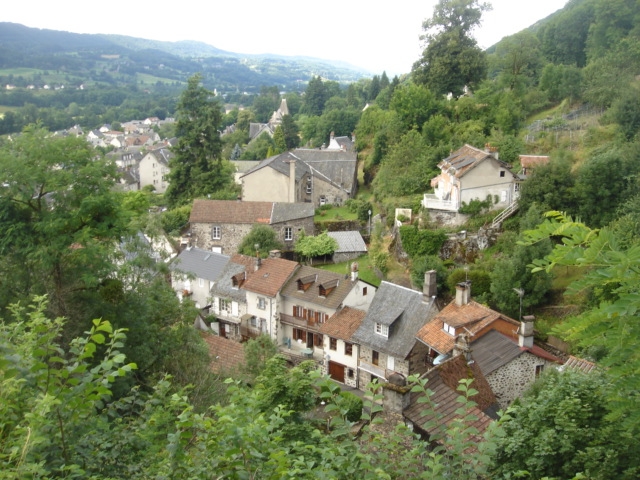 A general view of Vic-sur-Cère | |
 Coat of arms | |
Location of Vic-sur-Cère  | |
 Vic-sur-Cère  Vic-sur-Cère | |
| Coordinates: 44°58′50″N 2°37′33″E | |
| Country | France |
| Region | Auvergne-Rhône-Alpes |
| Department | Cantal |
| Arrondissement | Aurillac |
| Canton | Vic-sur-Cère |
| Intercommunality | Cère et Goul en Carladès |
| Government | |
| • Mayor (2020–2026) | Annie Delrieu-Tourtoulou |
| Area 1 | 29.37 km2 (11.34 sq mi) |
| Population | 1,838 |
| • Density | 63/km2 (160/sq mi) |
| Time zone | UTC+01:00 (CET) |
| • Summer (DST) | UTC+02:00 (CEST) |
| INSEE/Postal code | 15258 /15800 |
| Elevation | 652–1,262 m (2,139–4,140 ft) |
| 1 French Land Register data, which excludes lakes, ponds, glaciers > 1 km2 (0.386 sq mi or 247 acres) and river estuaries. | |
Population
| Year | Pop. | ±% |
|---|---|---|
| 1962 | 1,721 | — |
| 1968 | 1,782 | +3.5% |
| 1975 | 1,963 | +10.2% |
| 1982 | 2,066 | +5.2% |
| 1990 | 1,968 | −4.7% |
| 1999 | 1,890 | −4.0% |
| 2006 | 1,985 | +5.0% |
See also
References
- "Populations légales 2019". The National Institute of Statistics and Economic Studies. 29 December 2021.
Wikimedia Commons has media related to Vic-sur-Cère.
Authority control | |
|---|---|
| General | |
| National libraries | |
This Cantal geographical article is a stub. You can help Wikipedia by expanding it. |
На других языках
- [en] Vic-sur-Cère
[es] Vic-sur-Cère
Vic-sur-Cère es una población y comuna francesa, situada en la región de Auvernia, departamento de Cantal, en el distrito de Aurillac y cantón de Vic-sur-Cère.[ru] Вик-сюр-Сер
Вик-сюр-Сер (фр. Vic-sur-Cère, окс. Vic de Cera) — коммуна во Франции, находится в регионе Овернь. Департамент — Канталь. Административный центр кантона Вик-сюр-Сер. Округ коммуны — Орийак.Текст в блоке "Читать" взят с сайта "Википедия" и доступен по лицензии Creative Commons Attribution-ShareAlike; в отдельных случаях могут действовать дополнительные условия.
Другой контент может иметь иную лицензию. Перед использованием материалов сайта WikiSort.org внимательно изучите правила лицензирования конкретных элементов наполнения сайта.
Другой контент может иметь иную лицензию. Перед использованием материалов сайта WikiSort.org внимательно изучите правила лицензирования конкретных элементов наполнения сайта.
2019-2026
WikiSort.org - проект по пересортировке и дополнению контента Википедии
WikiSort.org - проект по пересортировке и дополнению контента Википедии