world.wikisort.org - France
Arpajon-sur-Cère (French pronunciation: [aʁpaʒɔ̃ syʁ sɛʁ], literally Arpajon on Cère; Occitan: Arpajon de Cera or just Arpajon) is a commune in the Cantal department in the Auvergne region of south-central France.
Arpajon-sur-Cère | |
|---|---|
Commune | |
 Gardens at the Chateau of Carbonat | |
 Coat of arms | |
Location of Arpajon-sur-Cère  | |
 Arpajon-sur-Cère  Arpajon-sur-Cère | |
| Coordinates: 44°54′17″N 2°27′27″E | |
| Country | France |
| Region | Auvergne-Rhône-Alpes |
| Department | Cantal |
| Arrondissement | Aurillac |
| Canton | Arpajon-sur-Cère |
| Intercommunality | CA Bassin Aurillac |
| Government | |
| • Mayor (2020–2026) | Isabelle Lantuejoul[1] |
| Area 1 | 47.67 km2 (18.41 sq mi) |
| Population | 6,279 |
| • Density | 130/km2 (340/sq mi) |
| Time zone | UTC+01:00 (CET) |
| • Summer (DST) | UTC+02:00 (CEST) |
| INSEE/Postal code | 15012 /15130 |
| Elevation | 566–844 m (1,857–2,769 ft) (avg. 600 m or 2,000 ft) |
| 1 French Land Register data, which excludes lakes, ponds, glaciers > 1 km2 (0.386 sq mi or 247 acres) and river estuaries. | |
The inhabitants of the commune are known as Arpajonnais or Arpajonnaises[3]
Geography
Arpajon-sur-Cère is located immediately to the south of Aurillac some 70 km south-east of Brive-la-Gaillarde. The town is an extension of the urban area of Aurillac. Access to the commune is by the D920 from Aurillac which continues south to Lafeuillade-en-Vézie. The D990 also goes from south of the town to Vézac in the east. The D58 comes from Giou-de-Mamou in the north-east then goes south-west from the town to the Château de Conros and joins the D617 at the south-western border of the commune. Much of the runway of Aurillac – Tronquières Airport is in the commune. A railway passes through the north of the commune but the nearest station is in Aurillac. Apart from the town there are the villages and hamlets of:
- Carbonnat
- Esmoles
- Le Pont
- Roquetorte
- Douarat
- Le Bousquet
- Crespiat
- Le Cambon
- Le Sal
- Les Granges
- Lapeyrusse
- Carsac
- Combelles
- Senilhes
- Les Quatre Routes
- Toules
Outside the residential areas there are extensive forests in the south and south-west with the rest of the commune farmland.[4]
The Jordanne river flows from Aurillac to join the Cère just south-west of the town with the Cère continuing west to eventually join the Dordogne at Girac.[4]
Neighbouring communes and villages
Places adjacent to Arpajon-sur-Cère | ||||||||||||||||
|---|---|---|---|---|---|---|---|---|---|---|---|---|---|---|---|---|
| ||||||||||||||||
Toponymy
The name Arpjon originates from the Gallic word Arpaionem which is composed of the word arepo meaning "plough". It was attested in 923 in the form: vicaria arpajonensis.[5] In Carladézien dialect, Arpajon is pronounced Olpotsou, according to a recording there in 2007.
History


The Dejou Féniès & son and Lartigue companies were established in the commune in the 20th century manufacturing wood especially Jouets Dejou (Dejou Toys) which are highly sought after by Doll collectors.
Heraldry
 |
Blazon: Azure, a bend of Or, between 6 escallops set in orle.
|
Administration
This list is incomplete; you can help by adding missing items. (April 2021) |
List of Successive Mayors[6]
| From | To | Name | Party |
|---|---|---|---|
| 1977 | 2014 | Roger Destannes | PS |
| 2014 | 2020 | Michel Roussy | |
| 2020 | 2026 | Isabelle Lantuejoul |
Twinning
Arpajon-sur-Cère has twinning associations with:[7]
Demography
In 2017 the commune had 6,217 inhabitants.
|
| ||||||||||||||||||||||||||||||||||||||||||||||||||||||||||||||||||||||||||||||||||||||||||||||||||||||||||||||||||
| Source: EHESS[8] and INSEE[9] | |||||||||||||||||||||||||||||||||||||||||||||||||||||||||||||||||||||||||||||||||||||||||||||||||||||||||||||||||||
Sites and Monuments


The commune has several sites and buildings that are registered as historical monuments:
- The Birthplace of Général Milhaud at 1 Avenue du Général-Milhaud (1753)[10]
- The old Pont-de-Mamou Mill on Rue Jean-Jaurès (1772)[11]
- The Château de Conros (15th century)[12]
- The Château de Conros Park[13]
- The Château de Carbonat Park[14]
- The Château de Limagne Garden[15]
- Other sites of interest
- Barrière hamlet where Louis Laparra de Fieux was born.
- The Cabrières bridge, a hamlet and a bridge which once had a toll.
- The Chateau de Ganhac currently a mansion house, a former fief awarded in 1676 to Charles de Broquin who was married to Jeanne de Cambefort.
- The Château de Montal, a former fief whose family was originally the Lords of Laroquebrou and Conros, with a castrale chapel under the invocation of Saint Michael. It then became the property of the La Roque-Montal family.
- The Chateau de La Prade, purchased in 1756 by Marie-Françoise de Broglie, the widow of Charles Robert de Lignerac who did considerable work on the building. Ruined in the French Revolution.
- The Arboretum d'Arpajon-sur-Cère
- The Parish Church contains several items that are registered as historical objects:
- The Chateau de Carbonat Picture Gallery
 The Chateau front
 The Gardens
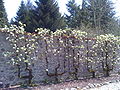 The Gardens
 An old postcard of the chateau
 An old postcard of the chateau
 The chateau in ruins
 The fireplace in the chateau
 A detail on the fireplace
 A filled-in embrasure in the chateau
 Arms of Carbonat
 A door in the chateau


Notable people linked to the commune
- Louis Laparra de Fieux (Arpajon 1651-1706), engineer of fortifications and strategist.
- Édouard Jean Baptiste Milhaud (Arpajon 1766 - Aurillac 1833), member of the National Convention, General, Count of the Empire.
- Eugene d'Humières, man of letters, translator of Kipling.
- Louis Dauzier, politician and mayor of Aurillac under the French Third Republic.
- Antoine Dusserre (Carbonnat 1865-1925), novelist.
- Léo Pons, filmmaker.
See also
References
- "Répertoire national des élus: les maires". data.gouv.fr, Plateforme ouverte des données publiques françaises (in French). 2 December 2020.
- "Populations légales 2019". The National Institute of Statistics and Economic Studies. 29 December 2021.
- Inhabitants of Cantal (in French)
- Google Maps
- Albert Dauzat
- List of Mayors of France (in French)
- National Commission for Decentralised cooperation (in French)
- Des villages de Cassini aux communes d'aujourd'hui: Commune data sheet Arpajon-sur-Cère, EHESS. (in French)
- Population en historique depuis 1968, INSEE
- Ministry of Culture, Mérimée PA00093445 Birthplace of Général Milhaud (in French)
- Ministry of Culture, Mérimée PA00093446 Pont-de-Mamou Mill (in French)
- Ministry of Culture, Mérimée PA00093444 Château de Conros (in French)
- Ministry of Culture, Mérimée IA15000309 Château de Conros Park (in French)
- Ministry of Culture, Mérimée IA15000367 Château de Carbonat Park (in French)
- Ministry of Culture, Mérimée IA15000297 Château de Limagne Park (in French)
- Ministry of Culture, Palissy PM15000060 Bronze BellPM15000059 Bronze Bell (in French)

- Ministry of Culture, Palissy PM15000058 Painting: The Placing in the Tomb (in French)
- Ministry of Culture, Palissy PM15000770 Painting: Framed Painting: The Baptism of Christ (in French)
- Ministry of Culture, Palissy PM15000552 Sarcophagus (in French)
External links
- Discovery of an early Christian sarcophagus and medieval sepulchres in sarcophagi at Arpajon-sur-Cère (in French)
- Arpajon-sur-Cère on the National Geographic Institute website (in French)
- Arpajon on the 1750 Cassini Map
Authority control | |
|---|---|
| General | |
| National libraries | |
| Other | |
На других языках
[de] Arpajon-sur-Cère
Arpajon-sur-Cère ist eine französische Gemeinde mit 6279 Einwohnern (Stand 1. Januar 2019) im Département Cantal in der Region Auvergne-Rhône-Alpes; sie gehört administrativ zum Arrondissement Aurillac.- [en] Arpajon-sur-Cère
[ru] Арпажон-сюр-Сер
Арпажо́н-сюр-Сер (фр. Arpajon-sur-Cère, окс. Arpajon de Cera) — коммуна во Франции, находится в регионе Овернь. Департамент — Канталь. Административный центр кантона Арпажон-сюр-Сер. Округ коммуны — Орийак.Другой контент может иметь иную лицензию. Перед использованием материалов сайта WikiSort.org внимательно изучите правила лицензирования конкретных элементов наполнения сайта.
WikiSort.org - проект по пересортировке и дополнению контента Википедии