world.wikisort.org - France
Tramezaïgues (French pronunciation: [tʁamza.iɡ], official name[3]) or Tramezaygues (local name) is a commune in the Hautes-Pyrénées department, in the Occitanie region of France.[3]
Tramezaïgues | |
|---|---|
Commune | |
 Tramezaïgues village seen from the Cap de Laubère, at 2200 meters | |
 Coat of arms | |
Location of Tramezaïgues  | |
 Tramezaïgues  Tramezaïgues | |
| Coordinates: 42°47′53″N 0°17′24″E | |
| Country | France |
| Region | Occitania |
| Department | Hautes-Pyrénées |
| Arrondissement | Bagnères-de-Bigorre |
| Canton | Neste, Aure et Louron |
| Government | |
| • Mayor (2020–2026) | Didier Fourtine[1] |
| Area 1 | 34.96 km2 (13.50 sq mi) |
| Population | 37 |
| • Density | 1.1/km2 (2.7/sq mi) |
| Time zone | UTC+01:00 (CET) |
| • Summer (DST) | UTC+02:00 (CEST) |
| INSEE/Postal code | 65450 /65170 |
| Elevation | 913–2,935 m (2,995–9,629 ft) (avg. 950 m or 3,120 ft) |
| 1 French Land Register data, which excludes lakes, ponds, glaciers > 1 km2 (0.386 sq mi or 247 acres) and river estuaries. | |
Geography

The commune of Tramezaïgues, in the south of the Hautes-Pyrénées department, extends from the Aure Valley to the Spanish border.
The village is located at the foot of Pic de Tramezaïgues 2,548 m (8,360 ft), and at the confluence of the Neste d'Aure and the Neste de Rioumajou. The name of Tramezaïgues is derived from the Latin description: inter ambas aquas (between two waters).
To the north of the village is the Pla d'Adet ski resort, and Aragnouet is to the west. East of the village is Loudenvielle and the Col de Val Louron-Azet. Cadeilhan-Trachère and Saint-Lary-Soulan are situated to the north-east. The Spanish border is to the south of the village.
History

The Château de Tramezaygues has been existent since the 12th century. The château was a position for monitoring the Spanish border until the French Revolution.
Sites and monuments
- The ruins of the 12th Century Château de Tramezaygues, restored in 1990 is a listed historic monument since 1980.
- The Saint-Denis Saint-Nicolas Church, of which survives the original apse of Romanesque style. The rest of the church was modified during the 16th, 17th and 19th centuries.
Politics and administration
| Period | Name |
|---|---|
| March 2001 - 2014 | Gérard Palasset |
| 2014 - current | Didier Fourtine |
Demographics
In 2017, the commune had 34 inhabitants.
Gallery
 Panorama from Tramezaïgues Valley
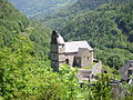 The church of Tramezaïgues
 The town hall
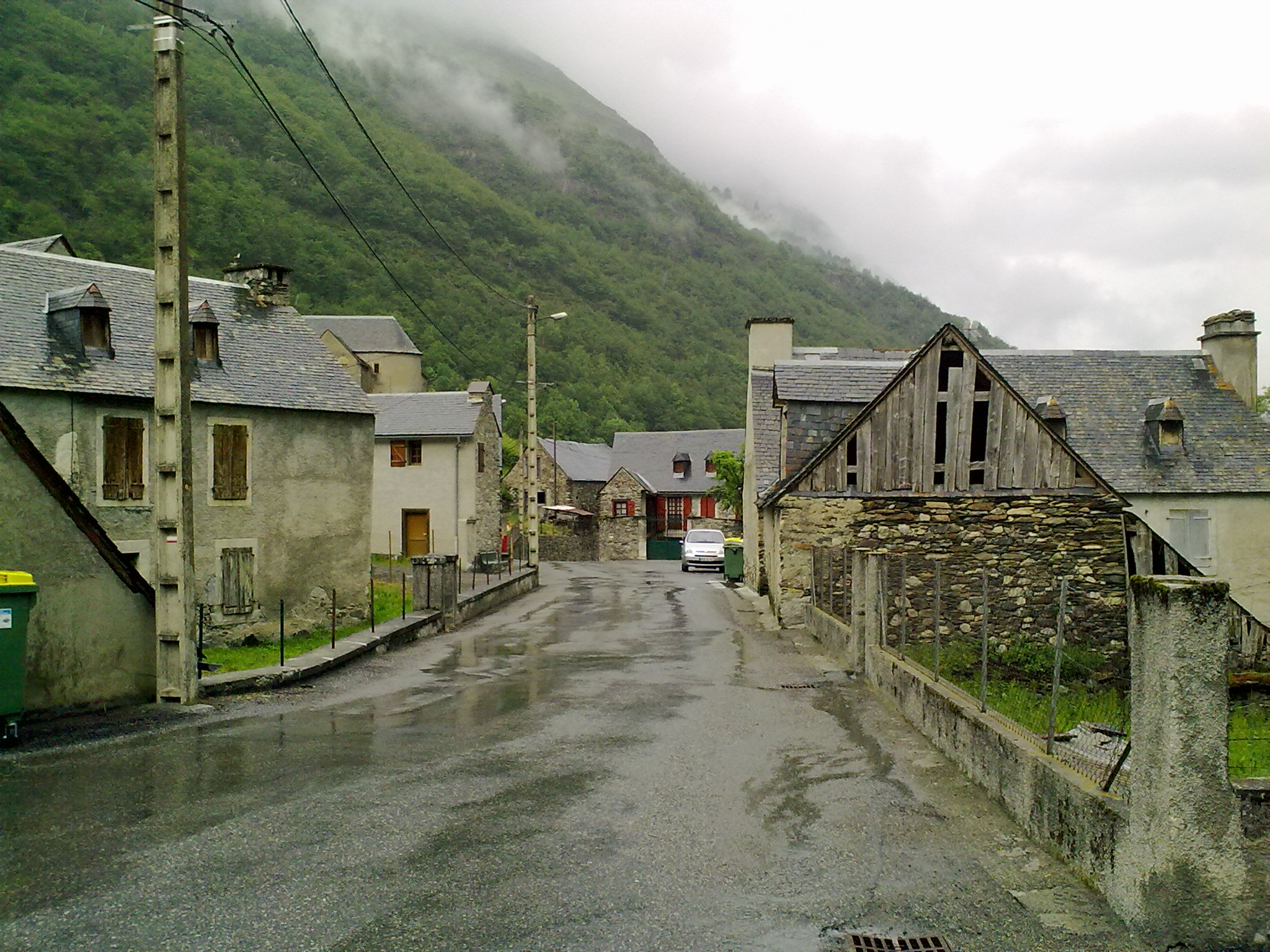
 The narrow streets of the village of Tramezaïgues
 The fountain of the village
 The village wash-house
 A village entry sign
 Street sign in the village


See also
References
- "Répertoire national des élus: les maires". data.gouv.fr, Plateforme ouverte des données publiques françaises (in French). 9 August 2021.
- "Populations légales 2019". The National Institute of Statistics and Economic Studies. 29 December 2021.
- "Code officiel géographique - Fiche de la commune de Tramezaïgues". Insee. Retrieved 21 March 2022.
This Hautes-Pyrénées geographical article is a stub. You can help Wikipedia by expanding it. |
На других языках
- [en] Tramezaïgues
[es] Tramezaïgues
Tramezaïgues es una población y comuna francesa, situada en la región de Mediodía-Pirineos, departamento de Altos Pirineos, en el distrito de Bagnères-de-Bigorre y cantón de Vielle-Aure.[ru] Трамезаиг
Трамезаи́г (фр. Tramezaïgues, окс. Tramedaigas) — коммуна во Франции, находится в регионе Юг — Пиренеи. Департамент — Верхние Пиренеи. Входит в состав кантона Вьель-Ор. Округ коммуны — Баньер-де-Бигор.Другой контент может иметь иную лицензию. Перед использованием материалов сайта WikiSort.org внимательно изучите правила лицензирования конкретных элементов наполнения сайта.
WikiSort.org - проект по пересортировке и дополнению контента Википедии