world.wikisort.org - France
Adé (French pronunciation: [ade]; Occitan: Adèr) is a commune in the Hautes-Pyrénées department in southwestern France.
Adé | |
|---|---|
Commune | |
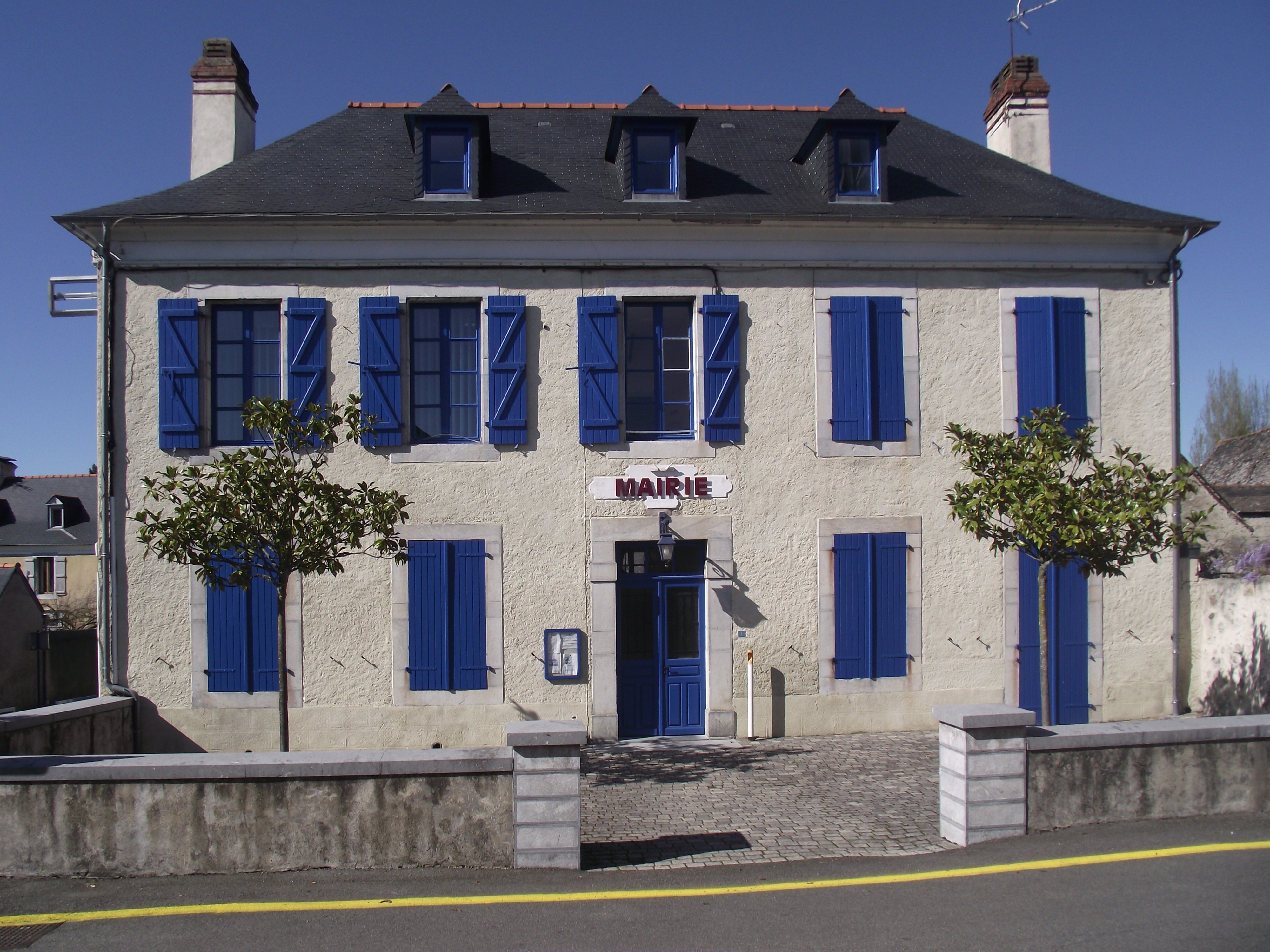 The town hall of Adé. | |
 Coat of arms | |
Location of Adé  | |
 Adé  Adé | |
| Coordinates: 43°08′05″N 0°01′34″W | |
| Country | France |
| Region | Occitania |
| Department | Hautes-Pyrénées |
| Arrondissement | Argelès-Gazost |
| Canton | Lourdes-2 |
| Intercommunality | Tarbes-Lourdes-Pyrénées |
| Government | |
| • Mayor (2020–2026) | Jean-Marc Boya[1] |
| Area 1 | 7.24 km2 (2.80 sq mi) |
| Population | 826 |
| • Density | 110/km2 (300/sq mi) |
| Time zone | UTC+01:00 (CET) |
| • Summer (DST) | UTC+02:00 (CEST) |
| INSEE/Postal code | 65002 /65100 |
| Elevation | 382–583 m (1,253–1,913 ft) (avg. 428 m or 1,404 ft) |
| 1 French Land Register data, which excludes lakes, ponds, glaciers > 1 km2 (0.386 sq mi or 247 acres) and river estuaries. | |
Geography
Adé is a commune in the Hautes-Pyrénées and part of the agglomeration of Lourdes, 5 km (3.1 mi) north of the centre of Lourdes, itself.
The commune has a weakly extended territory of 7.24 km2 (2.80 sq mi), which sprawls 382 m (1,253 ft) to the north-east, where the Geune leaves the town and enters Lanne, and 583 m (1,913 ft) to the south-east, near the locality of le Sarraut.
Transport
The N21 road travels through the commune, from north to south. The commune is also immediately adjacent to the south-western end of the Tarbes–Lourdes–Pyrénées Airport, to the north-east, along the N21 road.
Sites and monuments
- The chapel of Notre-Dame du Rosaire.
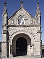
- The church of Saint-Hippolyte of Adé and the Basilica of the Immaculate Conception de Lourdes are the works of the same architect. This building with three naves was built on the former feudal motte. The cellar of the rectory is the former armory of the castle which was built in the 11th Century. Inside, a tympanum represents the martyrdom of St. Hippolytus, patron saint of the village.
- The old château, of which remain the ancient walls.
 The chapel of Notre-Dame du Rosaire
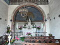 The Interior of the chapel of Notre-Dame du Rosaire
 The Church of Saint-Hippolyte


Population
| Year | Pop. | ±% |
|---|---|---|
| 1999 | 674 | — |
| 2004 | 711 | +5.5% |
| 2006 | 711 | +0.0% |
| 2007 | 731 | +2.8% |
| 2008 | 738 | +1.0% |
| 2009 | 744 | +0.8% |
| 2010 | 741 | −0.4% |
| 2011 | 748 | +0.9% |
| 2012 | 762 | +1.9% |
| 2013 | 780 | +2.4% |
| 2014 | 798 | +2.3% |
| 2015 | 802 | +0.5% |
| 2016 | 801 | −0.1% |
See also
References
- "Répertoire national des élus: les maires". data.gouv.fr, Plateforme ouverte des données publiques françaises (in French). 2 December 2020.
- "Populations légales 2019". The National Institute of Statistics and Economic Studies. 29 December 2021.
This Hautes-Pyrénées geographical article is a stub. You can help Wikipedia by expanding it. |
На других языках
[de] Adé
Adé ist eine französische Gemeinde mit 826 Einwohnern (Stand 1. Januar 2019) im Département Hautes-Pyrénées in der Region Okzitanien.- [en] Adé, Hautes-Pyrénées
[fr] Adé (Hautes-Pyrénées)
Adé est une commune française située dans l'ouest du département des Hautes-Pyrénées, en région Occitanie. Sur le plan historique et culturel, la commune est de l’ancien comté de Bigorre, comté historique des Pyrénées françaises et de Gascogne.[ru] Аде (Франция)
Аде́ (фр. Adé, окс. Adèr) — коммуна во Франции, находится в регионе Юг — Пиренеи. Департамент — Верхние Пиренеи. Входит в состав кантона Лурд-Уэст. Округ коммуны — Аржелес-Газост.Другой контент может иметь иную лицензию. Перед использованием материалов сайта WikiSort.org внимательно изучите правила лицензирования конкретных элементов наполнения сайта.
WikiSort.org - проект по пересортировке и дополнению контента Википедии