world.wikisort.org - France
Plan-d'Aups-Sainte-Baume (French pronunciation: [plɑ̃ dops sɛ̃t bom]; Provençal: Lo Plan d’Aups de la Santa Bauma) is a commune in the Var department in the Provence-Alpes-Côte d'Azur region in southeastern France. It lies to the north of the Sainte-Baume mountain range.
Plan-d'Aups-Sainte-Baume | |
|---|---|
Commune | |
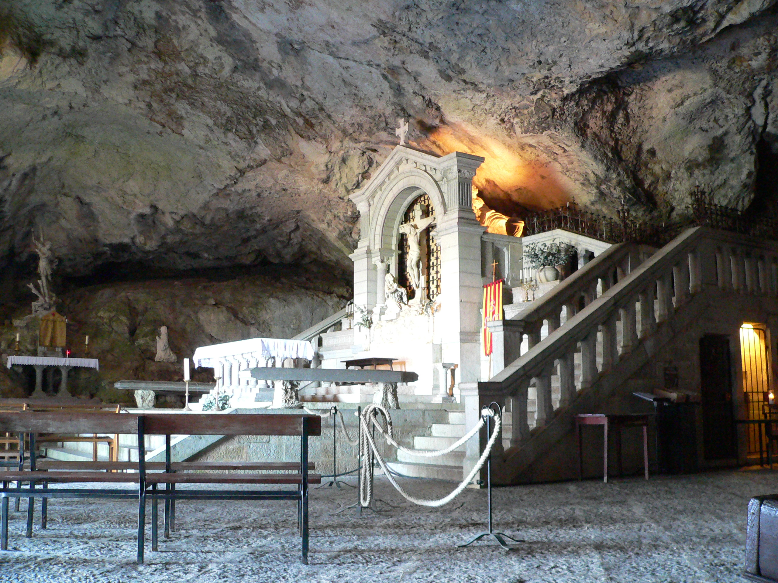 The cave of Sainte-Baume | |
 Coat of arms | |
Location of Plan-d'Aups-Sainte-Baume  | |
 Plan-d'Aups-Sainte-Baume  Plan-d'Aups-Sainte-Baume | |
| Coordinates: 43°19′46″N 5°43′01″E | |
| Country | France |
| Region | Provence-Alpes-Côte d'Azur |
| Department | Var |
| Arrondissement | Brignoles |
| Canton | Saint-Cyr-sur-Mer |
| Intercommunality | CA Provence Verte |
| Government | |
| • Mayor (2020–2026) | Carine Paillard[1] |
| Area 1 | 24.91 km2 (9.62 sq mi) |
| Population | 2,187 |
| • Density | 88/km2 (230/sq mi) |
| Time zone | UTC+01:00 (CET) |
| • Summer (DST) | UTC+02:00 (CEST) |
| INSEE/Postal code | 83093 /83640 |
| Elevation | 510–1,148 m (1,673–3,766 ft) (avg. 700 m or 2,300 ft) |
| 1 French Land Register data, which excludes lakes, ponds, glaciers > 1 km2 (0.386 sq mi or 247 acres) and river estuaries. | |
History
Second World War
In June 1944, at the aftermath of D-Day when the French Resistance went on an offensive against the German occupiers, the hills near Plan-d'Aups were the site of a bloody battle. Some 200 Maquis had set up a camp there, commanded by SOE agent Robert Burdett. They were attacked by large German forces. Though taken by surprise due to a faulty placing of guards, the Maquis did inflict considerable casualties on the Germans and many of them managed to escape into the surrounding mountains.[3]
Geography
Climate
Plan-d'Aups-Sainte-Baume has a hot-summer Mediterranean climate (Köppen climate classification Csa). The average annual temperature in Plan-d'Aups-Sainte-Baume is 14.0 °C (57.2 °F). The average annual rainfall is 1,001.8 mm (39.44 in) with November as the wettest month. The temperatures are highest on average in August, at around 23.5 °C (74.3 °F), and lowest in January, at around 6.0 °C (42.8 °F). The highest temperature ever recorded in Plan-d'Aups-Sainte-Baume was 41.6 °C (106.9 °F) on 28 June 2019; the coldest temperature ever recorded was −8.9 °C (16.0 °F) on 4 February 2012.
| Climate data for Plan-d'Aups-Sainte-Baume (1991−2020 normals, extremes 2007−present) | |||||||||||||
|---|---|---|---|---|---|---|---|---|---|---|---|---|---|
| Month | Jan | Feb | Mar | Apr | May | Jun | Jul | Aug | Sep | Oct | Nov | Dec | Year |
| Record high °C (°F) | 20.7 (69.3) |
21.1 (70.0) |
23.4 (74.1) |
27.2 (81.0) |
31.5 (88.7) |
41.6 (106.9) |
38.1 (100.6) |
39.0 (102.2) |
33.0 (91.4) |
29.0 (84.2) |
20.7 (69.3) |
18.6 (65.5) |
41.6 (106.9) |
| Average high °C (°F) | 9.1 (48.4) |
10.3 (50.5) |
13.6 (56.5) |
17.1 (62.8) |
20.9 (69.6) |
25.9 (78.6) |
29.1 (84.4) |
29.3 (84.7) |
24.3 (75.7) |
19.0 (66.2) |
13.2 (55.8) |
9.7 (49.5) |
18.5 (65.3) |
| Daily mean °C (°F) | 6.0 (42.8) |
6.5 (43.7) |
9.3 (48.7) |
12.5 (54.5) |
15.9 (60.6) |
20.4 (68.7) |
23.3 (73.9) |
23.5 (74.3) |
19.2 (66.6) |
14.8 (58.6) |
10.0 (50.0) |
6.8 (44.2) |
14.0 (57.2) |
| Average low °C (°F) | 2.9 (37.2) |
2.7 (36.9) |
5.0 (41.0) |
7.9 (46.2) |
10.8 (51.4) |
14.9 (58.8) |
17.5 (63.5) |
17.8 (64.0) |
14.1 (57.4) |
10.6 (51.1) |
6.7 (44.1) |
3.8 (38.8) |
9.6 (49.3) |
| Record low °C (°F) | −6.8 (19.8) |
−8.9 (16.0) |
−4.4 (24.1) |
−3.0 (26.6) |
1.7 (35.1) |
6.5 (43.7) |
10.2 (50.4) |
10.1 (50.2) |
2.9 (37.2) |
−2.2 (28.0) |
−5.0 (23.0) |
−8.2 (17.2) |
−8.9 (16.0) |
| Average precipitation mm (inches) | 93.3 (3.67) |
82.3 (3.24) |
82.7 (3.26) |
93.2 (3.67) |
79.4 (3.13) |
52.0 (2.05) |
21.7 (0.85) |
28.4 (1.12) |
56.0 (2.20) |
122.2 (4.81) |
168.0 (6.61) |
122.6 (4.83) |
1,001.8 (39.44) |
| Average precipitation days (≥ 1.0 mm) | 7.2 | 6.8 | 6.3 | 7.0 | 6.8 | 3.7 | 1.9 | 2.1 | 4.4 | 6.5 | 8.9 | 7.1 | 68.6 |
| Source: Météo-France[4] | |||||||||||||
See also
References
- "Répertoire national des élus: les maires" (in French). data.gouv.fr, Plateforme ouverte des données publiques françaises. 13 September 2022.
- "Populations légales 2019". The National Institute of Statistics and Economic Studies. 29 December 2021.
- Evelyn Le Chene, "Watch for Me by Moonlight" (wartime experiences of Robert Burdett), Corgi, London 1974
- "Fiche Climatologique Statistiques 1991-2020 et records" (PDF) (in French). Météo-France. Retrieved September 14, 2022.
Authority control | |
|---|---|
| General |
|
| National libraries | |
This Var geographical article is a stub. You can help Wikipedia by expanding it. |
На других языках
[de] Plan-d’Aups-Sainte-Baume
Plan-d’Aups-Sainte-Baume ist eine französische Gemeinde mit 2.187 Einwohnern (Stand 1. Januar 2019) im Département Var in der Region Provence-Alpes-Côte d’Azur. Sie gehört zum Arrondissement Brignoles und zum Kanton Saint-Cyr-sur-Mer.- [en] Plan-d'Aups-Sainte-Baume
[ru] План-д’Опс-Сент-Бом
План-д’Опс-Сент-Бом (фр. Plan-d'Aups-Sainte-Baume) — коммуна на юго-востоке Франции в регионе Прованс — Альпы — Лазурный берег, департамент Вар, округ Тулон, кантон Сен-Сир-сюр-Мер[1].Другой контент может иметь иную лицензию. Перед использованием материалов сайта WikiSort.org внимательно изучите правила лицензирования конкретных элементов наполнения сайта.
WikiSort.org - проект по пересортировке и дополнению контента Википедии