world.wikisort.org - France
Montsauche-les-Settons (French pronunciation: [mɔ̃soʃ le sɛtɔ̃]) is a commune in the Nièvre department in the region of Bourgogne-Franche-Comté in central France.[3] Montsauche-les Settons is completely rural, the commune composed of a settlement, half of Lac des Settons (lake), and a few dispersed hamlets.
Montsauche-les-Settons | |
|---|---|
Commune | |
 A general view of Montsauche-les-Settons | |
 Coat of arms | |
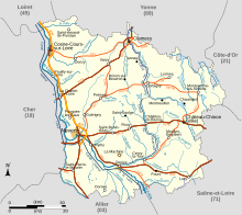
Location of Montsauche-les-Settons  | |
 Montsauche-les-Settons  Montsauche-les-Settons | |
| Coordinates: 47°12′56″N 4°01′36″E | |
| Country | France |
| Region | Bourgogne-Franche-Comté |
| Department | Nièvre |
| Arrondissement | Château-Chinon (Ville) |
| Canton | Château-Chinon |
| Intercommunality | CC Morvan Sommets et Grands Lacs |
| Government | |
| • Mayor (2020–2026) | Marie Leclercq[1] |
| Area 1 | 44.30 km2 (17.10 sq mi) |
| Population | 513 |
| • Density | 12/km2 (30/sq mi) |
| Time zone | UTC+01:00 (CET) |
| • Summer (DST) | UTC+02:00 (CEST) |
| INSEE/Postal code | 58180 /58230 |
| Elevation | 467–701 m (1,532–2,300 ft) |
| 1 French Land Register data, which excludes lakes, ponds, glaciers > 1 km2 (0.386 sq mi or 247 acres) and river estuaries. | |
Geography
The commune of Montsauche-les Settons is centrally located in Bourgogne-Franche-Comté in the Morvan mountainous massif, at the heart of the protected natural area of the Parc naturel régional du Morvan.
The settlement, located 3 km from the lake, contains all the businesses and essential services of the area. The lake area's economy is organized around tourism, while the principal economic activity of the surrounding hamlets is raising cattle and Christmas tree farming.
The associated historical place names of the area are:
|
|
Bordering Communes

See also
- Communes of the Nièvre department
- Parc naturel régional du Morvan
References
- "Répertoire national des élus: les maires". data.gouv.fr, Plateforme ouverte des données publiques françaises (in French). 2 December 2020.
- "Populations légales 2019". The National Institute of Statistics and Economic Studies. 29 December 2021.
- INSEE commune file
This Nièvre geographical article is a stub. You can help Wikipedia by expanding it. |
Другой контент может иметь иную лицензию. Перед использованием материалов сайта WikiSort.org внимательно изучите правила лицензирования конкретных элементов наполнения сайта.
WikiSort.org - проект по пересортировке и дополнению контента Википедии