world.wikisort.org - France
Macouba is a village and commune in the French overseas department of Martinique.
Macouba | |
|---|---|
Commune | |
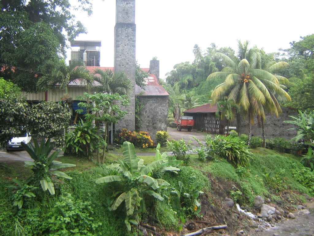 The distillery of Fonds-Préville, in Macouba | |
 Location of the commune (in red) within Martinique | |
Location of Macouba  | |
| Coordinates: 14°52′32″N 61°08′35″W | |
| Country | France |
| Overseas region and department | Martinique |
| Arrondissement | La Trinité |
| Intercommunality | CA Pays Nord Martinique |
| Government | |
| • Mayor (2020–2026) | Sainte-Rose Cakin[1] |
| Area 1 | 16.93 km2 (6.54 sq mi) |
| Population | 1,050 |
| • Density | 62/km2 (160/sq mi) |
| Time zone | UTC−04:00 (AST) |
| INSEE/Postal code | 97215 /97218 |
| Elevation | 0–1,300 m (0–4,265 ft) |
| 1 French Land Register data, which excludes lakes, ponds, glaciers > 1 km2 (0.386 sq mi or 247 acres) and river estuaries. | |
Geography
Climate
Macouba has a tropical rainforest climate (Köppen climate classification Af). The average annual temperature in Macouba is 25.4 °C (77.7 °F). The average annual rainfall is 2,803.8 mm (110.39 in) with November as the wettest month. The temperatures are highest on average in September, at around 26.5 °C (79.7 °F), and lowest in January, at around 24.0 °C (75.2 °F). The highest temperature ever recorded in Macouba was 34.0 °C (93.2 °F) on 19 September 1999; the coldest temperature ever recorded was 16.0 °C (60.8 °F) on 12 March 1974.
| Climate data for Macouba (1991−2020 normals, extremes 1974−present) | |||||||||||||
|---|---|---|---|---|---|---|---|---|---|---|---|---|---|
| Month | Jan | Feb | Mar | Apr | May | Jun | Jul | Aug | Sep | Oct | Nov | Dec | Year |
| Record high °C (°F) | 30.0 (86.0) |
31.0 (87.8) |
32.2 (90.0) |
32.3 (90.1) |
32.5 (90.5) |
32.1 (89.8) |
33.2 (91.8) |
34.0 (93.2) |
34.0 (93.2) |
33.0 (91.4) |
32.0 (89.6) |
30.5 (86.9) |
34.0 (93.2) |
| Average high °C (°F) | 26.9 (80.4) |
27.0 (80.6) |
27.7 (81.9) |
28.5 (83.3) |
29.1 (84.4) |
29.2 (84.6) |
29.3 (84.7) |
29.7 (85.5) |
29.9 (85.8) |
29.3 (84.7) |
28.4 (83.1) |
27.5 (81.5) |
28.5 (83.3) |
| Daily mean °C (°F) | 24.0 (75.2) |
24.0 (75.2) |
24.4 (75.9) |
25.2 (77.4) |
25.9 (78.6) |
26.2 (79.2) |
26.3 (79.3) |
26.5 (79.7) |
26.5 (79.7) |
26.1 (79.0) |
25.4 (77.7) |
24.6 (76.3) |
25.4 (77.7) |
| Average low °C (°F) | 21.1 (70.0) |
20.9 (69.6) |
21.2 (70.2) |
21.8 (71.2) |
22.6 (72.7) |
23.3 (73.9) |
23.3 (73.9) |
23.4 (74.1) |
23.2 (73.8) |
22.9 (73.2) |
22.5 (72.5) |
21.7 (71.1) |
22.3 (72.1) |
| Record low °C (°F) | 17.5 (63.5) |
16.5 (61.7) |
16.0 (60.8) |
18.0 (64.4) |
19.0 (66.2) |
19.0 (66.2) |
19.0 (66.2) |
19.0 (66.2) |
19.0 (66.2) |
19.0 (66.2) |
19.0 (66.2) |
17.0 (62.6) |
16.0 (60.8) |
| Average precipitation mm (inches) | 173.8 (6.84) |
103.4 (4.07) |
124.1 (4.89) |
199.4 (7.85) |
201.4 (7.93) |
213.7 (8.41) |
265.0 (10.43) |
294.1 (11.58) |
294.3 (11.59) |
311.6 (12.27) |
375.2 (14.77) |
247.8 (9.76) |
2,803.8 (110.39) |
| Average precipitation days (≥ 1.0 mm) | 21.3 | 16.6 | 16.1 | 16.9 | 17.1 | 19.3 | 22.2 | 23.2 | 19.7 | 21.3 | 22.2 | 20.9 | 236.7 |
| Source: Météo-France[3] | |||||||||||||
See also
References
- "Répertoire national des élus: les maires" (in French). data.gouv.fr, Plateforme ouverte des données publiques françaises. 4 May 2022.
- "Populations légales 2019". The National Institute of Statistics and Economic Studies. 29 December 2021.
- "Fiche Climatologique Statistiques 1991-2020 et records" (PDF) (in French). Météo-France. Retrieved August 31, 2022.
External links
Wikimedia Commons has media related to Macouba.
- Base Mérimée: Search for heritage in the commune, Ministère français de la Culture. (in French)
This Martinique location article is a stub. You can help Wikipedia by expanding it. |
На других языках
[de] Macouba
Macouba ist eine französische Gemeinde im Übersee-Département Martinique. Sie befindet sich im Norden der Insel und gehört administrativ zum Arrondissement La Trinité. Macouba war bis zu dessen Auflösung 2015 Hauptort (Chef-lieu) des Kantons Macouba.- [en] Macouba
Текст в блоке "Читать" взят с сайта "Википедия" и доступен по лицензии Creative Commons Attribution-ShareAlike; в отдельных случаях могут действовать дополнительные условия.
Другой контент может иметь иную лицензию. Перед использованием материалов сайта WikiSort.org внимательно изучите правила лицензирования конкретных элементов наполнения сайта.
Другой контент может иметь иную лицензию. Перед использованием материалов сайта WikiSort.org внимательно изучите правила лицензирования конкретных элементов наполнения сайта.
2019-2026
WikiSort.org - проект по пересортировке и дополнению контента Википедии
WikiSort.org - проект по пересортировке и дополнению контента Википедии