world.wikisort.org - Finland
Virolahti (Finnish: [ˈʋiroˌlɑhti]; Swedish: Vederlax) is the southeasternmost municipality of Finland on the border of Russia. It is located in the Kymenlaakso region. The municipality has a population of 3,042 (31 December 2021)[2] and covers an area of 558.92 square kilometres (215.80 sq mi), of which 186.97 km2 (72.19 sq mi) is water.[1] The population density is 8.18 inhabitants per square kilometre (21.2/sq mi).
Virolahti
Vederlax | |
|---|---|
Municipality | |
| Virolahden kunta Vederlax kommun | |
 | |
 Coat of arms | |
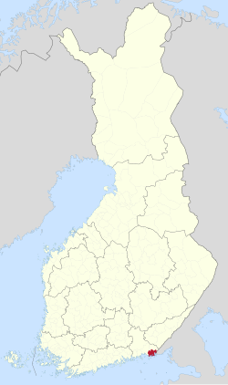 Location of Virolahti in Finland | |
| Coordinates: 60°35′N 027°42′E | |
| Country | |
| Region | Kymenlaakso |
| Sub-region | Kotka–Hamina sub-region |
| Government | |
| • Municipality manager | Veli-Matti Pulli |
| Area (2018-01-01)[1] | |
| • Total | 558.92 km2 (215.80 sq mi) |
| • Land | 371.95 km2 (143.61 sq mi) |
| • Water | 186.97 km2 (72.19 sq mi) |
| • Rank | 208th largest in Finland |
| Population (2021-12-31)[2] | |
| • Total | 3,042 |
| • Rank | 215th largest in Finland |
| • Density | 8.18/km2 (21.2/sq mi) |
| Population by native language | |
| • Finnish | 95.3% (official) |
| • Swedish | 0.5% |
| • Others | 4.2% |
| Population by age | |
| • 0 to 14 | 11.7% |
| • 15 to 64 | 55.3% |
| • 65 or older | 33% |
| Time zone | UTC+02:00 (EET) |
| • Summer (DST) | UTC+03:00 (EEST) |
| Municipal tax rate[5] | 20.5% |
| Climate | Dfb |
| Website | www.virolahti.fi |
The municipality is unilingually Finnish.
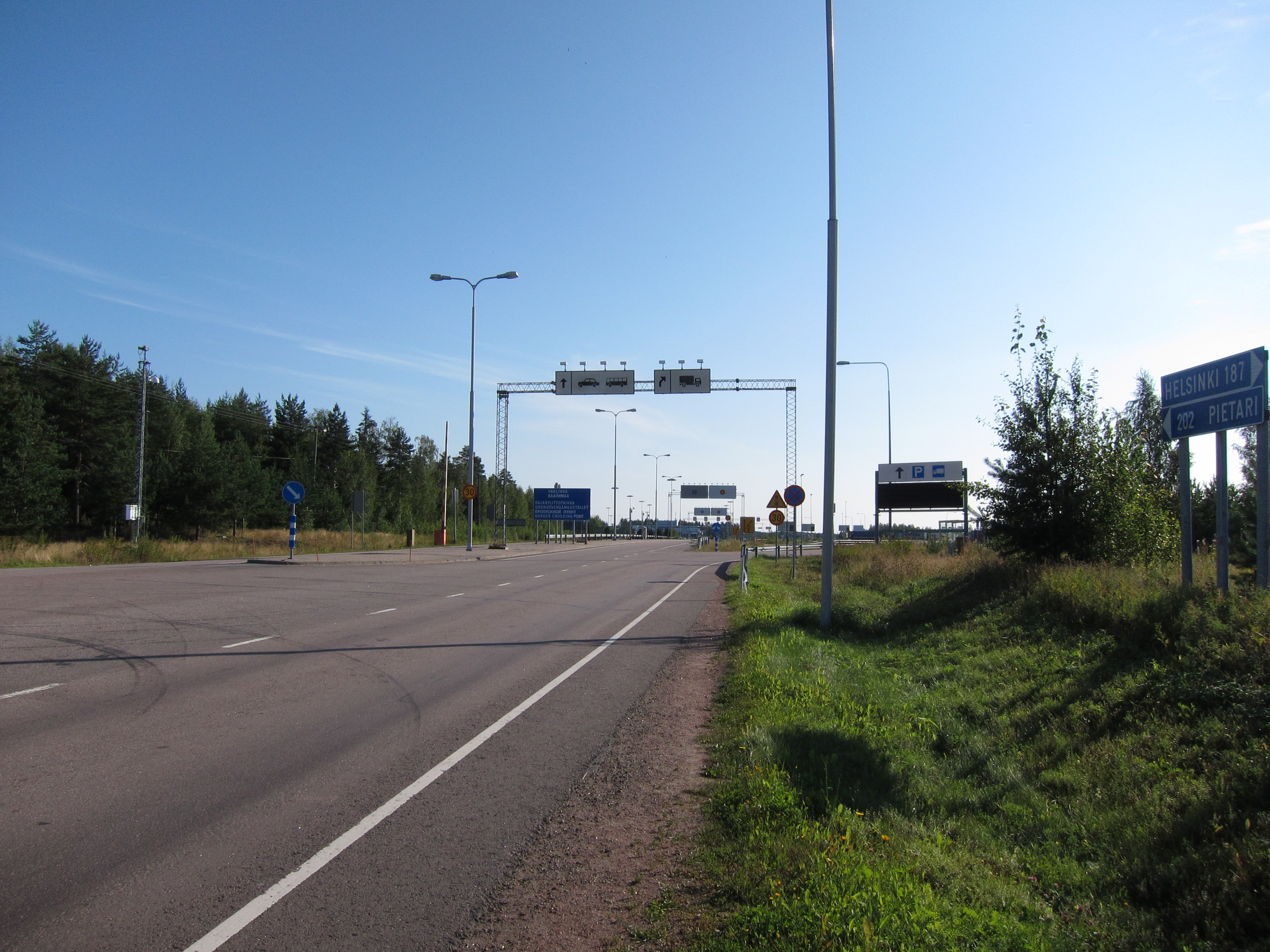
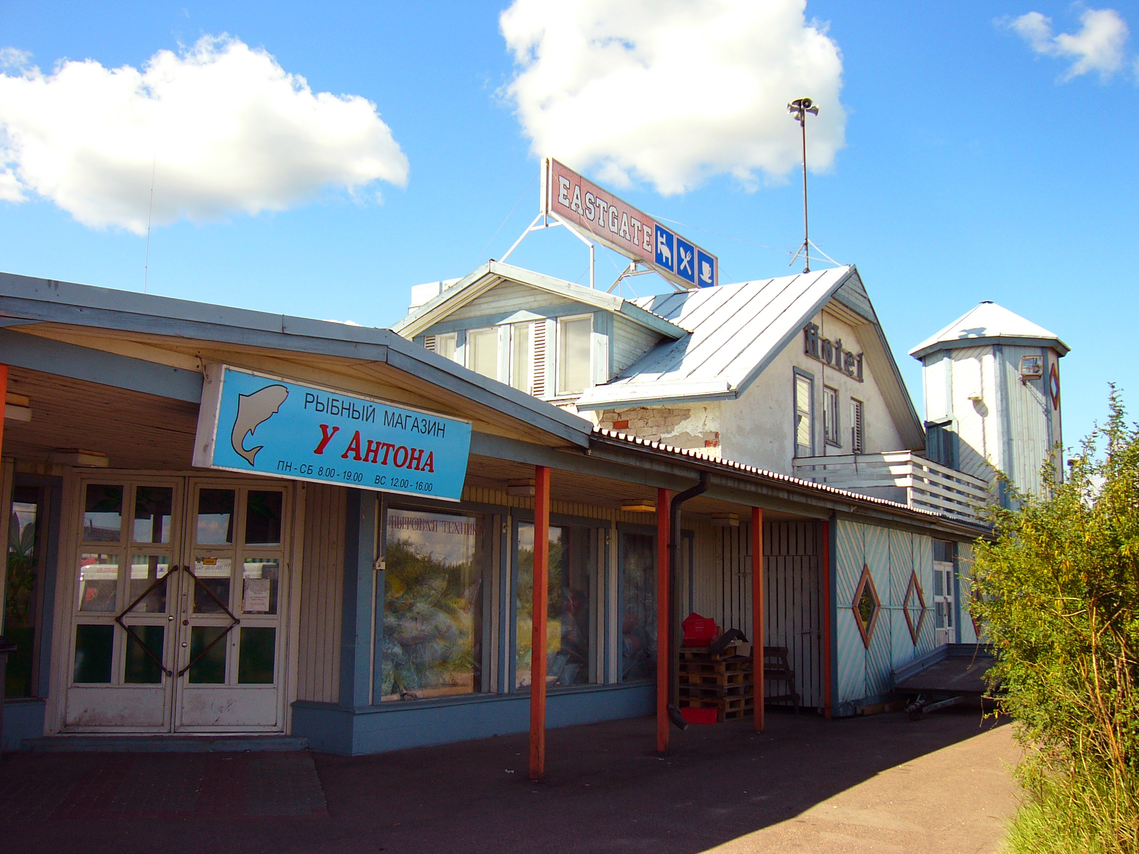
The Vaalimaa border crossing, which connects the municipality with Russia, is located in Virolahti.
History
Before World War I the Russian Emperor Nicholas II used to spend summers with his family in the archipelago of Virolahti with his yacht Standart, Finland being an autonomous province within the Russian Empire between 1809 and 1917.
Virolahti lost some of its area (over 100 km2 (39 sq mi)) to Soviet Union in Paris Peace Treaties, 1947, after World War II.
Villages in 1939
Villages marked with an asterisk (*) are now completely or partially on the Russian side:
Alapihlaja, Alaurpala*, Eerikkälä, Hailila, Hanski, Hellä (Heligby), Hämeenkylä (Tavastby), Häppilä, Järvenkylä, Kattilainen, Kiiskilahti* (now Kiyskinlakhti), Kirkonkylä, Klamila, Koivuniemi, Koskela*, Koskelanjoki, Kotola, Kurkela, Laitsalmi*, Länsikylä (Flonckarböle), Martinsaari* (Now Island of Maly Pogranichny), Mattila, Mustamaa, Nopala, Orslahti* (now Primorskoye), Paatio* (Båtö in Swedish, now Bolshoy Pogranitshny), Pajulahti, Pajusaari*, Pitkäpaasi* (Island of Gorniya Kamenya), Pyterlahti, Ravijoki, Ravijärvi, Reinikkala, Rännänen (Grennäs), Sydänkylä (Kallfjärd), Säkäjärvi, Tiilikkala, Vaalimaa (Vaderma), Vilkkilä, Virojoki, Yläpihlaja, Yläurpala* (now Torfjanovka).
Notable people born in Virolahti
- Uuno Klami, composer
- Johannes Takanen, sculptor
- Aarne Sihvo, general
- Veli Saarinen, cross-country skiner, olympic gold medalist
References
- "Area of Finnish Municipalities 1.1.2018" (PDF). National Land Survey of Finland. Retrieved 30 January 2018.
- "Preliminary population structure by area, 2021M01*-2021M12*". StatFin (in Finnish). Statistics Finland. Retrieved 2 February 2022.
- "Population according to language and the number of foreigners and land area km2 by area as of 31 December 2008". Statistics Finland's PX-Web databases. Statistics Finland. Retrieved 29 March 2009.
- "Population according to age (1-year) and sex by area and the regional division of each statistical reference year, 2003–2020". StatFin. Statistics Finland. Retrieved 2 May 2021.
- "List of municipal and parish tax rates in 2021" (PDF). Tax Administration of Finland. 1 December 2020. Retrieved 10 April 2021.
External links
![]() Media related to Virolahti at Wikimedia Commons
Media related to Virolahti at Wikimedia Commons
- Municipality of Virolahti – Official website (in Finnish)
- Map of Virolahti
Places adjacent to Virolahti | ||||||||||||||||
|---|---|---|---|---|---|---|---|---|---|---|---|---|---|---|---|---|
| ||||||||||||||||
Municipalities of Kymenlaakso | ||
|---|---|---|
| Municipalities |  | |
| Former municipalities | ||
| ||
Authority control | |
|---|---|
| General |
|
| National libraries | |
| Other |
|
This Southern Finland location article is a stub. You can help Wikipedia by expanding it. |
На других языках
[de] Virolahti
Virolahti [.mw-parser-output .IPA a{text-decoration:none}ˈvirɔlɑhti] (schwedisch historisch: Vederlax) ist eine Gemeinde im Südosten Finnlands mit 3087 Einwohnern (Stand 31. Dezember 2020). Sie liegt an der Küste Finnischen Meerbusens an der Grenze zu Russland in der Landschaft Kymenlaakso. Die nächste Stadt ist Hamina 35 Kilometer westlich, in die Hauptstadt Helsinki sind es 178 Kilometer und nach Sankt Petersburg 210 Kilometer. Die Gemeinde ist einsprachig finnischsprachig.- [en] Virolahti
[ru] Виролахти (община)
Виролахти (фин. Virolahti) — община в провинции Кюменлааксо, Финляндия. Общая площадь территории — 558,92 км², из которых 186,97 км² — вода.Другой контент может иметь иную лицензию. Перед использованием материалов сайта WikiSort.org внимательно изучите правила лицензирования конкретных элементов наполнения сайта.
WikiSort.org - проект по пересортировке и дополнению контента Википедии