world.wikisort.org - Finland
Kuivaniemi is a former municipality of Finland.
Kuivaniemi | |
|---|---|
Former municipality | |
| Kuivaniemen kunta Kuivaniemi kommun | |
 Coat of arms | |
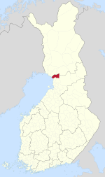 Location of Kuivaniemi in Finland | |
| Coordinates: 65°36′15″N 025°12′30″E | |
| Country | Finland |
| Region | Northern Ostrobothnia |
| Sub-region | Oulu Arc sub-region |
| Charter | 1867 |
| Consolidated | 2007 |
| Area | |
| • Total | 1,149.58 km2 (443.86 sq mi) |
| • Land | 927.21 km2 (358.00 sq mi) |
| • Water | 222.37 km2 (85.86 sq mi) |
| Population (2006-12-31)[2] | |
| • Total | 1,977 |
| • Density | 1.7/km2 (4.5/sq mi) |
| Time zone | UTC+2 (EET) |
| • Summer (DST) | UTC+3 (EEST) |
It was located in the province of Oulu and is part of the Northern Ostrobothnia region. The municipality had a population of 1,977 on 31 December 2006[2] (ranked 351st) and covered a land area of 927.21 square kilometres (358.00 sq mi) on 1 January 2006.[1] The population density was 2.1 inhabitants per square kilometre (5.4/sq mi).
The municipality was unilingually Finnish.
Kuivaniemi was incorporated into Ii municipality on 1 January 2007. The formed municipality inherited Kuivaniemi's seal-sporting coat of arms.
References
- "Area by municipality as of 1 January 2006" (PDF) (in Finnish and Swedish). Land Survey of Finland. Retrieved 11 April 2010.[permanent dead link]
- "Population by municipality as of 31 December 2006". Population Information System (in Finnish and Swedish). Population Register Center of Finland. Retrieved 11 April 2010.[permanent dead link]
External links
![]() Media related to Kuivaniemi at Wikimedia Commons
Media related to Kuivaniemi at Wikimedia Commons
Municipalities of North Ostrobothnia | ||
|---|---|---|
| Municipalities |  | |
| Former | ||
| ||
This Oulu Province location article is a stub. You can help Wikipedia by expanding it. |
Текст в блоке "Читать" взят с сайта "Википедия" и доступен по лицензии Creative Commons Attribution-ShareAlike; в отдельных случаях могут действовать дополнительные условия.
Другой контент может иметь иную лицензию. Перед использованием материалов сайта WikiSort.org внимательно изучите правила лицензирования конкретных элементов наполнения сайта.
Другой контент может иметь иную лицензию. Перед использованием материалов сайта WikiSort.org внимательно изучите правила лицензирования конкретных элементов наполнения сайта.
2019-2026
WikiSort.org - проект по пересортировке и дополнению контента Википедии
WikiSort.org - проект по пересортировке и дополнению контента Википедии