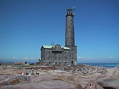
 Strömma Canal
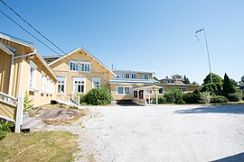 Restaurant Hotel Villa Felix
 The Obelisk of Kimito Church
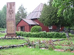 Västanfjärd Old Church
world.wikisort.org - Finland
Kimitoön (Finnish: Kemiönsaari) is a municipality and island of Finland. It was created on 1 January 2009, when the municipalities of Dragsfjärd, Kimito and Västanfjärd were consolidated into a single municipality.
Kimitoön
Kimitoön – Kemiönsaari | |
|---|---|
Municipality | |
| Kimitoöns kommun Kemiönsaaren kunta | |
 An old sauna, Sagalund outdoor museum, Kimito, Finland | |
 Flag  Coat of arms | |
 Location of Kimitoön in Finland | |
| Coordinates: 60°10′N 022°44′E | |
| Country | |
| Region | Southwest Finland |
| Sub-region | Åboland–Turunmaa sub-region |
| Charter | 2009 |
| Government | |
| • Municipal manager | Anneli Pahta |
| Area (2018-01-01)[1] | |
| • Total | 2,800.99 km2 (1,081.47 sq mi) |
| • Land | 686.93 km2 (265.23 sq mi) |
| • Water | 2,113.94 km2 (816.20 sq mi) |
| • Rank | 123rd largest in Finland |
| Population (2021-12-31)[2] | |
| • Total | 6,617 |
| • Rank | 141st largest in Finland |
| • Density | 9.63/km2 (24.9/sq mi) |
| Population by native language | |
| • Swedish | 71.4% (official) |
| • Finnish | 27.4% |
| • Others | 1.2% |
| Population by age | |
| • 0 to 14 | 11.9% |
| • 15 to 64 | 53.3% |
| • 65 or older | 34.8% |
| Time zone | UTC+02:00 (EET) |
| • Summer (DST) | UTC+03:00 (EEST) |
| Municipal tax rate[5] | 19.75% |
| Website | www.kimitoon.fi |
The municipality is located in the Archipelago Sea in the Southwest Finland region. The municipality has a population of 6,617 (31 December 2021)[2] and covers an area of 2,800.99 square kilometres (1,081.47 sq mi) of which 2,113.94 km2 (816.20 sq mi) is water.[1] The population density is 9.63 inhabitants per square kilometre (24.9/sq mi). Actual island is the largest coastal island of Finland with the area of 524 square kilometres (202 sq mi). It is situated in the Southwest Finland region in Western Finland province. The island has a population of 7,500 divided between the two municipalities: Kimitoön and Salo of which Salo is mostly located on the mainland. Kimitoön is bilingual with the majority speaking Swedish and a minority Finnish as their native language.
Politics
Results of the 2015 Finnish parliamentary election in Kimitoön:[6]
- Swedish People's Party 49.6%
- Social Democratic Party 13.0%
- Left Alliance 9.7%
- True Finns 6.7%
- Centre Party 10.4%
- National Coalition Party 5.4%
- Green League 3.8%
- Christian Democrats 0.8%
- Other parties 0.6%
Gallery


See also
References
- "Area of Finnish Municipalities 1.1.2018" (PDF). National Land Survey of Finland. Retrieved 30 January 2018.
- "Preliminary population structure by area, 2021M01*-2021M12*". StatFin (in Finnish). Statistics Finland. Retrieved 2 February 2022.
- "Population according to language and the number of foreigners and land area km2 by area as of 31 December 2008". Statistics Finland's PX-Web databases. Statistics Finland. Retrieved 29 March 2009.
- "Population according to age (1-year) and sex by area and the regional division of each statistical reference year, 2003–2020". StatFin. Statistics Finland. Retrieved 2 May 2021.
- "List of municipal and parish tax rates in 2021" (PDF). Tax Administration of Finland. 1 December 2020. Retrieved 10 April 2021.
- "Kemiönsaari, tulokset puolueittain". tulospalvelu.vaalit.fi.
External links
Wikivoyage has a travel guide for Kimitoön.
![]() Media related to Kimitoön at Wikimedia Commons
Media related to Kimitoön at Wikimedia Commons
- Municipality of Kimitoön – Official website (in Swedish and Finnish)
Municipalities of Southwest Finland | ||
|---|---|---|
| Municipalities |  | |
| Former municipalities |
| |
| ||
| Authority control |
|
|---|
This Western Finland location article is a stub. You can help Wikipedia by expanding it. |
На других языках
[de] Kimitoön
Kimitoön (schwedisch) bzw. Kemiönsaari [.mw-parser-output .IPA a{text-decoration:none}ˈkemiønˌsɑːri] (finnisch) ist eine Gemeinde in der südwestfinnischen Landschaft Varsinais-Suomi. Sie entstand zum Jahresbeginn 2009 durch den Zusammenschluss der Gemeinden Kimito (Kemiö), Dragsfjärd und Västanfjärd.- [en] Kimitoön
[ru] Кимиёнсаари
Кимиёнсаари (швед. Kimitoön, фин. Kemiönsaari) — община в провинции Исконная Финляндия, губерния Западная Финляндия, Финляндия. Общая площадь территории — 2800,87 км², из которых 2113,94 км² — вода. Размещается на шхерных островах, самым большим из которых является остров Чимиту.Текст в блоке "Читать" взят с сайта "Википедия" и доступен по лицензии Creative Commons Attribution-ShareAlike; в отдельных случаях могут действовать дополнительные условия.
Другой контент может иметь иную лицензию. Перед использованием материалов сайта WikiSort.org внимательно изучите правила лицензирования конкретных элементов наполнения сайта.
Другой контент может иметь иную лицензию. Перед использованием материалов сайта WikiSort.org внимательно изучите правила лицензирования конкретных элементов наполнения сайта.
2019-2026
WikiSort.org - проект по пересортировке и дополнению контента Википедии
WikiSort.org - проект по пересортировке и дополнению контента Википедии