world.wikisort.org - Czech
Rozvadov (German: Roßhaupt) is a municipality and village in Tachov District in the Plzeň Region of the Czech Republic. It has about 700 inhabitants.
Rozvadov | |
|---|---|
Municipality | |
 Rozvadov / Waidhaus border crossing | |
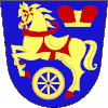
 Flag  Coat of arms | |
 Rozvadov Location in the Czech Republic | |
| Coordinates: 49°40′6″N 12°33′7″E | |
| Country | |
| Region | Plzeň |
| District | Tachov |
| First mentioned | 1581 |
| Area | |
| • Total | 54.94 km2 (21.21 sq mi) |
| Elevation | 570 m (1,870 ft) |
| Population (2022-01-01)[1] | |
| • Total | 718 |
| • Density | 13/km2 (34/sq mi) |
| Time zone | UTC+1 (CET) |
| • Summer (DST) | UTC+2 (CEST) |
| Postal code | 348 07 |
| Website | www |
Administrative parts
Villages of Diana, Milíře, Nové Domky, Rozcestí and Svatá Kateřina are administrative parts of Rozvadov.
Geography
Rozvadov is located about 15 kilometres (9 mi) southwest of Tachov, 59 km (37 mi) west of Plzeň and 138 km (86 mi) southwest of Prague, on the border with Germany. It lies in the central part of the Upper Palatine Forest. The highest point of the municipality is below the summit of the hill Javorný vrch, at 674 metres (2,211 ft).
History
The first written mention of Rozvadov is from 1581. The customs office is first mentioned in 1613. The current customhouse is a building from 1934.[2]
Before the expulsion of Germans in the wake of World War II, the municipality had a German-speaking majority.
Economy
King's Casino Rozvadov is located here and as of 2021, it contains the largest poker room in Europe.[3]
Transport
Rozvadov is known for its important road border crossing with Germany Rozvadov / Waidhaus, located on the D5 motorway.
References
- "Population of Municipalities – 1 January 2022". Czech Statistical Office. 2022-04-29.
- "Historie" (in Czech). Obec Rozvadov. Retrieved 2021-06-14.
- Glatzer, Jason (2018-10-01). "History of the WSOP Europe Part I: The London Years". PokerNews. Retrieved 29 December 2018.
External links
На других языках
[de] Rozvadov
Rozvadov (deutsch Roßhaupt) ist eine Gemeinde mit 780 Einwohnern (Stand: 1. Januar 2021) in Tschechien. Sie liegt in 570 m ü. M. im Oberpfälzer Wald (Český les) an der Grenze zu Bayern und gehört dem Okres Tachov an. Die Gemeinde hat eine Fläche von 54,9 km².- [en] Rozvadov
Другой контент может иметь иную лицензию. Перед использованием материалов сайта WikiSort.org внимательно изучите правила лицензирования конкретных элементов наполнения сайта.
WikiSort.org - проект по пересортировке и дополнению контента Википедии
