world.wikisort.org - Czech
Pohnání is a village and municipality (obec) in Tábor District in the South Bohemian Region of the Czech Republic.
Pohnání | |
|---|---|
Municipality | |
 | |
 Coat of arms | |
 Pohnání | |
| Coordinates: 49°28′25″N 14°49′10″E | |
| Country | |
| Region | South Bohemian |
| District | Tábor |
| Area | |
| • Total | 3.57 km2 (1.38 sq mi) |
| Elevation | 627 m (2,057 ft) |
| Population (2011) | |
| • Total | 79 |
| • Density | 22/km2 (57/sq mi) |
| Postal code | 391 42 |
The municipality covers an area of 3.57 square kilometres (1.38 sq mi), and has a population of 80 (as at 3 July 2006).
Pohnání lies approximately 14 kilometres (9 mi) north-east of Tábor, 61 km (38 mi) north-east of České Budějovice, and 74 km (46 mi) south-east of Prague.
Gallery
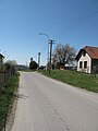 Road
Road Cottage
 Neighbouring countryside


References
Wikimedia Commons has media related to Pohnání.
| Authority control: National libraries |
|---|
This South Bohemian Region location article is a stub. You can help Wikipedia by expanding it. |
Текст в блоке "Читать" взят с сайта "Википедия" и доступен по лицензии Creative Commons Attribution-ShareAlike; в отдельных случаях могут действовать дополнительные условия.
Другой контент может иметь иную лицензию. Перед использованием материалов сайта WikiSort.org внимательно изучите правила лицензирования конкретных элементов наполнения сайта.
Другой контент может иметь иную лицензию. Перед использованием материалов сайта WikiSort.org внимательно изучите правила лицензирования конкретных элементов наполнения сайта.
2019-2026
WikiSort.org - проект по пересортировке и дополнению контента Википедии
WikiSort.org - проект по пересортировке и дополнению контента Википедии