world.wikisort.org - Czech
Klapý is a municipality and village in Litoměřice District in the Ústí nad Labem Region of the Czech Republic. It has about 500 inhabitants.
Klapý | |
|---|---|
Municipality | |
 Klapý seen from Hazmburk | |
 Flag  Coat of arms | |
 Klapý Location in the Czech Republic | |
| Coordinates: 50°25′53″N 14°0′24″E | |
| Country | |
| Region | Ústí nad Labem |
| District | Litoměřice |
| First mentioned | 1197 |
| Area | |
| • Total | 8.95 km2 (3.46 sq mi) |
| Elevation | 239 m (784 ft) |
| Population (2022-01-01)[1] | |
| • Total | 493 |
| • Density | 55/km2 (140/sq mi) |
| Time zone | UTC+1 (CET) |
| • Summer (DST) | UTC+2 (CEST) |
| Postal code | 411 16 |
| Website | www |
Geography
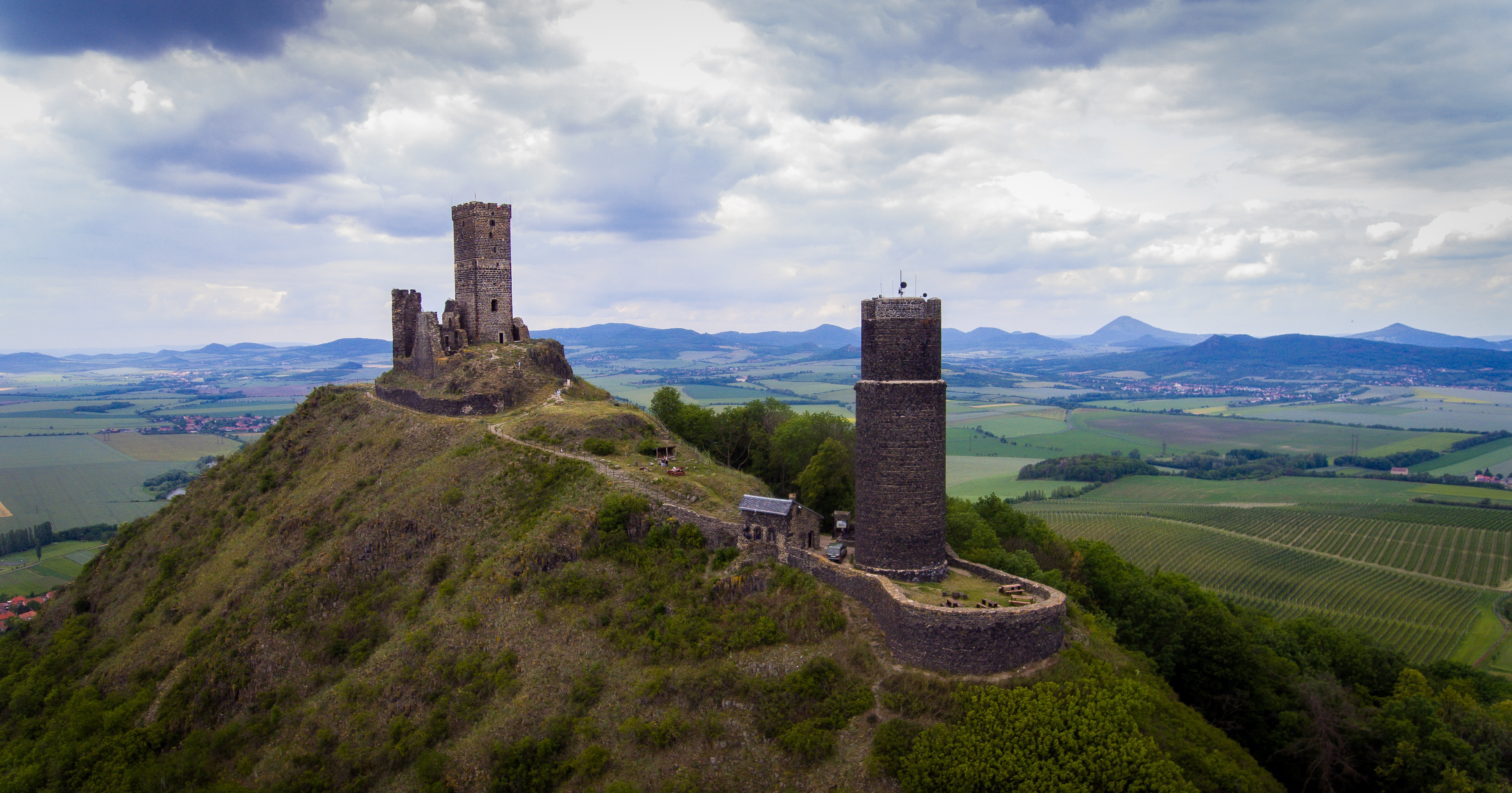
Klapý is located about 14 kilometres (9 mi) southwest of Litoměřice and 26 km (16 mi) south of Ústí nad Labem. It lies in a flat agricultural landscape of the Lower Eger Table from which the Hazmburk hill rises in the eastern part of the municipality. It is the highest point of Klapý with an altitude of 418 metres (1,371 ft).
Sights
There is a ruin of a medieval castle on the Hazmburk hill.
Notable people
- Lubor J. Zink (1920–2003), Czech-Canadian writer
References
- "Population of Municipalities – 1 January 2022". Czech Statistical Office. 2022-04-29.
Wikimedia Commons has media related to Klapý.
Authority control | |
|---|---|
| General |
|
| National libraries | |
This Ústí nad Labem Region location article is a stub. You can help Wikipedia by expanding it. |
Текст в блоке "Читать" взят с сайта "Википедия" и доступен по лицензии Creative Commons Attribution-ShareAlike; в отдельных случаях могут действовать дополнительные условия.
Другой контент может иметь иную лицензию. Перед использованием материалов сайта WikiSort.org внимательно изучите правила лицензирования конкретных элементов наполнения сайта.
Другой контент может иметь иную лицензию. Перед использованием материалов сайта WikiSort.org внимательно изучите правила лицензирования конкретных элементов наполнения сайта.
2019-2026
WikiSort.org - проект по пересортировке и дополнению контента Википедии
WikiSort.org - проект по пересортировке и дополнению контента Википедии