world.wikisort.org - Czech
Heřmanova Huť (German: Hermannshütte) is a municipality in Plzeň-North District in the Plzeň Region of the Czech Republic. It has about 1,800 inhabitants.
Heřmanova Huť | |
|---|---|
Municipality | |
 Municipal office | |
 Flag  Coat of arms | |
 Heřmanova Huť Location in the Czech Republic | |
| Coordinates: 49°42′43″N 13°5′15″E | |
| Country | |
| Region | Plzeň |
| District | Plzeň-North |
| Established | 1954 |
| Government | |
| • Mayor | Radek Lukáč |
| Area | |
| • Total | 9.88 km2 (3.81 sq mi) |
| Elevation | 380 m (1,250 ft) |
| Population (2022-01-01)[1] | |
| • Total | 1,812 |
| • Density | 180/km2 (480/sq mi) |
| Time zone | UTC+1 (CET) |
| • Summer (DST) | UTC+2 (CEST) |
| Postal code | 330 24 |
| Website | www |
Administrative parts
The municipality is made up of villages of Dolní Sekyřany, Horní Sekyřany, Vlkýš and Vlkýš I.
Geography
Heřmanova Huť is located about 19 km (12 mi) west of Plzeň. It lies in the Plasy Uplands. The highest point is at 487 m (1,598 ft) above sea level.
History
The first written mention of Sekyřany is from 1115. The village was later split to Dolní ("Lower") Sekyřany and Horní ("Upper") Sekyřany. Both villages were bought by the Chotěšov Abbey in 1253. The first written mention of Vlkýš is from 1457.[2]
The municipality of Heřmanova Huť was founded in 1954 through the merger of three municipalities: Vlkýš, Dolní Sekyřany and Horní Sekyřany.[2]
Demographics
|
|
| ||||||||||||||||||||||||||||||||||||||||||||||||||||||
| Source: Censuses[3][4] | ||||||||||||||||||||||||||||||||||||||||||||||||||||||||
Transport
The D5 motorway passes through the northern part of the municipal territory.
Gallery
- Train station
- Revoluční street
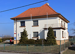
- Elementary school
References
- "Population of Municipalities – 1 January 2022". Czech Statistical Office. 2022-04-29.
- "Historie obce Heřmanova Huť" (in Czech). Obec Heřmanova Huť. Retrieved 2021-06-09.
- "Historický lexikon obcí České republiky 1869–2011 – Okres Plzeň-sever" (in Czech). Czech Statistical Office. 2015-12-21. pp. 3–4.
- "Population Census 2021: Population by sex". Public Database. Czech Statistical Office. 2021-03-27.
External links
На других языках
[de] Heřmanova Huť
Heřmanova Huť (deutsch Hermannshütte) ist eine Gemeinde in Tschechien. Sie liegt im Süden des Bezirkes Plzeň-Nord, ca. 25 Kilometer westlich der Stadt Plzeň an der Autobahn Dálnice 5. Žilov grenzt im Süden und Osten an Přehýšov und im Norden an Hněvnice. Die Gemeinde entstand im Jahr 1954 durch eine Fusion der Gemeinden Vlkýš, Horní Sekyřany und Dolní Sekyřany.- [en] Heřmanova Huť
Другой контент может иметь иную лицензию. Перед использованием материалов сайта WikiSort.org внимательно изучите правила лицензирования конкретных элементов наполнения сайта.
WikiSort.org - проект по пересортировке и дополнению контента Википедии


