world.wikisort.org - Cuba
Corralillo is a municipality and town in the Villa Clara Province of Cuba. It was founded in 1831[1] and established as a municipality in 1879.
Corralillo | |
|---|---|
Municipality | |
 Coat of arms | |
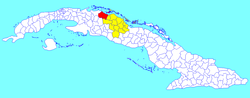 Corralillo municipality (red) within Villa Clara Province (yellow) and Cuba | |
| Coordinates: 22°59′8″N 80°34′59″W | |
| Country | Cuba |
| Province | Villa Clara |
| Founded | 1831[1] |
| Established | 1879 (Municipality) |
| Area | |
| • Total | 843 km2 (325 sq mi) |
| Elevation | 15 m (49 ft) |
| Population (2004)[3] | |
| • Total | 27,571 |
| • Density | 32.7/km2 (85/sq mi) |
| Time zone | UTC-5 (EST) |
| Area code(s) | +53-42 |
Geography
Corralillo is located on the northern coast of Cuba, in the north-western corner of the Villa Clara province, bordering the Matanzas Province to the west and the Bay of Cadiz to the north. The cays of Falcones, Blanquizal and Verde of the Sabana-Camagüey Archipelago as well as a multitude of reefs are located at sea north of Corralillo.
The municipality is divided into the consejos populares (mainly villages) of Ceja de Pablo, Corralillo (municipal seat), Palma Sola, Perú, Rancho Veloz, Sabana Grande, Santa María and Sierra Morena.[1]
Demographics
In 2004, the municipality of Corralillo had a population of 27,581.[3] With a total area of 843 km2 (325 sq mi),[2] it has a population density of 32.7/km2 (85/sq mi).
Institutions
- Library "Rafael Izquierdo Triana"
- Cultural center “Leopoldo Romañach”
- Movie theater Jigüe
- Municipal Directorate of Culture of Corralillo
- Bookstore “Esperanza Ruiz”
- Corralillo Municipal Museum
See also
- Municipalities of Cuba
- List of cities in Cuba
References
- Guije.com. "Corralillo" (in Spanish). Retrieved 2007-10-09.
- Statoids (July 2003). "Municipios of Cuba". Retrieved 2007-10-09.
- Atenas.cu (2004). "2004 Population trends, by Province and Municipality" (in Spanish). Archived from the original on 2006-07-14. Retrieved 2007-10-09.
- "Corralillo", Wikipedia, la enciclopedia libre (in Spanish), 2019-10-15, retrieved 2019-10-18
External links
![]() Media related to Corralillo at Wikimedia Commons
Media related to Corralillo at Wikimedia Commons
Places adjacent to Corralillo | ||||||||||||||||
|---|---|---|---|---|---|---|---|---|---|---|---|---|---|---|---|---|
| ||||||||||||||||
Municipalities in Villa Clara Province | ||
|---|---|---|
| ||
This Cuban location article is a stub. You can help Wikipedia by expanding it. |
Другой контент может иметь иную лицензию. Перед использованием материалов сайта WikiSort.org внимательно изучите правила лицензирования конкретных элементов наполнения сайта.
WikiSort.org - проект по пересортировке и дополнению контента Википедии