world.wikisort.org - Colombia
Valdivia is a town and municipality in Antioquia Department, Colombia. Part of the subregion of Northern Antioquia.
This article uses bare URLs, which are uninformative and vulnerable to link rot. (September 2022) |
Valdivia, Antioquia | |
|---|---|
Municipality and town | |
 Valdivia, Antioquia | |
 Flag | |
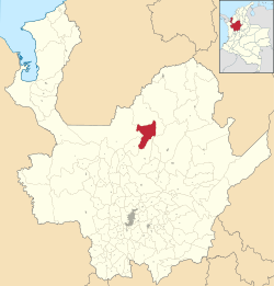 Location of the municipality and town of Valdivia, Antioquia in the Antioquia Department of Colombia | |
 Valdivia, Antioquia Location in Colombia | |
| Coordinates: 7°17′20.4″N 75°23′52.8″W | |
| Country | |
| Department | |
| Subregion | Northern |
| Elevation | 1,100 m (3,600 ft) |
| Population (Census 2018[1]) | |
| • Total | 11,511 |
| Time zone | UTC-5 (Colombia Standard Time) |
History
Valdivia was inhabited by the Nutabes people upon the arrival of the Spanish colonists. In 1849 Spanish Pedro Vasquez acquired the land and cultivated the area, bringing labourers from other regions of Antioquia, that eventually began exploring and exploiting other land nearby. On February 5, 1892, became a corregimiento part of the municipality of Yarumal. Braulio Berrio was named its first Corregidor. In 1912 the Assembly of Antioquia segregated Valdivia from Yarumal assigned more land to its territory from other municipalities and made it a municipality.
Climate
Valdivia has an elevation moderated tropical rainforest climate (Af). It has very heavy rainfall year-round.
| Climate data for Valdivia | |||||||||||||
|---|---|---|---|---|---|---|---|---|---|---|---|---|---|
| Month | Jan | Feb | Mar | Apr | May | Jun | Jul | Aug | Sep | Oct | Nov | Dec | Year |
| Average high °C (°F) | 24.3 (75.7) |
24.7 (76.5) |
25.1 (77.2) |
25.3 (77.5) |
25.6 (78.1) |
25.6 (78.1) |
25.7 (78.3) |
25.7 (78.3) |
25.5 (77.9) |
25.2 (77.4) |
24.8 (76.6) |
24.3 (75.7) |
25.1 (77.3) |
| Daily mean °C (°F) | 21.2 (70.2) |
21.4 (70.5) |
21.7 (71.1) |
21.8 (71.2) |
22.0 (71.6) |
22.0 (71.6) |
21.9 (71.4) |
22.0 (71.6) |
21.7 (71.1) |
21.5 (70.7) |
21.4 (70.5) |
21.2 (70.2) |
21.7 (71.0) |
| Average low °C (°F) | 18.6 (65.5) |
18.6 (65.5) |
18.8 (65.8) |
19.1 (66.4) |
19.2 (66.6) |
19.1 (66.4) |
18.8 (65.8) |
18.8 (65.8) |
18.8 (65.8) |
18.8 (65.8) |
19.0 (66.2) |
18.9 (66.0) |
18.9 (66.0) |
| Average rainfall mm (inches) | 332.8 (13.10) |
414.7 (16.33) |
410.7 (16.17) |
356.2 (14.02) |
392.6 (15.46) |
408.2 (16.07) |
346.0 (13.62) |
405.1 (15.95) |
497.1 (19.57) |
399.1 (15.71) |
466.3 (18.36) |
436.9 (17.20) |
4,865.7 (191.56) |
| Average rainy days | 15 | 15 | 17 | 22 | 26 | 25 | 26 | 25 | 25 | 27 | 24 | 18 | 265 |
| Average relative humidity (%) | 89 | 89 | 89 | 90 | 90 | 90 | 89 | 89 | 89 | 90 | 91 | 90 | 90 |
| Mean monthly sunshine hours | 124.0 | 101.6 | 93.0 | 84.0 | 102.3 | 114.0 | 145.7 | 139.5 | 114.0 | 105.4 | 120.0 | 120.9 | 1,364.4 |
| Mean daily sunshine hours | 4.0 | 3.6 | 3.0 | 2.8 | 3.3 | 3.8 | 4.7 | 4.5 | 3.8 | 3.4 | 4.0 | 3.9 | 3.7 |
| Source: [2] | |||||||||||||
References
- (in Spanish) University of Antioquia Library; Valdivia, Antioquia
Capital: Medellín | |||||||||||||||||||
| Regions and municipalities |
| ||||||||||||||||||
| Related topics |
| ||||||||||||||||||
This Department of Antioquia location article is a stub. You can help Wikipedia by expanding it. |
На других языках
- [en] Valdivia, Antioquia
[es] Valdivia (Antioquia)
Valdivia es un municipio de Colombia, localizado en la subregión Norte del departamento de Antioquia. Limita al norte con el municipio de Tarazá, por el este con los municipios de Tarazá, Anorí y Yarumal, por el sur con los municipios de Yarumal y Briceño, y por el oeste con los municipios de Briceño e Ituango. Su cabecera dista 153 kilómetros de la ciudad de Medellín, capital del departamento de Antioquia. El municipio posee una extensión de 545 kilómetros cuadrados.[ru] Вальдивия (Колумбия)
Вальдивия (исп. Valdivia) — город и муниципалитет на севере Колумбии, на территории департамента Антьокия. Входит в состав субрегиона Северная Антьокия.Другой контент может иметь иную лицензию. Перед использованием материалов сайта WikiSort.org внимательно изучите правила лицензирования конкретных элементов наполнения сайта.
WikiSort.org - проект по пересортировке и дополнению контента Википедии