world.wikisort.org - China
Zhong County or Zhongxian (simplified Chinese: 忠县; traditional Chinese: 忠縣; pinyin: Zhōng Xiàn) is a county of Chongqing Municipality, China.
Zhongxian
忠县 | |
|---|---|
County | |
 Zhongxian Yangtze River Bridge | |
 | |
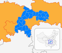
 Location of Zhong County in Chongqing | |
| Coordinates: 30°18′00″N 108°02′15″E | |
| Country | People's Republic of China |
| Municipality | Chongqing |
| Area | |
| • Total | 2,184 km2 (843 sq mi) |
| Population (2010) | |
| • Total | 751,400 |
| • Density | 340/km2 (890/sq mi) |
| Time zone | UTC+8 (China Standard) |
The Shibaozhai Temple, which is endangered by the rising waters caused by the Three Gorges Dam, is located there.
Zhong County has two Yangtze River crossings: the Zhongxian Yangtze River Bridge and Zhongzhou Yangtze River Bridge.
History
Linjiang County (临江县) was established under Ba Commandery (巴郡) in Han Dynasty. In Western Wei, Lin Prefecture (临州, Linzhou) was established, with Linjiang as its seat. In Tang Dynasty, it was renamed as Zhong Prefecture (忠州, Zhongzhou, literally "loyal prefecture"). In 1913, Zhongzhou was replaced by Zhong County.[1]
Climate
| Climate data for Zhongxian (1981−2010) | |||||||||||||
|---|---|---|---|---|---|---|---|---|---|---|---|---|---|
| Month | Jan | Feb | Mar | Apr | May | Jun | Jul | Aug | Sep | Oct | Nov | Dec | Year |
| Record high °C (°F) | 17.6 (63.7) |
25.3 (77.5) |
33.3 (91.9) |
36.8 (98.2) |
35.6 (96.1) |
38.3 (100.9) |
40.1 (104.2) |
42.6 (108.7) |
42.7 (108.9) |
36.3 (97.3) |
29.3 (84.7) |
17.5 (63.5) |
42.7 (108.9) |
| Average high °C (°F) | 9.4 (48.9) |
13.0 (55.4) |
17.8 (64.0) |
23.2 (73.8) |
26.5 (79.7) |
29.0 (84.2) |
33.5 (92.3) |
33.1 (91.6) |
29.6 (85.3) |
22.1 (71.8) |
16.8 (62.2) |
10.5 (50.9) |
22.0 (71.7) |
| Daily mean °C (°F) | 7.0 (44.6) |
9.7 (49.5) |
13.5 (56.3) |
18.3 (64.9) |
21.9 (71.4) |
24.6 (76.3) |
28.4 (83.1) |
27.7 (81.9) |
24.5 (76.1) |
18.6 (65.5) |
13.7 (56.7) |
8.4 (47.1) |
18.0 (64.5) |
| Average low °C (°F) | 5.3 (41.5) |
7.4 (45.3) |
10.3 (50.5) |
14.8 (58.6) |
18.6 (65.5) |
21.5 (70.7) |
24.6 (76.3) |
23.9 (75.0) |
20.9 (69.6) |
16.3 (61.3) |
11.6 (52.9) |
6.9 (44.4) |
15.2 (59.3) |
| Record low °C (°F) | −0.8 (30.6) |
0.5 (32.9) |
3.3 (37.9) |
5.6 (42.1) |
11.9 (53.4) |
15.3 (59.5) |
19.9 (67.8) |
18.2 (64.8) |
14.4 (57.9) |
9.4 (48.9) |
3.9 (39.0) |
−0.5 (31.1) |
−0.8 (30.6) |
| Average precipitation mm (inches) | 18.7 (0.74) |
20.9 (0.82) |
45.2 (1.78) |
115.8 (4.56) |
172.3 (6.78) |
194.9 (7.67) |
175.0 (6.89) |
142.0 (5.59) |
123.4 (4.86) |
105.1 (4.14) |
59.2 (2.33) |
22.4 (0.88) |
1,194.9 (47.04) |
| Average relative humidity (%) | 83 | 79 | 76 | 77 | 80 | 83 | 76 | 74 | 75 | 85 | 85 | 87 | 80 |
| Source: China Meteorological Data Service Center[2] | |||||||||||||
References
- "忠县县情". Zhong County Government. Retrieved 20 February 2019.
- 中国地面气候标准值月值(1981-2010) (in Simplified Chinese). China Meteorological Data Service Center. Retrieved 22 August 2022.
External links
| ||
| Districts | 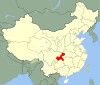
 | |
| Counties | ||
| Autonomous counties | ||
| Defunct divisions |
| |
| Attractions |
| |
| Sports Venues | ||
| Higher Education |
| |
| Culture & Demographics |
| |
| Transport |
| |
This Chongqing location article is a stub. You can help Wikipedia by expanding it. |
На других языках
- [en] Zhong County
[ru] Чжунсянь
Чжунся́нь'[1] (кит. упр. 忠县, пиньинь Zhōng xiàn) — уезд города центрального подчинения Чунцин (КНР).Другой контент может иметь иную лицензию. Перед использованием материалов сайта WikiSort.org внимательно изучите правила лицензирования конкретных элементов наполнения сайта.
WikiSort.org - проект по пересортировке и дополнению контента Википедии