world.wikisort.org - China
Wufeng Tujia Autonomous County (simplified Chinese: 五峰土家族自治县; traditional Chinese: 五峯土家族自治縣; pinyin: Wǔfēng Tǔjiāzú Zìzhìxiàn), formerly Changle County (Changlo County 長樂縣),[1] is a county in the west of Hubei province, People's Republic of China, bordering Hunan province to the south. It is under the administration of the prefecture-level city of Yichang. It is twinned with Westfield, Massachusetts, United States.[citation needed]
Wufeng County
五峰县 | |
|---|---|
County | |
| 五峰土家族自治县 Wufeng Tujia Autonomous County | |
 Wufeng Chai Buxi Grand Canyon Scenic Spot | |
 Wufeng is the southernmost division on this map of Yichang | |
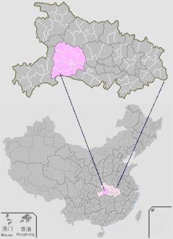 Yichang in Hubei | |
| Coordinates: 30°09′25″N 111°04′26″E | |
| Country | People's Republic of China |
| Province | Hubei |
| Prefecture-level city | Yichang |
| Area | |
| • Total | 2,401 km2 (927 sq mi) |
| Population (2010)[1] | |
| • Total | 188,923 |
| • Density | 79/km2 (200/sq mi) |
| Time zone | UTC+8 (China Standard) |
| Website | www |
Administrative divisions
Three townships:
Climate
| Climate data for Wufeng (1981−2010) | |||||||||||||
|---|---|---|---|---|---|---|---|---|---|---|---|---|---|
| Month | Jan | Feb | Mar | Apr | May | Jun | Jul | Aug | Sep | Oct | Nov | Dec | Year |
| Record high °C (°F) | 22.4 (72.3) |
26.7 (80.1) |
34.8 (94.6) |
36.9 (98.4) |
36.8 (98.2) |
37.2 (99.0) |
38.6 (101.5) |
38.4 (101.1) |
39.2 (102.6) |
33.9 (93.0) |
28.2 (82.8) |
21.0 (69.8) |
39.2 (102.6) |
| Average high °C (°F) | 8.7 (47.7) |
11.3 (52.3) |
16.3 (61.3) |
22.0 (71.6) |
25.7 (78.3) |
28.8 (83.8) |
31.2 (88.2) |
31.1 (88.0) |
27.5 (81.5) |
21.6 (70.9) |
16.5 (61.7) |
10.9 (51.6) |
21.0 (69.7) |
| Daily mean °C (°F) | 3.7 (38.7) |
6.0 (42.8) |
9.9 (49.8) |
15.1 (59.2) |
19.2 (66.6) |
22.5 (72.5) |
25.0 (77.0) |
24.4 (75.9) |
20.9 (69.6) |
15.6 (60.1) |
10.5 (50.9) |
5.6 (42.1) |
14.9 (58.8) |
| Average low °C (°F) | 0.5 (32.9) |
2.5 (36.5) |
5.7 (42.3) |
10.6 (51.1) |
14.8 (58.6) |
18.3 (64.9) |
21.2 (70.2) |
20.5 (68.9) |
16.8 (62.2) |
12.0 (53.6) |
6.8 (44.2) |
2.2 (36.0) |
11.0 (51.8) |
| Record low °C (°F) | −6.4 (20.5) |
−5.2 (22.6) |
−2.8 (27.0) |
0.9 (33.6) |
7.6 (45.7) |
11.8 (53.2) |
14.3 (57.7) |
13.6 (56.5) |
9.0 (48.2) |
2.9 (37.2) |
−1.7 (28.9) |
−6.7 (19.9) |
−6.7 (19.9) |
| Average precipitation mm (inches) | 26.2 (1.03) |
42.0 (1.65) |
65.2 (2.57) |
124.9 (4.92) |
182.4 (7.18) |
187.4 (7.38) |
260.5 (10.26) |
179.7 (7.07) |
106.0 (4.17) |
100.1 (3.94) |
58.3 (2.30) |
21.7 (0.85) |
1,354.4 (53.32) |
| Average relative humidity (%) | 75 | 74 | 73 | 75 | 78 | 80 | 82 | 80 | 78 | 80 | 78 | 75 | 77 |
| Source: China Meteorological Data Service Center[4] | |||||||||||||
References
- 五峰土家族自治县历史沿革 [Wufeng Tujia Autonomous County Historical Development] (in Simplified Chinese). XZQH.org. 14 July 2014. Retrieved 13 November 2018.
元末后久隶容美土司,清雍正十三年(1735)废土司设长乐县,1914年更名为五峰县,以县治西南五峰山命名。{...}1996年,五峰土家族自治县面积2401平方千米,{...}2010年第六次人口普查,五峰土家族自治县常住总人口188923人,其中:五峰镇37746人,长乐坪镇22500人,渔洋关镇46145人,仁和坪镇18879人,湾潭镇16743人,付家堰乡15567人,牛庄乡7496人,采花乡23847人。
- 2017年统计用区划代码和城乡划分代码:五峰土家族自治县 [2017 Statistical Area Numbers and Rural-Urban Area Numbers: Wufeng Tujia Autonomous County] (in Simplified Chinese). National Bureau of Statistics of the People's Republic of China. 2017. Retrieved 13 November 2018.
统计用区划代码 名称 420529111000 渔洋关镇 420529112000 仁和坪镇 420529113000 长乐坪镇 420529114000 五峰镇 420529115000 湾潭镇 420529201000 付家堰乡 420529202000 牛庄乡 420529203000 采花乡
- 行政区划 [Administrative Divisions] (in Simplified Chinese). Wufeng Tujia Autonomous County People's Government. Retrieved 13 November 2018.
将原16个乡镇撤并为五峰镇、长乐坪镇、渔洋关镇、仁和坪镇、湾潭镇和采花、傅家堰、牛庄3个乡,
- 中国地面气候标准值月值(1981-2010) (in Simplified Chinese). China Meteorological Data Service Center. Retrieved 22 August 2022.
Authority control | |
|---|---|
| General | |
| National libraries | |
This Hubei location article is a stub. You can help Wikipedia by expanding it. |
На других языках
- [en] Wufeng Tujia Autonomous County
[ru] Уфэн-Туцзяский автономный уезд
Уфэн-Туцзяский автономный уезд (кит. упр. 五峰土家族自治县, пиньинь Wǔfēng Tǔjiāzú zìzhìxiàn) — автономный уезд городского округа Ичан провинции Хубэй (КНР).Текст в блоке "Читать" взят с сайта "Википедия" и доступен по лицензии Creative Commons Attribution-ShareAlike; в отдельных случаях могут действовать дополнительные условия.
Другой контент может иметь иную лицензию. Перед использованием материалов сайта WikiSort.org внимательно изучите правила лицензирования конкретных элементов наполнения сайта.
Другой контент может иметь иную лицензию. Перед использованием материалов сайта WikiSort.org внимательно изучите правила лицензирования конкретных элементов наполнения сайта.
2019-2026
WikiSort.org - проект по пересортировке и дополнению контента Википедии
WikiSort.org - проект по пересортировке и дополнению контента Википедии