world.wikisort.org - China
Tongren (Tibetan: ཐུན་རིན་རྫོང་, Wylie: thun rin; Chinese: 同仁; pinyin: Tóngrén), known to Tibetans as Rebgong (Tibetan: རེབ་གོང་, རེབ་ཀོང་ or རེབ་སྐོང་)[1] in the historic region of Amdo, is the capital and second smallest administrative subdivision by area within Huangnan Tibetan Autonomous Prefecture in Qinghai, China. The city has an area of 3465 square kilometers and a population of ~80,000 (2002), 75% Tibetan. The economy of the city includes agriculture and aluminium mining.
Tongren
同仁市 · ཐུང་རིན་གྲོང་ཁྱེར། | |
|---|---|
County-level city | |
 Tongren from above | |
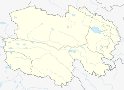
 Tongren County (light red) within Huangnan Prefecture (yellow) and Qinghai | |
 Tongren Location of the seat in Qinghai | |
| Coordinates (Tongren County government): 35°30′58″N 102°01′06″E | |
| Country | People's Republic of China |
| Province | Qinghai |
| Autonomous prefecture | Huangnan |
| County seat | Rongwu Town |
| Area | |
| • Total | 3,275 km2 (1,264 sq mi) |
| Elevation | 2,480 m (8,140 ft) |
| Population (2010) | |
| • Total | 92,601 |
| • Density | 28/km2 (73/sq mi) |
| Time zone | UTC+8 (China Standard) |
| Postal code | 811399 |
| Area code(s) | 0973 |
The city has a number of Tibetan Buddhist temples and gompas, including the large and significant Rongwo Monastery of the Gelug school. It is known as a center of thangka painting. Regong arts were named on the UNESCO Intangible Cultural Heritage Lists in 2009.
In October, 2010 there were reports of large demonstrations in Tongren by Tibetan students who reportedly shouted the slogans, “equality of ethnic groups” and “freedom of language."[2]
Demographics and languages
The Amdo Tibetan is the lingua franca of Tongren and the surrounding region, which is populated by Tibetan and Hui people, as well as some Han Chinese and Mongols.[3]
The Wutun language, a Chinese-Bonan-Tibetan mixed language, is spoken by some 2,000 people in the two villages of Upper and Lower Wutun, located on the eastern bank of the Rongwo River.[3]
Climate
Tongren has a highland humid continental climate (Köppen Dwb)
| Climate data for Tongren (1981–2010) | |||||||||||||
|---|---|---|---|---|---|---|---|---|---|---|---|---|---|
| Month | Jan | Feb | Mar | Apr | May | Jun | Jul | Aug | Sep | Oct | Nov | Dec | Year |
| Record high °C (°F) | 15.1 (59.2) |
21.6 (70.9) |
27.0 (80.6) |
32.7 (90.9) |
30.9 (87.6) |
31.3 (88.3) |
35.0 (95.0) |
34.2 (93.6) |
32.5 (90.5) |
23.4 (74.1) |
19.8 (67.6) |
13.9 (57.0) |
35.0 (95.0) |
| Average high °C (°F) | 1.3 (34.3) |
4.8 (40.6) |
10.1 (50.2) |
15.7 (60.3) |
18.9 (66.0) |
21.3 (70.3) |
23.5 (74.3) |
23.4 (74.1) |
18.7 (65.7) |
13.6 (56.5) |
8.1 (46.6) |
2.7 (36.9) |
13.5 (56.3) |
| Daily mean °C (°F) | −6.6 (20.1) |
−3.2 (26.2) |
2.0 (35.6) |
7.8 (46.0) |
11.9 (53.4) |
14.7 (58.5) |
16.7 (62.1) |
16.1 (61.0) |
12.0 (53.6) |
6.3 (43.3) |
0.1 (32.2) |
−5.1 (22.8) |
6.1 (42.9) |
| Average low °C (°F) | −12.2 (10.0) |
−9.2 (15.4) |
−3.9 (25.0) |
1.4 (34.5) |
5.8 (42.4) |
9.1 (48.4) |
11.2 (52.2) |
10.5 (50.9) |
7.4 (45.3) |
1.4 (34.5) |
−5.4 (22.3) |
−10.6 (12.9) |
0.5 (32.8) |
| Record low °C (°F) | −22.6 (−8.7) |
−19.5 (−3.1) |
−15.0 (5.0) |
−9.3 (15.3) |
−3.7 (25.3) |
1.2 (34.2) |
4.3 (39.7) |
2.3 (36.1) |
−0.9 (30.4) |
−10.5 (13.1) |
−16.4 (2.5) |
−21.5 (−6.7) |
−22.6 (−8.7) |
| Average precipitation mm (inches) | 2.5 (0.10) |
3.9 (0.15) |
11.0 (0.43) |
22.6 (0.89) |
58.0 (2.28) |
64.5 (2.54) |
80.4 (3.17) |
70.8 (2.79) |
65.1 (2.56) |
25.9 (1.02) |
3.1 (0.12) |
0.8 (0.03) |
408.6 (16.08) |
| Average relative humidity (%) | 41 | 42 | 45 | 47 | 55 | 63 | 67 | 66 | 69 | 63 | 49 | 42 | 54 |
| Source: China Meteorological Administration[4] | |||||||||||||
See also
- List of administrative divisions of Qinghai
References
- "China Adds to Security Forces in Tibet Amid Calls for a Boycott" article by Edward Wong in The New York Times Feb. 18, 2009, accessed October 21, 2010
- "China: Tibetan Students March To Protest Education Policies" article by Edward Wong in The New York Times October 21, 2010, accessed October 21, 2010
- Lee-Smith, Mei W.; Wurm, Stephen A. (1996), "The Wutun language", in Wurm, Stephen A.; Mühlhäusler, Peter; Tyron, Darrell T. (eds.), Atlas of languages of intercultural communication in the Pacific, Asia, and the Americas, Volume 2, Part 1. (Volume 13 of Trends in Linguistics, Documentation Series)., Walter de Gruyter, p. 883, ISBN 3-11-013417-9,
International Council for Philosophy and Humanistic Studies
- 中国气象数据网 - WeatherBk Data (in Chinese (China)). China Meteorological Administration. Retrieved 2020-04-16.
External links
| Wikivoyage has a travel guide for Tongren. |
- A Century in Rebkong, Amdo, an Amdo primer
- Video about Tongren - the city of Tongren and its most important monasteries with famous Buddhist art schools for Thangka painting
- Travel Videos from mickspatz at www.spatz-darmstadt.de - travel videos about Buddhist Monasteries and Tibetan Art of the Tongren-Rebkong valley and Xiahe
- Videos about a great festival in Tongren-Rebkong, July 2006 By Italian writer Mario Biondi, in Italian
- Photographs of Tongren/Repkong Shaman Festival
This Qinghai location article is a stub. You can help Wikipedia by expanding it. |
На других языках
- [en] Tongren, Qinghai
[ru] Тунжэнь (Цинхай)
Тунжэ́нь (кит. упр. 同仁, пиньинь Tóngrén) — городской уезд Хуаннань-Тибетского автономного округа провинции Цинхай (КНР); место пребывания властей округа.Другой контент может иметь иную лицензию. Перед использованием материалов сайта WikiSort.org внимательно изучите правила лицензирования конкретных элементов наполнения сайта.
WikiSort.org - проект по пересортировке и дополнению контента Википедии