world.wikisort.org - Canada
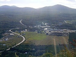
Saint-Augustin-de-Woburn, known locally as Woburn, is a parish municipality in Le Granit Regional County Municipality in the Estrie region of Quebec, Canada. The population is 695 as of the Canada 2011 Census. A parish municipality is the territory of a parish established as a municipality.
Saint-Augustin-de-Woburn | |
|---|---|
Parish municipality | |
 | |
 Location within Le Granit RCM | |
 Saint-Augustin-de-Woburn Location in southern Quebec | |
| Coordinates: 45°23′N 70°51′W[1] | |
| Country | |
| Province | |
| Region | Estrie |
| RCM | Le Granit |
| Constituted | January 13, 1900 |
| Government | |
| • Mayor | Steve Charrier |
| • Federal riding | Mégantic—L'Érable |
| • Prov. riding | Mégantic |
| Area | |
| • Total | 284.10 km2 (109.69 sq mi) |
| • Land | 280.63 km2 (108.35 sq mi) |
| Population (2011)[3] | |
| • Total | 695 |
| • Density | 2.5/km2 (6/sq mi) |
| • Pop 2006-2011 | |
| • Dwellings | 328 |
| Time zone | UTC−5 (EST) |
| • Summer (DST) | UTC−4 (EDT) |
| Postal code(s) | G0Y 1R0 |
| Area code | 819 |
| Highways | |
Settlement began around 1880.[4]
It is 5km from Canada–United States border and the Coburn Gore-Woburn Border Crossing. Mount Gosford lies entirely within the parish, making Woburn one of the highest towns in Quebec, at an altitude of 1,193 metres (3,914 ft).
Demographics
In the 2021 Census of Population conducted by Statistics Canada, Saint-Augustin-de-Woburn had a population of 667 living in 309 of its 354 total private dwellings, a change of -3.6% from its 2016 population of 692. With a land area of 281.07 km2 (108.52 sq mi), it had a population density of 2.4/km2 (6.1/sq mi) in 2021.[5]
References
- "Reference number 55699 in Banque de noms de lieux du Québec". toponymie.gouv.qc.ca (in French). Commission de toponymie du Québec.
- "Geographic code 30005 in the official Répertoire des municipalités". www.mamh.gouv.qc.ca (in French). Ministère des Affaires municipales et de l'Habitation.
- "(Code 2430005) Census Profile". 2011 census. Statistics Canada. 2012.
- "Saint-Augustin-de-Woburn". MRC du Granit. Retrieved 1 June 2020.
- "Population and dwelling counts: Canada, provinces and territories, and census subdivisions (municipalities), Quebec". Statistics Canada. February 9, 2022. Retrieved August 29, 2022.
See also
Types of municipalities in Quebec
External links
 Media related to Saint-Augustin-de-Woburn at Wikimedia Commons
Другой контент может иметь иную лицензию. Перед использованием материалов сайта WikiSort.org внимательно изучите правила лицензирования конкретных элементов наполнения сайта.
WikiSort.org - проект по пересортировке и дополнению контента Википедии