world.wikisort.org - Canada
Saint-Alexis-des-Monts is a parish municipality in the Mauricie region of the province of Quebec in Canada.
Saint-Alexis-des-Monts | |
|---|---|
Parish municipality | |
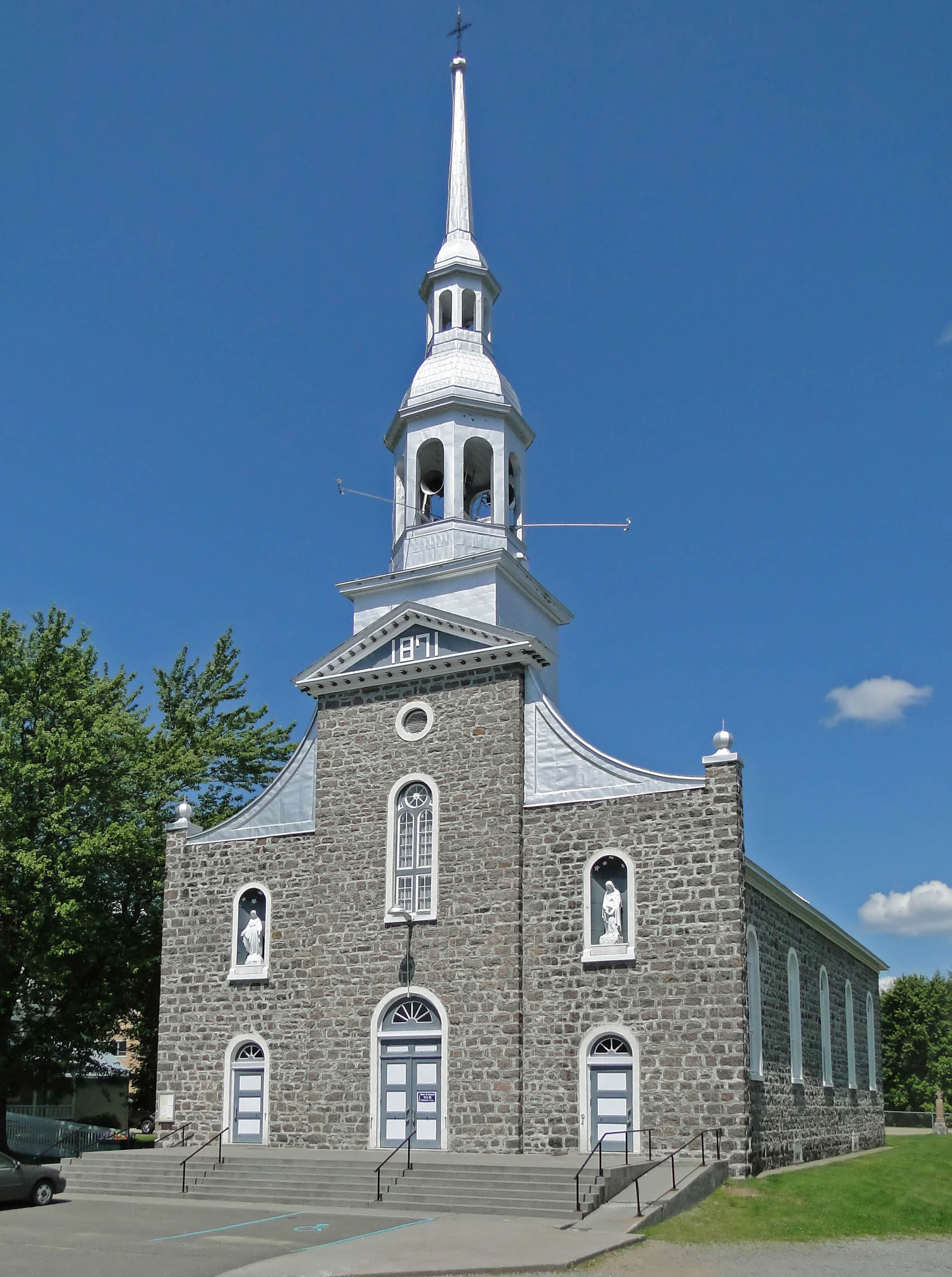 Saint-Alexis Church | |
| Motto: Progrès et Harmonie | |
 Location within Maskinongé RCM. | |
 Saint-Alexis-des-Monts Location in central Quebec. | |
| Coordinates: 46°28′N 73°08′W[1] | |
| Country | |
| Province | |
| Region | Mauricie |
| RCM | Maskinongé |
| Settled | 1865 |
| Constituted | April 21, 1984 |
| Government | |
| • Mayor | Madeleine L. Robert |
| • Federal riding | Berthier—Maskinongé |
| • Prov. riding | Maskinongé |
| Area | |
| • Total | 1,135.80 km2 (438.53 sq mi) |
| • Land | 1,048.39 km2 (404.79 sq mi) |
| Population (2016)[3] | |
| • Total | 2,981 |
| • Density | 2.8/km2 (7/sq mi) |
| • Pop 2011-2016 | |
| • Dwellings | 2,149 |
| Time zone | UTC−5 (EST) |
| • Summer (DST) | UTC−4 (EDT) |
| Postal code(s) | J0K 1V0 |
| Area code | 819 |
| Highways | |
| Website | www.saint- alexis-des-monts.ca |
It is located in the Laurentian Mountains, having a topography that is characterized by valleys and rounded hills, with an altitude varying between 150 metres (490 ft) to 560 metres (1,840 ft). There are more than 600 lakes, 400 named and another 200 unnamed minor lakes.[4] The majority (65%) of its territory is part of the Matawin Wildlife Reserve. The town depends on outdoor tourism that increases its seasonal population to between 8000 and 10,000 persons.[5]
History
The first settlers were originally from Saint-Paulin and established the community on the banks of the Du Loup River, north-west of Saint-Paulin, around 1865. On October 30 of that year, Alexis Lefebvre Boulanger (1812-1885), pioneer and farmer, donated the land on which the village's chapel was built in 1867, and the church in 1884. Saint-Alexis was named after him.[1]
Its post office, identified as Saint-Alexis-des-Monts, opened in 1876. In 1877, the Parish Municipality of Saint-Alexis-des-Monts was formed.[1]
In 1973, a portion of Saint-Alexis-des-Monts separated and formed the Municipality of Belleau, named in honour of Sir Narcisse-Fortunat Belleau (1808-1894), former lieutenant-governor of Quebec. On April 21, 1984, Belleau rejoined Saint-Alexis-des-Monts again, and the parish municipality had a surface area of more than 500 square kilometres (190 sq mi). On December 9, 1995, 763 square kilometres (295 sq mi) was added following the annexation of the Lac-Marcotte and Lac-au-Sorcier unorganized territories.[1]
Demographics
In the 2021 Census of Population conducted by Statistics Canada, Saint-Alexis-des-Monts had a population of 2,999 living in 1,593 of its 2,136 total private dwellings, a change of 0.6% from its 2016 population of 2,981. With a land area of 1,035.74 km2 (399.90 sq mi), it had a population density of 2.9/km2 (7.5/sq mi) in 2021.[6]
| 2016 | 2011 | |
|---|---|---|
| Population | 2,981 (-2.1% from 2011) | 3,046 (-2.3% from 2006) |
| Land area | 1,048.39 km2 (404.79 sq mi) | 1,048.28 km2 (404.74 sq mi) |
| Population density | 2.8/km2 (7.3/sq mi) | 2.9/km2 (7.5/sq mi) |
| Median age | 56.3 (M: 56.6, F: 55.9) | 52.5 (M: 52.3, F: 52.9) |
| Total private dwellings | 2,149 | 2,036 |
| Median household income | $41,216 | $36,984 |
Population trend:[10]
- Population in 2016: 2981 (2011 to 2016 population change: -2.1%)
- Population in 2011: 3046 (2006 to 2011 population change: -2.3%)
- Population in 2006: 3118
- Population in 2001: 2909
- Population in 1996: 2741
- Population in 1991: 2745
Mother tongue:
- English as first language: 0.5%
- French as first language: 97.7%
- English and French as first language: 0%
- Other as first language: 1.8%
References
- "Saint-Alexis-des-Monts (Municipalité de paroisse)" (in French). Commission de toponymie du Québec. Retrieved 2010-02-08.
- "Geographic code 51065 in the official Répertoire des municipalités". www.mamh.gouv.qc.ca (in French). Ministère des Affaires municipales et de l'Habitation.
- "2016 Community Profiles". 2016 Canadian Census. Statistics Canada. August 12, 2021. Retrieved 2022-07-29.
- "Saint-Alexis-des-Monts en quelques chiffres" (in French). Municipalité de Saint-Alexis-des-Monts. Archived from the original on 2010-01-28. Retrieved 2010-02-08.
- "La Municipalité" (in French). Municipalité de Saint-Alexis-des-Monts. Archived from the original on 2010-01-28. Retrieved 2010-02-08.
- "Population and dwelling counts: Canada, provinces and territories, and census subdivisions (municipalities), Quebec". Statistics Canada. February 9, 2022. Retrieved August 29, 2022.
- "2011 Community Profiles". 2011 Canadian Census. Statistics Canada. March 21, 2019. Retrieved 2022-07-29.
- "2006 Community Profiles". 2006 Canadian Census. Statistics Canada. August 20, 2019.
- "2001 Community Profiles". 2001 Canadian Census. Statistics Canada. July 18, 2021.
- Statistics Canada: 1996, 2001, 2006, 2011, 2016 census
External links
Places adjacent to Saint-Alexis-des-Monts, Quebec | ||||||||||||||||
|---|---|---|---|---|---|---|---|---|---|---|---|---|---|---|---|---|
| ||||||||||||||||
| Cities & towns | |
|---|---|
| Municipalities |
|
| Parishes |
|
| |
Authority control | |
|---|---|
| General |
|
| National libraries | |
Другой контент может иметь иную лицензию. Перед использованием материалов сайта WikiSort.org внимательно изучите правила лицензирования конкретных элементов наполнения сайта.
WikiSort.org - проект по пересортировке и дополнению контента Википедии