world.wikisort.org - Canada
Maskinongé is a municipality in the Mauricie region of the province of Quebec in Canada.
This article may be expanded with text translated from the corresponding article in French. (August 2015) Click [show] for important translation instructions.
|
Maskinongé | |
|---|---|
Municipality | |
 | |
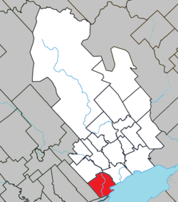 Location within Maskinongé RCM. | |
 Maskinongé Location in central Quebec. | |
| Coordinates: 46°14′N 73°01′W[1] | |
| Country | |
| Province | |
| Region | Mauricie |
| RCM | Maskinongé |
| Constituted | April 25, 2001 |
| Government | |
| • Mayor | Roger Michaud |
| • Federal riding | Berthier—Maskinongé |
| • Prov. riding | Maskinongé |
| Area | |
| • Total | 74.40 km2 (28.73 sq mi) |
| • Land | 74.55 km2 (28.78 sq mi) |
| There is an apparent contradiction between two authoritative sources | |
| Population (2011)[3] | |
| • Total | 2,253 |
| • Density | 30.2/km2 (78/sq mi) |
| • Pop 2006-2011 | |
| • Dwellings | 1,093 |
| Time zone | UTC−5 (EST) |
| • Summer (DST) | UTC−4 (EDT) |
| Postal code(s) | J0K 1N0 |
| Area code(s) | 819 |
| Highways | |
| Website | www |
References
- Reference number 367126 of the Commission de toponymie du Québec (in French)
- Geographic code 51008 in the official Répertoire des municipalités (in French)
- "(Code 2451008) Census Profile". 2011 census. Statistics Canada. 2012.
External links
 Media related to Maskinongé, Quebec at Wikimedia Commons
Places adjacent to Maskinongé, Quebec | ||||||||||||||||
|---|---|---|---|---|---|---|---|---|---|---|---|---|---|---|---|---|
| ||||||||||||||||
| Cities & towns |
|
|---|---|
| Municipalities |
|
| Parishes |
|
| |
Authority control | |
|---|---|
| General | |
| National libraries | |
This Quebec location article is a stub. You can help Wikipedia by expanding it. |
Текст в блоке "Читать" взят с сайта "Википедия" и доступен по лицензии Creative Commons Attribution-ShareAlike; в отдельных случаях могут действовать дополнительные условия.
Другой контент может иметь иную лицензию. Перед использованием материалов сайта WikiSort.org внимательно изучите правила лицензирования конкретных элементов наполнения сайта.
Другой контент может иметь иную лицензию. Перед использованием материалов сайта WikiSort.org внимательно изучите правила лицензирования конкретных элементов наполнения сайта.
2019-2026
WikiSort.org - проект по пересортировке и дополнению контента Википедии
WikiSort.org - проект по пересортировке и дополнению контента Википедии