world.wikisort.org - Canada
Nutashkuan (INAC[5][1]) or Natashquan (CGNDB) (sometimes Natashquan 1) is a First Nations reserve in the Canadian province of Quebec, belonging to the Première Nation des Innus de Nutashkuan band. The reserve is located on the north shore of the Gulf of St. Lawrence at the mouth of the Natashquan River, 336 km (209 mi) east of Sept-Îles and has been accessible by Route 138 since 1996.
Nutashkuan | |
|---|---|
First Nations reserve | |
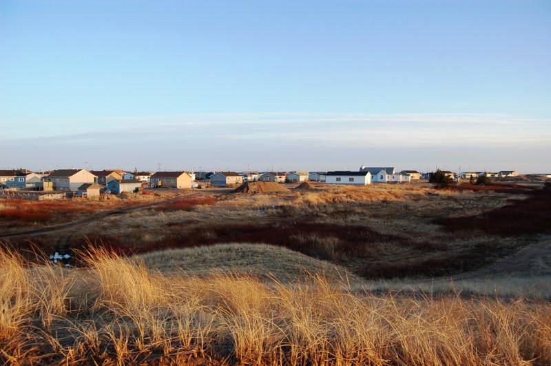 | |
 Nutashkuan Location in the Côte-Nord region | |
| Coordinates: 50°08′N 61°48′W[1] | |
| Country | Canada |
| Province | Quebec |
| Region | Côte-Nord |
| Regional county | none |
| Formed | 1953 |
| Government | |
| • Chief | Réal Tettaut |
| • Federal riding | Manicouagan |
| • Provincal riding | Duplessis |
| Area | |
| • Land | 1.35 km2 (0.52 sq mi) |
| Population (2021)[3] | |
| • Total | 915 |
| Time zone | UTC−05:00 (Within the AST legislated time zone boundary but observes EST[4]) |
| • Summer (DST) | UTC−04:00 (EDT) |
| Postal Code | G0G 2E0 |
| Area code(s) | 418 and 581 |
The reserve should not be confused with the adjacent but distinct township of Natashquan just to the north and east.
The community is serviced by a nursing station, community radio station, municipal water and sewer system, fire station, and an aboriginal police force.[6]
The site was mapped in 1684 by Louis Jolliet who called it Noutascoüan. It was subsequently spelled as Nontascouanne (1734), Natasquan (1831), Nataskwan (1844), Natashkwan (1846), Natosquan (1857), Nataskouan (1858), and taking its current form, Natashquan, circa 1895. This name, spelled Nutahkuant or Nutashkuan in the contemporary Innu language, is usually translated as "where the black bear is taken" or "where one hunts for bear."[7]
History
Historically, the nomadic Innu lived on their hunting grounds of the interior during the winter and would move to the coast in the summer for salmon fishing and seal hunting. From as early as 1710, a trading post was established on the left (south) bank of the Natashquan River and later on the opposite bank to conduct fur trade with the indigenous. They gathered at the post during their annual migration and began to settle there permanently. The post was acquired by the Hudson's Bay Company in the middle of the 19th century, but abandoned circa 1914 due to lack of profitability.[7][8]
In 1909, the first land survey was conducted for the creation of a reserve. In 1952, the first 20.5 acres (83,000 m2) of land were bought by the Government of Canada and transferred for the use by the Innu on 31 March 1953. The reserve was incrementally enlarged in 1954, 1970, and 1993.[9]
Demographics
As of May 2022, the band counted 1,212 members, of which 1,095 persons lived on the reserve.[10] In the 2021 Canadian census[3] there were 228 private dwellings that are occupied by usual residents, out of a total of 234. The mother tongue of the residents is:
- English as first language: 0%
- French as first language: 1.83%
- Innu-aimun as first language: 97.56%
- Other indigenous languages: 0.61%
- Population in 1991: 598
- Population in 1996: 639
- Population in 2001: 761
- Population in 2006: 810 (2001 to 2006 population change: 6.4%)
- Population in 2011: 841 (2006 to 2011 population change: 3.8%)
- Population in 2016: 835 (2011 to 2016 population change: -0.7%)
- Population in 2021: 915 (2016 to 2021 population change: 9.6%)
Climate
Nutashkuan has a subarctic climate (Dfc), typical of communities along the Gulf of St. Lawrence. Summers are mild and rainy, with mild days and cool nights. Winters are cold with extremely heavy annual snowfall, averaging 356.3 cm (140.3 in). Nutashkuan receives around 1,900 hours of sunshine per year.[12]
| Climate data for Natashquan Airport | |||||||||||||
|---|---|---|---|---|---|---|---|---|---|---|---|---|---|
| Month | Jan | Feb | Mar | Apr | May | Jun | Jul | Aug | Sep | Oct | Nov | Dec | Year |
| Record high humidex | 8.1 | 5.8 | 10.0 | 16.7 | 25.2 | 30.2 | 35.9 | 32.9 | 31.2 | 20.6 | 14.8 | 8.7 | 35.9 |
| Record high °C (°F) | 8.2 (46.8) |
6.7 (44.1) |
12.8 (55.0) |
17.8 (64.0) |
23.9 (75.0) |
26.4 (79.5) |
28.9 (84.0) |
28.3 (82.9) |
26.1 (79.0) |
19.4 (66.9) |
14.4 (57.9) |
9.4 (48.9) |
28.9 (84.0) |
| Average high °C (°F) | −8.0 (17.6) |
−7.2 (19.0) |
−2.2 (28.0) |
3.4 (38.1) |
9.7 (49.5) |
15.0 (59.0) |
18.5 (65.3) |
18.2 (64.8) |
14.2 (57.6) |
8.1 (46.6) |
1.9 (35.4) |
−4.3 (24.3) |
5.6 (42.1) |
| Daily mean °C (°F) | −13.5 (7.7) |
−12.7 (9.1) |
−7.1 (19.2) |
−0.3 (31.5) |
5.5 (41.9) |
10.7 (51.3) |
14.4 (57.9) |
14.1 (57.4) |
10.0 (50.0) |
4.2 (39.6) |
−1.9 (28.6) |
−9.0 (15.8) |
1.2 (34.2) |
| Average low °C (°F) | −19.0 (−2.2) |
−18.1 (−0.6) |
−12.0 (10.4) |
−3.9 (25.0) |
1.3 (34.3) |
6.3 (43.3) |
10.3 (50.5) |
9.9 (49.8) |
5.7 (42.3) |
0.3 (32.5) |
−5.6 (21.9) |
−13.7 (7.3) |
−3.2 (26.2) |
| Record low °C (°F) | −42.8 (−45.0) |
−37.2 (−35.0) |
−33.7 (−28.7) |
−22.5 (−8.5) |
−12.8 (9.0) |
−3.9 (25.0) |
1.1 (34.0) |
−1.1 (30.0) |
−7.8 (18.0) |
−15.0 (5.0) |
−25.6 (−14.1) |
−35.0 (−31.0) |
−42.8 (−45.0) |
| Record low wind chill | −52.3 | −47.9 | −42.9 | −31.3 | −17.9 | −15.0 | 0.9 | −3.4 | −7.3 | −19.6 | −30.4 | −46.2 | −52.3 |
| Average precipitation mm (inches) | 95.7 (3.77) |
67.4 (2.65) |
95.2 (3.75) |
81.7 (3.22) |
88.6 (3.49) |
86.2 (3.39) |
99.0 (3.90) |
96.0 (3.78) |
100.5 (3.96) |
107.9 (4.25) |
106.4 (4.19) |
105.3 (4.15) |
1,129.8 (44.48) |
| Average rainfall mm (inches) | 18.8 (0.74) |
12.5 (0.49) |
27.7 (1.09) |
47.2 (1.86) |
83.6 (3.29) |
86.2 (3.39) |
99.0 (3.90) |
97.1 (3.82) |
100.4 (3.95) |
102.2 (4.02) |
70.5 (2.78) |
29.4 (1.16) |
774.5 (30.49) |
| Average snowfall cm (inches) | 79.1 (31.1) |
55.8 (22.0) |
66.9 (26.3) |
33.3 (13.1) |
4.5 (1.8) |
0.0 (0.0) |
0.0 (0.0) |
0.0 (0.0) |
0.0 (0.0) |
5.5 (2.2) |
34.4 (13.5) |
76.8 (30.2) |
356.3 (140.3) |
| Average precipitation days (≥ 0.2 mm) | 19.1 | 15.8 | 15.7 | 14.5 | 13.9 | 13.0 | 14.3 | 13.2 | 14.3 | 15.2 | 15.1 | 17.7 | 181.9 |
| Average rainy days (≥ 0.2 mm) | 2.5 | 2.4 | 4.5 | 8.5 | 13.2 | 13.0 | 14.3 | 13.2 | 14.3 | 14.4 | 9.0 | 4.4 | 113.8 |
| Average snowy days (≥ 0.2 cm) | 18.4 | 14.9 | 13.6 | 9.3 | 1.8 | 0.0 | 0.0 | 0.0 | 0.0 | 2.2 | 9.2 | 16.1 | 85.6 |
| Average relative humidity (%) (at 06:00 / 15:00 LST) | 73.3 | 73.4 | 77.4 | 82.2 | 84.1 | 85.2 | 90.7 | 92.7 | 91.5 | 87.1 | 82.7 | 76.7 | 83.1 |
| Average afternoon relative humidity (%) (at 06:00 / 15:00 LST) | 68.8 | 67.6 | 70.4 | 73.3 | 70.5 | 71.5 | 76.1 | 77.1 | 75.6 | 73.1 | 73.2 | 71.9 | 72.4 |
| Mean monthly sunshine hours | 104.7 | 125.3 | 148.2 | 161.4 | 214.2 | 219.3 | 236.8 | 228.2 | 166.0 | 125.4 | 96.8 | 87.2 | 1,913.4 |
| Percent possible sunshine | 39.4 | 44.2 | 40.3 | 39.1 | 44.8 | 44.8 | 48.0 | 50.8 | 43.7 | 37.5 | 35.5 | 34.6 | 41.9 |
| Source: Environment and Climate Change Canada[12] | |||||||||||||
Economy
Nutashkuan's economy is mostly based on arts and handicrafts, trapping, tourism, and some construction, transport, and commercial fishing. In all there are some 20 businesses on the reserve. The Band council owns a boat and holds a crab-fishing licence.[6]
Local economic development is promoted by and the responsibility of the Corporation de développement économique de Natashquan.
Education
There is only one school on the reserve, École Uauitshitun, that provides pre-Kindergarten to Secondary grade 3.[6]
See also
- List of Indian reserves in Quebec
References
- "Nutashkuan". Geographical Names Data Base. Natural Resources Canada. Retrieved 18 August 2021.
- First Nation details for the Nutashkuan First Nations at Indigenous and Northern Affairs Canada. Retrieved 18 August 2021.
- "Natashquan, Indian reserve [Census subdivision], Quebec and Minganie--Le Golfe-du-Saint-Laurent, Census division [Census division], Quebec". 9 February 2022. Retrieved 21 March 2022.
- National Research Council Canada – Time Zones & Daylight Saving Time Archived 17 March 2010 at the Wayback Machine
- Reserve, settlement or village details for Nutashkuan Reserve at Indigenous and Northern Affairs Canada. Retrieved 18 August 2021.
- "Natashquan First Nation". Aboriginal Community profiles. Indian and Northern Affairs Canada. Archived from the original on 13 June 2011. Retrieved 15 September 2010.
- "Natashquan (Réserve indienne)" (in French). Commission de toponymie du Québec. Retrieved 15 September 2010.
- "Natashquan (Municipalité de canton)" (in French). Commission de toponymie du Québec. Retrieved 15 September 2010.
- Natural Resources Canada – Legal Surveys Division, Historical Review – Natashquan land title history
- "Indigenous communities in Quebec". 15 October 2021.
- "2021 Community Profiles". 9 February 2022. Retrieved 21 March 2022.
- "Canadian Climate Normals 1981-2010 Station Data". climate.weather.gc.ca. Environment and Climate Change Canada. 9 July 2021. Retrieved 18 August 2021.
External links
- Conseil tribal Mamuitun – Nutashkuan
- Indian and Northern Affairs Canada – Aboriginal Community profiles: Première Nation des Innus de Nutashkuan
Adjacent Municipal Subdivisions | ||||||||||||||||
|---|---|---|---|---|---|---|---|---|---|---|---|---|---|---|---|---|
| ||||||||||||||||
| Administrative units |
| ||||
|---|---|---|---|---|---|
| Protected areas |
| ||||
| Major river basins | |||||
| Significant lakes | |||||
| Transport infrastructure |
| ||||
| |||||
Innu and Naskapi people | ||
|---|---|---|
Innu language Naskapi language Nitassinan Innu music Northeastern Quebec Agreement (1978) Côte-Nord Eastern Labrador | ||
| First Nations (Indian bands) |
|  |
| Communities |
| |
See also: Category:Innu Category:Naskapi | ||
| Regional county municipalities and equivalent territories |
|
|---|---|
| Municipalities |
|
Administrative divisions of Quebec | |
| Authority control |
|
|---|
Другой контент может иметь иную лицензию. Перед использованием материалов сайта WikiSort.org внимательно изучите правила лицензирования конкретных элементов наполнения сайта.
WikiSort.org - проект по пересортировке и дополнению контента Википедии