world.wikisort.org - Canada
Morley is a township in the Canadian province of Ontario, located within the Rainy River District. The township had a population of 481 in the Canada 2016 Census. Named after John Morley, it was formed in 1903 when the townships of Morley and Pattullo, as well as the village of Stratton, were amalgamated.[3]
Morley | |
|---|---|
Township (single-tier) | |
| Township of Morley | |
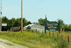
 Stratton | |
 Morley | |
| Coordinates: 48°50′N 94°10′W | |
| Country | Canada |
| Province | Ontario |
| District | Rainy River |
| Settled | 1880s |
| Incorporated | 1903 |
| Government | |
| • Reeve | George Heyens |
| • Federal riding | Thunder Bay—Rainy River |
| • Prov. riding | Kenora—Rainy River |
| Area | |
| • Land | 390.61 km2 (150.82 sq mi) |
| Population (2016)[2] | |
| • Total | 481 |
| • Density | 1.2/km2 (3/sq mi) |
| Time zone | UTC-6 (CST) |
| • Summer (DST) | UTC-5 (CDT) |
| Postal Code FSA | P0W 1N0 |
| Area code(s) | 807 |
| Website | www.townshipofmorley.ca |
In 2004, the Township of Morley was greatly expanded through the addition of the geographic townships of Sifton and Dewart, that were previously part of Unorganized Rainy River District.[3]
Demographics
In the 2021 Census of Population conducted by Statistics Canada, Morley had a population of 493 living in 186 of its 235 total private dwellings, a change of 2.5% from its 2016 population of 481. With a land area of 388.38 km2 (149.95 sq mi), it had a population density of 1.3/km2 (3.3/sq mi) in 2021.[4]
| 2021 | 2016 | 2011 | |
|---|---|---|---|
| Population | 493 (+2.5% from 2016) | 481 (-4.0% from 2011) | 501 (+1.8% from 2006) |
| Land area | 388.38 km2 (149.95 sq mi) | 390.61 km2 (150.82 sq mi) | 375.61 km2 (145.02 sq mi) |
| Population density | 1.3/km2 (3.4/sq mi) | 1.2/km2 (3.1/sq mi) | 1.3/km2 (3.4/sq mi) |
| Median age | 40 (M: 40, F: 40) | 40.6 (M: 41.1, F: 40.3) | 45.5 (M: 45.9, F: 44.2) |
| Total private dwellings | 185 | 232 | 227 |
| Median household income | $71,680 |
| Year | Pop. | ±% |
|---|---|---|
| 1991 | 435 | — |
| 1996 | 478 | +9.9% |
| 2001 | 447 | −6.5% |
| 2006 | 492 | +10.1% |
| 2011 | 501 | +1.8% |
| 2016 | 481 | −4.0% |
| [9][10][2] 2001 population would have been 526 if 2006 boundaries were used | ||
See also
- List of townships in Ontario
References
- "2011 Community Profiles". 2011 Canadian Census. Statistics Canada. March 21, 2019. Retrieved 2012-03-30.
- "Census Profile, 2016 Census: Morley, Township". Statistics Canada. Retrieved July 1, 2019.
- "The Full History". The Corporation of the Township of Morley. Archived from the original on 2012-03-23. Retrieved 2011-05-04.
- "Population and dwelling counts: Canada, provinces and territories, census divisions and census subdivisions (municipalities), Ontario". Statistics Canada. February 9, 2022. Retrieved April 2, 2022.
- "2021 Community Profiles". 2021 Canadian Census. Statistics Canada. February 4, 2022. Retrieved 2022-04-27.
- "2016 Community Profiles". 2016 Canadian Census. Statistics Canada. August 12, 2021. Retrieved 2019-07-01.
- "2006 Community Profiles". 2006 Canadian Census. Statistics Canada. August 20, 2019.
- "2001 Community Profiles". 2001 Canadian Census. Statistics Canada. July 18, 2021.
- Statistics Canada: 2001, 2006, 2011 census
- "Morley census profile". 2011 Census of Population. Statistics Canada. Retrieved 2012-03-30.
External links
На других языках
[de] Morley (Ontario)
Morley ist ein ländliches Gebiet, genauer ein Township, in der kanadischen Provinz Ontario. Es liegt im Rainy River District und hatte 2006 492 Einwohner. Bedeutendster Ort ist das 1901 entstandene Stratton mit rund 125 Einwohnern, das einen hohen Anteil an Mennoniten aufweist.- [en] Morley, Ontario
Другой контент может иметь иную лицензию. Перед использованием материалов сайта WikiSort.org внимательно изучите правила лицензирования конкретных элементов наполнения сайта.
WikiSort.org - проект по пересортировке и дополнению контента Википедии
