world.wikisort.org - Canada
Howick is the third smallest municipality in the Canadian province of Quebec, located in Le Haut-Saint-Laurent Regional County Municipality. The population as of the Canada 2021 Census was 850. Situated along the English River in the heart of the Chateauguay Valley, it is approximately 50 minutes southwest of Montreal and 20 minutes north of the Canada–United States border.
Howick | |
|---|---|
Municipality | |
 | |
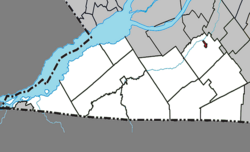 Location within Le Haut-Saint-Laurent RCM. | |
 Howick Location in southern Quebec. | |
| Coordinates: 45°11′N 73°51′W[1] | |
| Country | |
| Province | |
| Region | Montérégie |
| RCM | Le Haut-Saint-Laurent |
| Constituted | October 29, 1915 |
| Government | |
| • Mayor | Richard Raithby |
| • Federal riding | Beauharnois—Salaberry |
| • Prov. riding | Huntingdon |
| Area | |
| • Total | 1.00 km2 (0.39 sq mi) |
| • Land | 0.96 km2 (0.37 sq mi) |
| Population (2021)[5] | |
| • Total | 850 |
| • Density | 885/km2 (2,290/sq mi) |
| • Pop 2016-2021 | |
| • Dwellings | 366 |
| Time zone | UTC−5 (EST) |
| • Summer (DST) | UTC−4 (EDT) |
| Postal code(s) | J0S 1G0 |
| Area code(s) | 450 and 579 |
| Highways | |
Geography
Lakes & Rivers
The following waterways pass through or are situated within the municipality's boundaries:[1]
- English River – runs south to north along Howick's southeast boundary
Demographics
Population
|
Canada census – Howick community profile
|
|
|
|
Language
| Canada Census Mother Tongue - Howick, Quebec[10] | ||||||||||||||||||
|---|---|---|---|---|---|---|---|---|---|---|---|---|---|---|---|---|---|---|
| Census | Total | French |
English |
French & English |
Other | |||||||||||||
| Year | Responses | Count | Trend | Pop % | Count | Trend | Pop % | Count | Trend | Pop % | Count | Trend | Pop % | |||||
2016 |
780 |
525 | 67.3% | 225 | 28.8% | 20 | 2.6% | 10 | 1.3% | |||||||||
2011 |
630 |
395 | 62.7% | 205 | 32.5% | 20 | 3.2% | 10 | 1.6% | |||||||||
2006 |
600 |
435 | 72.5% | 155 | 25.8% | 0 | 0.0% | 10 | 1.7% | |||||||||
2001 |
580 |
315 | 54.3% | 240 | 41.4% | 10 | 1.7% | 15 | 2.6% | |||||||||
1996 |
615 |
370 | n/a | 60.2% | 225 | n/a | 36.6% | 20 | n/a | 3.3% | 0 | n/a | 0.0% | |||||
Attractions
Located outside Howick, in the hamlet of Allan's Corners, is the site of the Battle of the Chateauguay, where on October 25, 1813 Canadian and Native forces fought and repelled an invading American force that was planning to attack Montreal during the War of 1812. There is a National Parks of Canada museum near the site of the battle.
Transportation
The CIT du Haut-Saint-Laurent provides commuter and local bus services.
See also
- Le Haut-Saint-Laurent Regional County Municipality
- Chateauguay River
- List of municipalities in Quebec
References
- "Reference number 29106 in Banque de noms de lieux du Québec". toponymie.gouv.qc.ca (in French). Commission de toponymie du Québec.
- Ministère des Affaires municipales, des Régions et de l'Occupation du territoire: Howick
- Riding history for Beauharnois—Salaberry, Quebec from the Library of Parliament
- "Profile table, Census Profile, 2021 Census of Population - Howick, Municipalité (MÉ) [Census subdivision], Quebec". 9 February 2022.
- "Profile table, Census Profile, 2021 Census of Population - Howick, Municipalité (MÉ) [Census subdivision], Quebec". 9 February 2022.
- "2016 Community Profiles". 2016 Canadian Census. Statistics Canada. August 12, 2021. Retrieved 2022-06-14.
- "2011 Community Profiles". 2011 Canadian Census. Statistics Canada. March 21, 2019. Retrieved 2014-02-15.
- "2006 Community Profiles". 2006 Canadian Census. Statistics Canada. August 20, 2019.
- "2001 Community Profiles". 2001 Canadian Census. Statistics Canada. July 18, 2021.
- Statistics Canada: 1996, 2001, 2006, 2011, 2016, 2021 census
Adjacent Municipal Subdivisions | ||||||||||||||||
|---|---|---|---|---|---|---|---|---|---|---|---|---|---|---|---|---|
| ||||||||||||||||
| Cities | |
|---|---|
| Municipalities | |
| Parishes |
|
| Townships | |
| |
| Authority control |
|
|---|
Другой контент может иметь иную лицензию. Перед использованием материалов сайта WikiSort.org внимательно изучите правила лицензирования конкретных элементов наполнения сайта.
WikiSort.org - проект по пересортировке и дополнению контента Википедии