world.wikisort.org - Canada
Grise Fiord (/ɡriːz fiˈɔːrd/; Inuktitut: ᐊᐅᔪᐃᑦᑐᖅ, romanized: Aujuittuq, lit. 'place that never thaws') is an Inuit hamlet on the southern tip of Ellesmere Island, in the Qikiqtaaluk Region, Nunavut, Canada. It is one of three populated places on the island; despite its low population (144 residents as of the 2021 Canadian census),[5] it is the largest community (and only public community) on Ellesmere Island. The hamlet at Grise Fiord, created by the Canadian Government in 1953 through a relocation of Inuit families from Inukjuak, Quebec, is the northernmost public community in Canada. It is also one of the coldest inhabited places in the world, with an average yearly temperature of −16.5 °C (2.3 °F).
Grise Fiord
ᐊᐅᔪᐃᑦᑐᖅ Aujuittuq | |
|---|---|
Hamlet | |
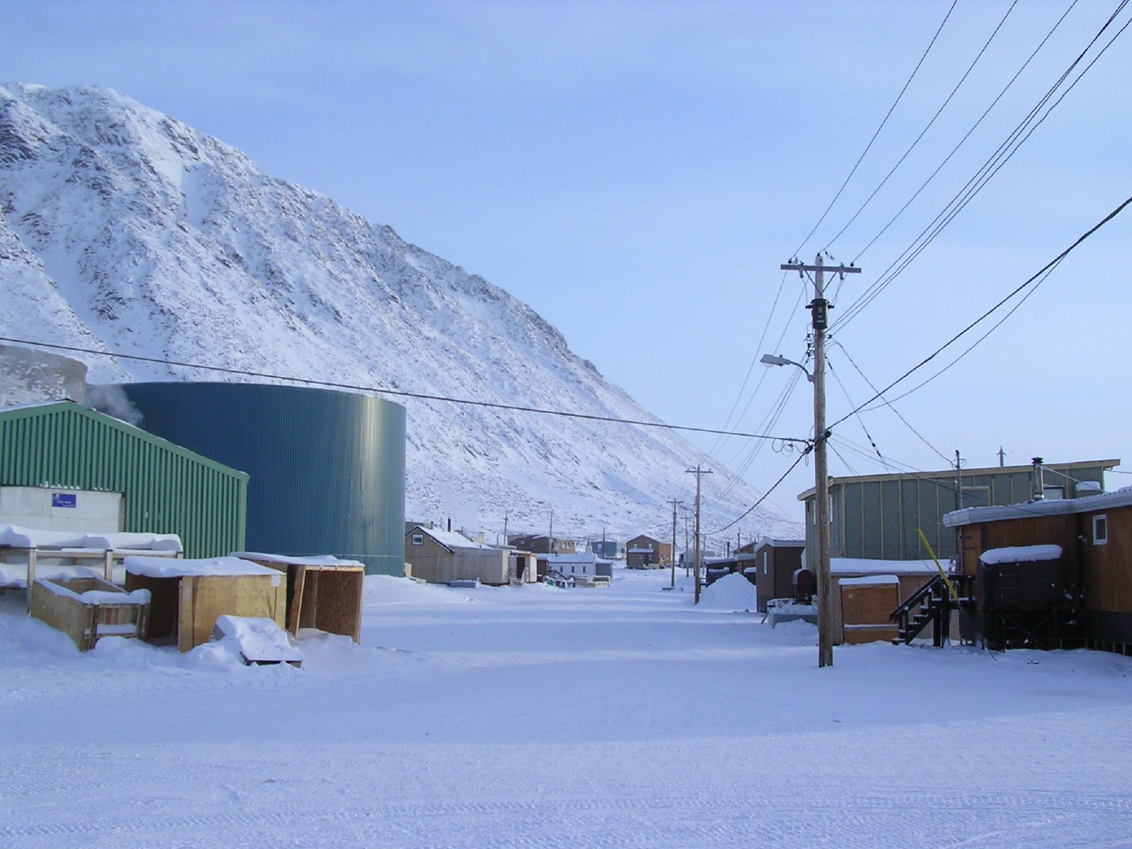 Downtown Grise Fiord, March 2004 | |
 Flag | |
 Grise Fiord  Grise Fiord | |
| Coordinates: 76°25′00″N 082°53′45″W[1] | |
| Country | Canada |
| Territory | Nunavut |
| Region | Qikiqtaaluk |
| Electoral district | Quttiktuq |
| High Arctic relocation | 1953 |
| Government | |
| • Mayor | Meeka Kiguktak |
| • MLA | David Akeeagok |
| Area | |
| • Total | 332.90 km2 (128.53 sq mi) |
| Elevation (at airport)[6] | 41 m (135 ft) |
| Population (2021)[5] | |
| • Total | 144 |
| • Density | 0.4/km2 (1/sq mi) |
| Time zone | UTC−05:00 (EST) |
| • Summer (DST) | UTC−04:00 (EDT) |
| Canadian Postal code | X0A 0J0 |
| Area code(s) | 867, Exchange: 980 |
History
![Grise Fiord Church, which was destroyed by fire on February 27, 2018[7]](http://upload.wikimedia.org/wikipedia/commons/0/0a/Grise_Fiord_Church.jpg)
Creation

This community (and that of Resolute) was created by the Canadian government in 1953, partly to assert sovereignty in the High Arctic during the Cold War. Eight Inuit families from Inukjuak, Quebec (on the Ungava Peninsula), were relocated after being promised homes and game to hunt, but the relocated people discovered no buildings and very little familiar wildlife.[8] They were told that they would be returned home after a year if they wished, but this offer was later withdrawn, for it would have damaged Canada's claims to sovereignty in the area; the Inuit were forced to stay. Eventually, the Inuit learned the local beluga whale migration routes and were able to survive in the area, hunting over a range of 18,000 km2 (6,900 sq mi) each year.[9]
In 1993, the Canadian government held hearings to investigate the relocation program. The Royal Commission on Aboriginal Peoples issued a report entitled The High Arctic Relocation: A Report on the 1953–55 Relocation, recommending a settlement.[10] The government paid CAD10 million to the survivors and their families,[11] and gave a formal apology in 2010.[12]
In 2009, artist and Grise Fiord resident Looty Pijamini was commissioned by Nunavut Tunngavik Incorporated to build a monument to commemorate the Inuit who sacrificed so much as a result of the Government's forced relocation programme of 1953 and 1955. Pijamini's monument, located in Grise Fiord, depicts a woman with a young boy and a husky, with the woman sombrely looking out towards Resolute Bay. Amagoalik's monument, located in Resolute, depicts a lone man looking towards Grise Fiord. This was meant to show separated families, and depicting them longing to see each other again.[13] The Grise Fiord monument was unveiled by John Duncan, at the time, Minister of Aboriginal Affairs and Northern Development and Federal Interlocutor for Métis and Non-Status Indians, on September 10, 2010.[14][15]
Grise Fiord was the location for a 1995 BBC documentary entitled Billy Connolly: A Scot in the Arctic, in which the comedian Billy Connolly camped alone for a week on the pack ice near to the community, armed with a rifle to protect him from polar bears.
Geography

Located at the southern tip of Ellesmere Island, Grise Fiord is one of three permanent inhabited places on the island; further north on the island Environment Canada has a permanent weather station at Eureka, and at Alert there is a permanent Canadian Forces Base (CFS Alert) and weather station. Grise Fiord lies 1,160 km (720 mi) north of the Arctic Circle, and is the northernmost civilian community in Canada.[16]
Grise Fiord is cradled by the Arctic Cordillera mountain range.
Demographics
In the 2021 Census of Population conducted by Statistics Canada, Grise Fiord had a population of 144 living in 58 of its 64 total private dwellings, a change of 11.6% from its 2016 population of 129. With a land area of 332.9 km2 (128.5 sq mi), it had a population density of 0.4/km2 (1.1/sq mi) in 2021.[25]
Community and fiord names
Just to the north of the community is the actual fiord, Grise Fiord. It means "pig inlet" in Norwegian. Otto Sverdrup from Norway named it so during an expedition around 1900 because he thought the walrus in the area sounded like pigs.
The Inuktitut name is ᐊᐅᔪᐃᑦᑐᖅ (Aujuittuq), which means "place that never thaws".
Living conditions
The houses are wooden and built on platforms to cope with the freezing and thawing of the permafrost. Hunting is still an important part of the lifestyle of the mostly Inuit population. Quota systems allow the villagers to supply many of their needs from populations of seals, walruses, narwhal and beluga whales, polar bears and muskox. Ecotourism is developing as people come to see the northern wildlife found on Ellesmere and surrounding islands.[26]
Transportation
There are no connecting roads on Ellesmere Island, so Grise Fiord is connected to the rest of the world by a small airstrip (Grise Fiord Airport), 1,675 ft (511 m) in length. Surrounded by mountains, it has one of the most difficult approaches for aircraft; it is cautioned that only very experienced pilots of Pilatus PC-12, DHC-6 Twin Otter, and DHC-7 aircraft attempt the approach.[6]
For local travel needs, the villagers use all-terrain vehicles in the summer and snowmobiles in the winter. During the winter months travel is limited to the town site and a small patch of land to the east called Nuvuk due to mountains and ice fields that cut the town off from the rest of the island. Small boats are used in summer to reach hunting grounds, or hunting sea mammals on the ocean. Once a year large ships (sealift) arrive with supplies and fuel.
Economy, development, and sustainability
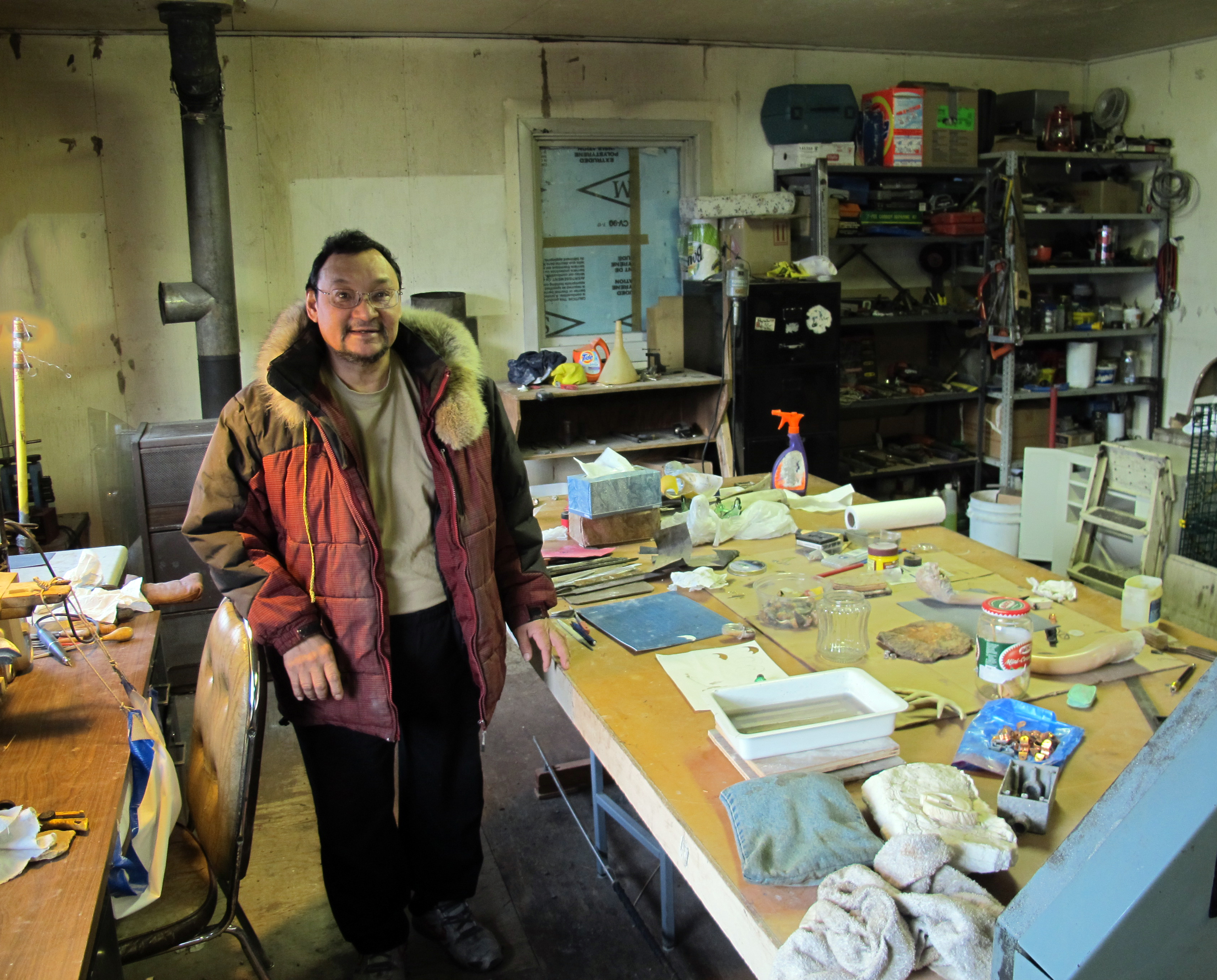
The local co-operative is the main place to purchase supplies. There are local guide and outfitting operations, which are an important source of income for many families. Carving, traditional clothing and other Inuit crafts are also important sources of income. Due to the extreme location, the economy is subsistence-based. Because of the potential for avalanches and falling rocks from mountains, there is no room for expansion.[citation needed]
Communications

In 1970, Bell Canada established what was then the world's most northerly telephone exchange (operated since 1992 by Northwestel). It is in the 867 area code (formerly 819 before October 1997) with its only exchange code of 980.
The community has been served by the Qiniq network since 2005. Qiniq is a fixed wireless service to homes and businesses, connecting to the outside world via a satellite backbone. The Qiniq network is designed and operated by SSI Micro. In 2017, the network was upgraded to 4G LTE technology, and 2G-GSM for mobile voice. In 2019, Bell Mobility became available to Grise Fiord.[27][28]
Crime and safety
A Simon Fraser University study of Royal Canadian Mounted Police (RCMP) activity in the Baffin Region states that Grise Fiord had the lowest rate of criminal offences of all communities examined in 1992,[29] and cites a 1994 Statistics Canada survey that gives the highest perception of personal safety.[30]
Climate
Grise Fiord has a tundra climate (ET) with very short but cool summers and long, cold winters lasting almost the entire year.
| Climate data for Grise Fiord (Grise Fiord Airport) WMO ID: 71971; coordinates 76°25′22″N 82°54′08″W; elevation: 44.5 m (146 ft) | |||||||||||||
|---|---|---|---|---|---|---|---|---|---|---|---|---|---|
| Month | Jan | Feb | Mar | Apr | May | Jun | Jul | Aug | Sep | Oct | Nov | Dec | Year |
| Record high °C (°F) | −0.6 (30.9) |
−0.5 (31.1) |
2.7 (36.9) |
10.5 (50.9) |
12.5 (54.5) |
15.0 (59.0) |
15.6 (60.1) |
14.1 (57.4) |
8.5 (47.3) |
7.5 (45.5) |
3.0 (37.4) |
4.0 (39.2) |
15.6 (60.1) |
| Average high °C (°F) | −24 (−11) |
−27 (−17) |
−24 (−11) |
−15 (5) |
−5 (23) |
3 (37) |
7 (45) |
6 (43) |
0 (32) |
−7 (19) |
−15 (5) |
−20 (−4) |
−10 (14) |
| Daily mean °C (°F) | −27 (−17) |
−29 (−20) |
−26 (−15) |
−18 (0) |
−7 (19) |
1 (34) |
5 (41) |
4 (39) |
−1 (30) |
−9 (16) |
−17 (1) |
−23 (−9) |
−12 (10) |
| Average low °C (°F) | −30 (−22) |
−32 (−26) |
−29 (−20) |
−20 (−4) |
−9 (16) |
0 (32) |
3 (37) |
3 (37) |
−2 (28) |
−10 (14) |
−19 (−2) |
−25 (−13) |
−14 (6) |
| Record low °C (°F) | −47.0 (−52.6) |
−47.0 (−52.6) |
−46.0 (−50.8) |
−40.5 (−40.9) |
−30.5 (−22.9) |
−13.0 (8.6) |
−5.0 (23.0) |
−7.4 (18.7) |
−16.0 (3.2) |
−29.0 (−20.2) |
−41.1 (−42.0) |
−42.0 (−43.6) |
−47.0 (−52.6) |
| Average precipitation mm (inches) | 4.7 (0.19) |
5.2 (0.20) |
10.4 (0.41) |
7.0 (0.28) |
12.8 (0.50) |
20 (0.8) |
24.7 (0.97) |
25.0 (0.98) |
13.2 (0.52) |
15.4 (0.61) |
9.9 (0.39) |
8.2 (0.32) |
156.5 (6.17) |
| Source 1: [31][32] | |||||||||||||
| Source 2: Meteo Climate (extremes)[33] | |||||||||||||
See also
- List of municipalities in Nunavut
- Florin Fodor, a Romanian who was arrested trying to illegally enter Canada via Grise Fiord in September 2006.
References
- "Grise Fiord". Geographical Names Data Base. Natural Resources Canada.
- "Grise Fiord". Geographical Names Data Base. Natural Resources Canada.
- "NunatsiaqOnline 2013-12-03: NEWS: Nunavummiut vie for council positions in upcoming hamlet elections". 4 December 2013.
- Results for the constituency of Quttiktuq Archived 2013-11-13 at the Wayback Machine at Elections Nunavut
- "Census Profile, 2021 Census of Population". Statistics Canada. Retrieved 2022-03-04.
- Canada Flight Supplement. Effective 0901Z 16 July 2020 to 0901Z 10 September 2020.
- Grise Fiord's only church a 'total loss' after late night fire
- "Grise Fiord: History". Grisefiord.ca. Archived from the original on 2008-12-28. Retrieved 2013-01-10.
- McGrath, Melanie. The Long Exile: A Tale of Inuit Betrayal and Survival in the High Arctic. Alfred A. Knopf, 2006 (268 pages) Hardcover: ISBN 0-00-715796-7 Paperback: ISBN 0-00-715797-5
- The High Arctic Relocation: A Report on the 1953–55 Relocation by René Dussault and George Erasmus, produced by the Royal Commission on Aboriginal Peoples, published by Canadian Government Publishing, 1994 (190 pages)"The High Arctic Relocation". Archived from the original on 2009-10-01. Retrieved 2009-10-09.
- Royte, Elizabeth (2007-04-08). "Trail of Tears". The New York Times.
- "Apology for the Inuit High Arctic relocation". www.aadnc-aandc.gc.ca. Archived from the original on 2017-01-09. Retrieved 2015-09-04.
- "Carvers chosen for Arctic monuments" Archived 2012-03-25 at the Wayback Machine, Northern News Services. Retrieved 1 June 2011.
- "Minister Duncan Attends Unveiling of Inuit Relocation Monuments" Archived 2010-10-09 at the Wayback Machine, Indian and Northern Affairs Canada. Retrieved 1 June 2011.
- Gabriel Zarate, "For Grise Fiord’s exiles, an apology that came too late", Nunatsiaq Online. Retrieved 1 June 2011.
- "Grise Fiord fire hall catches fire". CBC News. October 8, 2014.
- "1981 Census of Canada: Census subdivisions in decreasing population order" (PDF). Statistics Canada. May 1992. Retrieved February 1, 2021.
- "1986 Census: Population - Census Divisions and Census Subdivisions" (PDF). Statistics Canada. September 1987. Retrieved February 1, 2022.
- "91 Census: Census Divisions and Census Subdivisions - Population and Dwelling Counts" (PDF). Statistics Canada. April 1992. Retrieved February 1, 2022.
- "96 Census: A National Overview - Population and Dwelling Counts" (PDF). Statistics Canada. April 1997. Retrieved February 1, 2022.
- "Population and Dwelling Counts, for Canada, Provinces and Territories, and Census Subdivisions (Municipalities), 2001 and 1996 Censuses - 100% Data (Nunavut)". Statistics Canada. August 15, 2012. Retrieved February 1, 2022.
- "Population and dwelling counts, for Canada, provinces and territories, and census subdivisions (municipalities), 2006 and 2001 censuses - 100% data (Nunavut)". Statistics Canada. August 20, 2021. Retrieved February 1, 2022.
- "Population and dwelling counts, for Canada, provinces and territories, and census subdivisions (municipalities), 2011 and 2006 censuses (Nunavut)". Statistics Canada. July 25, 2021. Retrieved February 1, 2022.
- "Population and dwelling counts, for Canada, provinces and territories, and census subdivisions (municipalities), 2016 and 2011 censuses – 100% data (Nunavut)". Statistics Canada. February 8, 2017. Retrieved February 1, 2022.
- "Population and dwelling counts: Canada, provinces and territories, and census subdivisions (municipalities), Nunavut". Statistics Canada. February 9, 2022. Retrieved February 19, 2022.
- "Grise Fiord: Wildlife".
- CTS 2018: It's not easy to bring wireless to the top of the world
- Competitive cell service coming to all Nunavut communities by 2019
- Curt Taylor Griffiths, Gregory Saville, Darryl S. Wood, and Evelyn Zellerer. POLICING THE BAFFIN REGION, N.W.T.: Findings From the Eastern Arctic Crime and Justice Study, 1995
- "Aboriginal Peoples Survey", Statistics Canada, 1994, cited on p17 of Curt Taylor Griffiths, Gregory Saville, Darryl S. Wood, and Evelyn Zellerer, POLICING THE BAFFIN REGION, N.W.T.: Findings From the Eastern Arctic Crime and Justice Study
- Annual Weather Averages in Grise Fiord
- "Daily Data Report for July 2019". Environment and Climate Change Canada. Government of Canada. Retrieved July 28, 2019.
- "71971: Grise Fiord Climate, Nu (Canada)". ogimet.com. OGIMET. 21 December 2021. Retrieved 22 December 2021.
External links
На других языках
[de] Grise Fiord
Grise Fiord ist die nördlichste Gemeinde des Territoriums Nunavut und gilt als eine der nördlichsten Gemeinden der Erde. In der Sprache der Inuit (Inuktitut) heißt die Siedlung Aujuittuq (ᐊᐅᔪᐃᑦᑐᖅ), was „Land, das niemals taut“ bedeutet (vgl. auch Auyuittuq-Nationalpark). Sie ist an der Südküste der Ellesmere-Insel inmitten der Arktischen Kordilleren gelegen und hat 144 Einwohner (davon rund 85 Prozent Inuit).[1] Der Name Grise Fiord stammt aus dem Norwegischen und bedeutet „Schweine-Fjord“; der Norweger Otto Sverdrup, der die Gegend hier zwischen 1899 und 1902 erforschte, verlieh ihn diesem Fjord, weil ihn das Grunzen der vielen hier vorkommenden Walrosse an Schweine erinnerte.- [en] Grise Fiord
[ru] Грис-Фьорд
Грис-Фьорд (англ. Grise Fiord, инуктитут Aujuittuq, ᐊᐅᔪᐃᑦᑐᖅ) — небольшая канадская инуитская деревня, расположенная в регионе Кикиктани. Несмотря на своё небольшое население (130 жителей, согласно переписи 2011 года[en][3]), это крупнейшее поселение на острове Элсмир. Является одним из самых холодных поселений, среднегодовая температура здесь — минус 16,5 °C.Другой контент может иметь иную лицензию. Перед использованием материалов сайта WikiSort.org внимательно изучите правила лицензирования конкретных элементов наполнения сайта.
WikiSort.org - проект по пересортировке и дополнению контента Википедии