world.wikisort.org - Brazil
Tupanciretã is a municipality of the western part of the state of Rio Grande do Sul, Brazil. The population is 24,068 (2020 est.) in an area of 2251.86 km².[2] Its elevation is 465 m. The name comes from the Tupi language. It is located west of the state capital of Porto Alegre and northeast of Alegrete.
Tupanciretã | |
|---|---|
Municipality | |
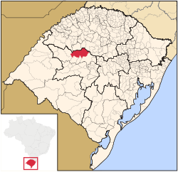 Location in Rio Grande do Sul state | |
 Tupanciretã Location in Brazil | |
| Coordinates: 29°4′50″S 53°50′9″W | |
| Country | Brazil |
| Region | South |
| State | Rio Grande do Sul |
| Mesoregion | Centro Ocidental Rio-Grandense |
| Microregion | Santiago |
| Area | |
| • Total | 2,251.86 km2 (869.45 sq mi) |
| Elevation | 465 m (1,526 ft) |
| Population (2020 [1]) | |
| • Total | 24,068 |
| • Density | 11/km2 (28/sq mi) |
| Time zone | UTC-03:00 (BRT) |
| • Summer (DST) | UTC-02:00 (BRST) |
| Postal code | 98170-000 |
| Website | www |
Neighboring municipalities
References
External links
- http://www.citybrazil.com.br/rs/tupancireta/ (in Portuguese)
- Anthem of the municipality of Tupanciretã
Capital: Porto Alegre | |||||||||||||||||||||||||||||||
|  | ||||||||||||||||||||||||||||||
|
| |||||||||||||||||||||||||||||||
| |||||||||||||||||||||||||||||||
| |||||||||||||||||||||||||||||||
| |||||||||||||||||||||||||||||||
| Authority control |
|
|---|
 | This geographical article relating to Rio Grande do Sul is a stub. You can help Wikipedia by expanding it. |
На других языках
- [en] Tupanciretã
[ru] Тупансиретан
Тупансиретан (порт. Tupanciretã) — муниципалитет в Бразилии, входит в штат Риу-Гранди-ду-Сул. Составная часть мезорегиона Западно-центральная часть штата Риу-Гранди-ду-Сул. Входит в экономико-статистический микрорегион Сантиагу. Население составляет 22 123 человека на 2006 год. Занимает площадь 2 251,863 км². Плотность населения — 9,8 чел./км².Текст в блоке "Читать" взят с сайта "Википедия" и доступен по лицензии Creative Commons Attribution-ShareAlike; в отдельных случаях могут действовать дополнительные условия.
Другой контент может иметь иную лицензию. Перед использованием материалов сайта WikiSort.org внимательно изучите правила лицензирования конкретных элементов наполнения сайта.
Другой контент может иметь иную лицензию. Перед использованием материалов сайта WikiSort.org внимательно изучите правила лицензирования конкретных элементов наполнения сайта.
2019-2026
WikiSort.org - проект по пересортировке и дополнению контента Википедии
WikiSort.org - проект по пересортировке и дополнению контента Википедии