world.wikisort.org - Brazil
Porteirão is a municipality in south Goiás state, Brazil.
Porteirão | |
|---|---|
Municipality | |
 Coat of arms | |
 Location in Goiás state | |
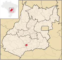
 Porteirão Location in Brazil | |
| Coordinates: 17°49′10″S 50°08′34″W | |
| Country | Brazil |
| Region | Central-West |
| State | Goiás |
| Microregion | Meia Ponte Microregion |
| Area | |
| • Total | 603.9 km2 (233.2 sq mi) |
| Elevation | 470 m (1,540 ft) |
| Population (2020 [1]) | |
| • Total | 3,931 |
| • Density | 6.5/km2 (17/sq mi) |
| Time zone | UTC−3 (BRT) |
| Postal code | 75603-000 |
Geographical Information
Porteirão is located in the Meia Ponte Microregion in the Rio dos Bois basin. It is connected by a state highway (27 km.) with the BR-452 highway, which connects Rio Verde with Itumbiara.
The distance to the state capital, Goiânia, is 178 km. Highway connections from Goiânia are made by GO-040 / Aragoiânia / Cromínia / GO-319 / Pontalina / GO-040 / Aloândia / BR-452 / Bom Jesus de Goiás / GO-410. For the complete list of all distances in Goiás see Seplan
Neighboring municipalities are:
Political Information
- Mayor: Pedro Augusto dos Reis (January 2005 to January 2009)
Demographics
- Population density: 4.98 inhabitants/km2 (2007)
- Urban population: 2,726(2007)
- Rural population: 282 (2007)
- Population growth or loss: 0.91% from 2000/2007
The economy
The economy is based on agriculture, cattle raising, services, public administration, and small transformation industries.
- Industrial units: 2 (2006)
- Commercial units: 45 (2006)
- Cattle herd: 24,280 head (2006)
- Main crops (2006): cotton, rice, sugarcane (13,000 hectares), beans, soybeans (18,000 hectares), sorghum, and corn.
- People employed in agriculture: 1,670
- Number of farming establishments: 43
- Area of the farming establishments: 27,367 ha.
- Area in planted crops: 17,500 ha.
- Farming establishments with tractors: 14
Education (2006)
- Schools: 2 with 821 students
- Higher education: none
- Adult literacy rate: 80.4% (2000) (national average was 86.4%)
Health (2007)
- Hospitals: 0
- Hospital beds: 0
- Ambulatory clinics: 1
- Infant mortality rate: 27.9 (2000) (national average was 33.0).
Qualtity of Life
The municipality achieved a score of 0.724 on the United Nations Human Development Index (2000), ranking it 162 out of 242 municipalities in the state of Goiás. For the complete list see Frigoletto.com
See also
- List of municipalities in Goiás
References
Capital: Goiânia | |||||||||||||||||
 | |||||||||||||||||
| |||||||||||||||||
| |||||||||||||||||
| |||||||||||||||||
На других языках
- [en] Porteirão
[ru] Портейран
Портейран (порт. Porteirão) — муниципалитет в Бразилии, входит в штат Гояс. Составная часть мезорегиона Юг штата Гойас. Входит в экономико-статистический микрорегион Мея-Понти. Население составляет 2983 человека на 2006 год. Занимает площадь 603,917 км². Плотность населения — 4,9 чел./км².Другой контент может иметь иную лицензию. Перед использованием материалов сайта WikiSort.org внимательно изучите правила лицензирования конкретных элементов наполнения сайта.
WikiSort.org - проект по пересортировке и дополнению контента Википедии