world.wikisort.org - Brazil
Paranaiguara is a municipality in south Goiás state, Brazil.
Paranaiguara | |
|---|---|
Municipality | |
 Flag  Coat of arms | |
 Location in Goiás state | |
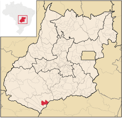
 Paranaiguara Location in Brazil | |
| Coordinates: 18°54′25″S 50°39′19″W | |
| Country | Brazil |
| Region | Central-West |
| State | Goiás |
| Microregion | Quirinópolis Microregion |
| Area | |
| • Total | 1,153.7 km2 (445.4 sq mi) |
| Elevation | 479 m (1,572 ft) |
| Population (2020 [1]) | |
| • Total | 10,140 |
| • Density | 8.8/km2 (23/sq mi) |
| Time zone | UTC−3 (BRT) |
| Postal code | 75880-000 |
Location and Geography
Paranaiguara is in the Quirinópolis Microregion, whose most important city is Quirinópolis. The distance to the state capital, Goiânia, is 351 km. Highway connections are made by BR-060 / Abadia de Goiás / Guapó / Indiara / Acreúna / GO-164 / Quirinópolis / BR-483 / GO-164. See Sepin
There are municipal boundaries with:
- north: Quirinópolis
- south: São Simão
- east: São Simão and Santa Vitória, Minas Gerais
- west: Cachoeira Alta and Caçu
The climate is temperate tropical, with an average annual temperature of 26 °C. There are maximums of 26 °C and minimums of 10 °C. The main river is the Paranaíba, which has tributaries such as the Rio Claro and Ribeirão Alegre.
Demographics
- Population density in 2007: 6.69 inhabitants/km2
- Population growth rate 1996/2007: -0.67.%
- Total population in 2007: 7,724
- Total population in 1980: 6,782
- Urban population in 2007: 6,991
- Rural population in 2007: 733
- Population change: the population has increased by about 960 inhabitants since 1980.
The economy
The economy is based on agriculture, cattle raising, services, public administration, and small transformation industries. In the secondary sector there are clothing industries, brickworks, and a paving company. The cattle herd had 110,000 head (2006) and the main agricultural crops were corn and soybeans.
Economic Data (2007)
- Industrial establishments: 18
- Financial institutions: Banco Itaú S.A. (August/2007)
- Retail establishments in 2007: 88
- Automobiles: 976 (2007)
Main agricultural products in ha.(2006)
- rice: 170
- manioc: 40
- corn: 200
- soybeans: 400
Farm Data (2006)in ha.
- Number of farms: 239
- Total area: 92,485
- Area of permanent crops: 78
- Area of perennial crops: 1,433
- Area of natural pasture: 71,227
- Persons dependent on farming: 566
- Farms with tractors: 102
- Number of tractors: 143 IBGE
Education and Health
There were 05 schools (2006) and 01 hospital with 23 beds (2007).
- Adult literacy rate: 84.3% (2000) (national average was 86.4%)
- Infant mortality rate: 22.10 (2000) (national average was 33.0)
- Ranking on the Municipal Human Development Index: 0.751 (middle)
For the complete list see Frigoletto.com
History
Paranaiguara began in the 1930s when diamond prospectors came into the area. In 1950 the settlement became a district of Quirinópolis and in 1967 it got its emancipation with the present name. The name means "inhabitants of the great river" in Tupi-guarani. In 1976 the construction of the São Simão Dam and reservoir forced the evacuation of the old town, which was moved 15 kilometers away.
See also
- List of municipalities in Goiás
- Microregions of Goiás
- Quirinópolis Microregion
References
Capital: Goiânia | |||||||||||||||||
|  | ||||||||||||||||
|
| |||||||||||||||||
| |||||||||||||||||
| |||||||||||||||||
На других языках
- [en] Paranaiguara
[ru] Паранайгуара
Паранайгуара (порт. Paranaiguara) — муниципалитет в Бразилии, входит в штат Гояс. Составная часть мезорегиона Юг штата Гойас. Входит в экономико-статистический микрорегион Киринополис. Население составляет 8719 человек на 2006 год. Занимает площадь 1 153,786 км². Плотность населения — 7,6 чел./км².Другой контент может иметь иную лицензию. Перед использованием материалов сайта WikiSort.org внимательно изучите правила лицензирования конкретных элементов наполнения сайта.
WikiSort.org - проект по пересортировке и дополнению контента Википедии