world.wikisort.org - Brazil
Garruchos is a municipality in the western part of the state of Rio Grande do Sul, Brazil. The population is 2,886 (2020 est.) in an area of 799.85 km².[2] Its elevation is 69 m by the Uruguay River. It is located 627 km west of the state capital of Porto Alegre, northeast of Alegrete.
Garruchos | |
|---|---|
Municipality | |
 Coat of arms | |
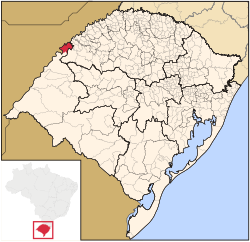 Location in Rio Grande do Sul state | |
 Garruchos Location in Brazil | |
| Coordinates: 28°11′2″S 55°38′20″W | |
| Country | |
| State | Rio Grande do Sul |
| Meso-region | Sudoeste Rio-Grandense |
| Micro-region | Campanha Ocidental |
| Area | |
| • Total | 799.85 km2 (308.82 sq mi) |
| Population (2020 [1]) | |
| • Total | 2,886 |
| • Density | 3.6/km2 (9.3/sq mi) |
| Time zone | UTC−3 (BRT) |
| Postal code | 97685-xxx |
| Website | www |
The town is situated by the Uruguay River which forms the border with Argentina to the west; an Argentine settlement with the same name, Garruchos, is on the other side.
The municipality would be partially flooded by the proposed Garabí Dam.[3]
References
- IBGE 2020
- Instituto Brasileiro de Geografia e Estatística
- Eletrobras apresenta Garabi-Panambi a prefeitos (in Portuguese), Eletrobras CGTEE, 7 April 2014, retrieved 2016-11-11
External links
- http://www.citybrazil.com.br/rs/garruchos/ (in Portuguese)
Capital: Porto Alegre | |||||||||||||||||||||||||||||||
|  | ||||||||||||||||||||||||||||||
|
| |||||||||||||||||||||||||||||||
| |||||||||||||||||||||||||||||||
| |||||||||||||||||||||||||||||||
| |||||||||||||||||||||||||||||||
 | This geographical article relating to Rio Grande do Sul is a stub. You can help Wikipedia by expanding it. |
На других языках
- [en] Garruchos, Rio Grande do Sul
[ru] Гаррушус
Гаррушус (порт. Garruchos) — муниципалитет в Бразилии, входит в штат Риу-Гранди-ду-Сул. Составная часть мезорегиона Юго-запад штата Риу-Гранди-ду-Сул. Входит в экономико-статистический микрорегион Кампанья-Осидентал. Население составляет 4051 человек на 2006 год. Занимает площадь 799,849 км². Плотность населения — 5,1 чел./км².Текст в блоке "Читать" взят с сайта "Википедия" и доступен по лицензии Creative Commons Attribution-ShareAlike; в отдельных случаях могут действовать дополнительные условия.
Другой контент может иметь иную лицензию. Перед использованием материалов сайта WikiSort.org внимательно изучите правила лицензирования конкретных элементов наполнения сайта.
Другой контент может иметь иную лицензию. Перед использованием материалов сайта WikiSort.org внимательно изучите правила лицензирования конкретных элементов наполнения сайта.
2019-2025
WikiSort.org - проект по пересортировке и дополнению контента Википедии
WikiSort.org - проект по пересортировке и дополнению контента Википедии