world.wikisort.org - Brazil
Chapada dos Guimarães is a municipality located in central Brazil, 62 km from the city of Cuiabá, the capital of Mato Grosso State. It is home to the Chapada dos Guimarães National Park. Outside this town is the geographic center of South America.
Chapada dos Guimarães | |
|---|---|
Municipality | |
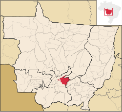 Location in Mato Grosso state | |
 Chapada dos Guimarães Location in Brazil | |
| Coordinates: 15°27′39″S 55°45′00″W | |
| Country | Brazil |
| Region | Central-West |
| State | Mato Grosso |
| Population (2020 [1]) | |
| • Total | 19,453 |
| Time zone | UTC−3 (BRT) |
The municipality contains 77% of the 3,534 hectares (8,730 acres) Rio da Casca Ecological Station, a strictly protected conservation unit created in 1994.[2] The municipal seat contains the 31 hectares (77 acres) Quineira State Park, created in 2006.[3]
References
- IBGE 2020
- ESEC do Rio da Casca (in Portuguese), ISA: Instituto Socioambiental, retrieved 2016-07-18
- PES Quineira (in Portuguese), ISA: Instituto Socioambiental, retrieved 2016-12-10
External links
Wikivoyage has a travel guide for Chapada dos Guimarães.
Municipalities of Mato Grosso | |||||||||||||||||
|---|---|---|---|---|---|---|---|---|---|---|---|---|---|---|---|---|---|
Capital: Cuiabá | |||||||||||||||||
| Centro-Sul Mato-Grossense |
|  | |||||||||||||||
| Nordeste Mato-Grossense |
| ||||||||||||||||
| Norte Mato-Grossense |
| ||||||||||||||||
| Sudeste Mato-Grossense |
| ||||||||||||||||
| Sudoeste Mato-Grossense |
| ||||||||||||||||
Authority control | |
|---|---|
| General |
|
| National libraries | |
This Mato Grosso, Brazil location article is a stub. You can help Wikipedia by expanding it. |
На других языках
[de] Chapada dos Guimarães
Chapada dos Guimarães, amtlich Município de Chapada dos Guimarães, ist eine Stadt mit 18.190 Einwohnern (2009) im brasilianischen Bundesstaat Mato Grosso, 62 km nördlich von Cuiabá. Chapada dos Guimarães bezeichnet auch die gleichnamige felsige 836 Meter hoch gelegene Hochebene, die von Cerrado und Regenwald umgeben ist. Wegen ihrer Wasserfälle, Höhlen, Tafelberge, Canyons und der artenreichen Tierwelt ist sie auch ein touristisches Ziel. Der höchste Wasserfall ist der Cachoeira Véu da Noiva mit 96 Metern.- [en] Chapada dos Guimarães
[ru] Шапада-дус-Гимарайнс
Шапада-дус-Гимарайнс (порт. Chapada dos Guimarães) — муниципалитет в Бразилии, входит в штат Мату-Гросу. Составная часть мезорегиона Юго-центральная часть штата Мату-Гроссу. Входит в экономико-статистический микрорегион Куяба. Население составляет 17 940 человек на 2006 год. Занимает площадь 6 206,573 км². Плотность населения — 2,9 чел./км².Текст в блоке "Читать" взят с сайта "Википедия" и доступен по лицензии Creative Commons Attribution-ShareAlike; в отдельных случаях могут действовать дополнительные условия.
Другой контент может иметь иную лицензию. Перед использованием материалов сайта WikiSort.org внимательно изучите правила лицензирования конкретных элементов наполнения сайта.
Другой контент может иметь иную лицензию. Перед использованием материалов сайта WikiSort.org внимательно изучите правила лицензирования конкретных элементов наполнения сайта.
2019-2026
WikiSort.org - проект по пересортировке и дополнению контента Википедии
WikiSort.org - проект по пересортировке и дополнению контента Википедии