world.wikisort.org - Brazil
Catete is a neighborhood in the South Zone of Rio de Janeiro, Brazil.[1] It has strong commerce, with the majority of population being middle class.
This article needs additional citations for verification. (October 2014) |
Catete | |
|---|---|
Neighborhood | |
 Palácio do Catete | |
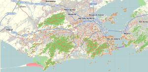 Catete Location in Rio de Janeiro  Catete Catete (Brazil) | |
| Coordinates: 22°55′38″S 43°10′52″W | |
| Country | |
| State | Rio de Janeiro (RJ) |
| Municipality/City | Rio de Janeiro |
| Zone | South Zone |
| Administrative Region | Botafogo |
| Area | |
| • Total | 68.10 ha (168.28 acres) |
| Population (2010) | |
| • Total | 24,057 |
| • Density | 35,000/km2 (91,000/sq mi) |
History
Catete has many historic buildings dating from the colonial period. The district was one of the noblest in Rio until the transfer of the capital city from Rio de Janeiro to Brasília, when its real estate values declined.
Metro stations
Catete is served by two metro stations: Catete and Largo do Machado.[2][3]
References
- "Bairro: Catete". Prefeitura da Cidade do Rio de Janeiro. Archived from the original on 6 October 2014. Retrieved 2 October 2014.
- "Catete - Sobre a Estação". MetrôRio. Retrieved 2 October 2014.
- "Largo do Machado - Sobre a Estação". MetrôRio. Retrieved 2 October 2014.
Authority control | |
|---|---|
| General |
|
| National libraries | |
Текст в блоке "Читать" взят с сайта "Википедия" и доступен по лицензии Creative Commons Attribution-ShareAlike; в отдельных случаях могут действовать дополнительные условия.
Другой контент может иметь иную лицензию. Перед использованием материалов сайта WikiSort.org внимательно изучите правила лицензирования конкретных элементов наполнения сайта.
Другой контент может иметь иную лицензию. Перед использованием материалов сайта WikiSort.org внимательно изучите правила лицензирования конкретных элементов наполнения сайта.
2019-2026
WikiSort.org - проект по пересортировке и дополнению контента Википедии
WikiSort.org - проект по пересортировке и дополнению контента Википедии