world.wikisort.org - Brazil
Engenho Novo is a neighborhood of middle class and lower middle of the North Zone of Rio de Janeiro, Brazil.[1] It neighbors the neighborhoods Méier, Vila Isabel, Lins de Vasconcelos, Sampaio, Jacaré, Cachambi and Grajaú. It has 264.48 hectares of land area. It is part of a region called the Grande Méier encompassing the neighborhoods of the Abolição, Água Santa, Cachambi, Encantado, Engenho de Dentro, Jacaré, Lins de Vasconcelos, Méier, Piedade, Pilares, Riachuelo, Rocha, Sampaio, São Francisco Xavier and Todos os Santos. It is the fifth largest district population group.
Engenho Novo | |
|---|---|
Neighborhood | |
 | |
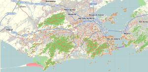 Engenho Novo Location in Rio de Janeiro  Engenho Novo Engenho Novo (Brazil) | |
| Coordinates: 22°54′29″S 43°16′05″W | |
| Country | |
| State | Rio de Janeiro (RJ) |
| Municipality/City | Rio de Janeiro |
| Zone | North Zone |
| Administrative Region | Méier |
| Area | |
| • Total | 264.48 ha (653.54 acres) |
| Population (2010) | |
| • Total | 42,172 |
| • Density | 16,000/km2 (41,000/sq mi) |
The neighborhood is served by the Engenho Novo Station on the Deodoro Line of the Supervia rail network.[2]
It is cut by the Rio Jacaré which is currently severely degraded by urbanization and consequent pollution.
It has an active Residents' Association, whose current President is Dr. Célio Andrade.
History
The occupation of the region known today as Grande Méier began when Estácio de Sá donated the Sesmaria do Iguaçú to Jesuits priests.
Freed slaves built flimsy dwellings in the Morro dos Pretos Forros, region currently covered by the motorway Grajaú-Jacarépagua, increasing the occupation of the region.
References
- "Bairro: Engenho Novo". Prefeitura da Cidade do Rio de Janeiro. Retrieved 3 October 2014.
- "Estações e Integrações". SuperVia. Archived from the original on 3 January 2015. Retrieved 3 October 2014.
This Rio de Janeiro state, Brazil location article is a stub. You can help Wikipedia by expanding it. |
Другой контент может иметь иную лицензию. Перед использованием материалов сайта WikiSort.org внимательно изучите правила лицензирования конкретных элементов наполнения сайта.
WikiSort.org - проект по пересортировке и дополнению контента Википедии