world.wikisort.org - Brazil
Campo Formoso is a municipality in the state of Bahia in the North-East region of Brazil. Campo Formoso covers 7,161.83 km2 (2,765.20 sq mi), and has a population of 71,487 with a population density of 9.2 inhabitants per square kilometer.[1] It is about 248 miles from Bahia's capital Salvador. It is famous for the gems, rare stones and caves that are abundant in the area and it is the host of the cement factory, Cimpor. The city is surrounded by green mountains, and on the edge of one of them there are four transmission towers which allow the population to be connected to the Internet, TV, cable TV, wireless and phone. Campo Formoso has hot weather with temperatures of about 25 °C.[2][3][4][5][6]
Campo Formoso
Terra dos Minérios e Esmeraldas | |
|---|---|
Municipality | |
 Flag  Seal | |
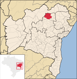 Location of Campo Formoso in Bahia | |
 Campo Formoso Location of Campo Formoso in the Brazil | |
| Coordinates: 10°30′32.04″S 40°19′14.88″W | |
| Country | |
| Region | Northeast |
| State | |
| Founded | July 28, 1880 |
| Government | |
| • Mayor | Rosangela Maria Monteiro de Menezes (PSD)(2017 – 2020) |
| Area | |
| • Total | 7,258.68 km2 (2,802.59 sq mi) |
| Elevation | 566 m (1,857 ft) |
| Population (2020 [1]) | |
| • Total | 71,487 hab. (BA: 28°) |
| Demonym(s) | campo-formosense |
| Time zone | UTC−3 (BRT) |
| Website | campoformoso.ba.gov.br |
See also
- List of municipalities in Bahia
References
- IBGE 2020
- "Campo Formoso" (in Portuguese). Brasília, Brazil: Instituto Brasileiro de Geografia e Estatstica. 2015. Retrieved 2015-07-29.
- "Divisão Territorial do Brasil" (in Portuguese). Divisão Territorial do Brasil e Limites Territoriais, Instituto Brasileiro de Geografia e Estatística (IBGE). July 1, 2008. Retrieved December 17, 2009.
- "Estimativas da população para 1º de julho de 2009" (PDF) (in Portuguese). Estimativas de População, Instituto Brasileiro de Geografia e Estatística (IBGE). August 14, 2009. Retrieved December 17, 2009.
- "Ranking decrescente do IDH-M dos municípios do Brasil" (in Portuguese). Atlas do Desenvolvimento Humano, Programa das Nações Unidas para o Desenvolvimento (PNUD). 2000. Archived from the original on October 3, 2009. Retrieved December 17, 2009.
- "Produto Interno Bruto dos Municípios 2002-2005" (PDF) (in Portuguese). Instituto Brasileiro de Geografia e Estatística (IBGE). December 19, 2007. Archived from the original (PDF) on October 2, 2008. Retrieved December 17, 2009.

 | This Bahia, Brazil location article is a stub. You can help Wikipedia by expanding it. |
На других языках
- [en] Campo Formoso
[ru] Кампу-Формозу
Кампу-Формозу (порт. Campo Formoso) — муниципалитет в Бразилии, входит в штат Баия. Составная часть мезорегиона Северо-центральная часть штата Баия. Входит в экономико-статистический микрорегион Сеньор-ду-Бонфин. Население составляет 61 824 человека на 2006 год. Занимает площадь 6806,097 км². Плотность населения — 9,1 чел./км².Другой контент может иметь иную лицензию. Перед использованием материалов сайта WikiSort.org внимательно изучите правила лицензирования конкретных элементов наполнения сайта.
WikiSort.org - проект по пересортировке и дополнению контента Википедии