world.wikisort.org - Brazil
Irará is a city in Bahia, Brazil. The municipality is the hometown of former professional footballer Dida, of A.C. Milan and Brazil national football team fame and musician Tom Zé.
Irará | |
|---|---|
Municipality | |
 Seal | |
 Location in Bahia | |
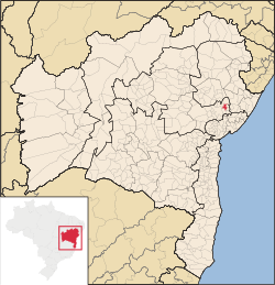
 Irará Location in Brazil | |
| Coordinates: 12°02′45″S 38°45′57″W | |
| Country | |
| Region | Northeast |
| State | Bahia |
| Mesoregion | Centro-Norte Baiano |
| Microregion | Feira de Santana |
| Founded | May 27th, 1842 |
| Incorporated (municipality) | August 8th, 1895 |
| Government | |
| • Mayor | Juscelino Souza |
| Area | |
| • Total | 267.88 km2 (103.43 sq mi) |
| Elevation | 283 m (928 ft) |
| Population (2020)[2] | |
| • Total | 29,173 |
| Time zone | UTC−3 (BRT) |
| CEP postal code | 44255-000 |
| Area code | 75 |
| HDI (2010) [1] | 0,620 |
| Website | irara.ba.gov.br |
Until the 17th century, the region was inhabited by the
Irará was settled by the Paiaiá, a subgroup of the Quiriris peoples. The land was annexed by the Portuguese in the 16th century, and became part of the vast land holdings of Garcia d'Ávila (1528-1609) in the Captaincy of Bahia. The Jesuits explored the area from the north via their settlement in present-day Água Fria. Bandeirantes entered the city to both hunt for precious stones in the Serra de Irará and to enslave indigenous people. Two structures remain from the bandeirantes, a church in the Vila de Bento Simões and a chapel in Caroba.
In mid-1717, the first explorations of the lands in the center of the current municipality were registered, where
Antônio Homem da Fonseca Correia was an early permanent Portuguese settler to the area. He built a chapel dedicated to Our Lady of the Conception in 1717, and left the land to his son. The farmhouse of the family gave rise to the village of Irará, which was also a site of a Paiaiá settlement.
References
- "Área dos municípios" [Area of the municipalities] (in Portuguese). Brazilian Institute of Geography and Statistics(IBGE). Retrieved 2018-04-13.
- IBGE 2020
Capital: Salvador | |||||||||||||||||||||
|  | ||||||||||||||||||||
|
| |||||||||||||||||||||
| |||||||||||||||||||||
| |||||||||||||||||||||
| |||||||||||||||||||||
| |||||||||||||||||||||
| Authority control |
|
|---|
 | This Bahia, Brazil location article is a stub. You can help Wikipedia by expanding it. |
На других языках
- [en] Irará
[ru] Ирара
Ирара (порт. Irará) — муниципалитет в Бразилии, входит в штат Баия. Составная часть мезорегиона Северо-центральная часть штата Баия. Входит в экономико-статистический микрорегион Фейра-ди-Сантана. Население составляет 26 107 человек на 2006 год. Занимает площадь 239,659 км². Плотность населения — 108,9 чел./км².Другой контент может иметь иную лицензию. Перед использованием материалов сайта WikiSort.org внимательно изучите правила лицензирования конкретных элементов наполнения сайта.
WikiSort.org - проект по пересортировке и дополнению контента Википедии