world.wikisort.org - Brazil
Agudos is a Brazilian municipality located in the west-central part of the state of São Paulo. The population is 37,401 (2020 est.) in an area of 966 km².[2] Distance from the capital is 330 km and is accessed by the Rodovia Marechal Rondon. The municipality was established in 1898, when it was separated from Lençóis.[3]
Agudos | |
|---|---|
Municipality | |
 | |
 Flag | |
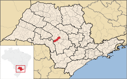 Location in São Paulo state | |
 Agudos Location in Brazil | |
| Coordinates: 22°28′26″S 48°59′1″W | |
| Country | Brazil |
| Region | Southeast |
| State | São Paulo |
| Area | |
| • Total | 966 km2 (373 sq mi) |
| Elevation | 580 m (1,900 ft) |
| Population (2020 [1]) | |
| • Total | 37,401 |
| • Density | 39/km2 (100/sq mi) |
| Time zone | UTC-03:00 (BRT) |
| • Summer (DST) | UTC-02:00 (BRST) |
| Postal code | 17120-000 |
Geography
Limits
- Bauru
- Lençóis Paulista
- Pederneiras
- Borebi
- Piratininga
- Cabrália Paulista
- Paulistânia
Economy
Agudos; economy is an agricultural municipality and have some industries of national prominence as Duratex and the Ambev. The municipal agricultural production is made up of:
- Pineapples
- Sugar cane
- Cassava
- Corn
- Orange
- Lemon
- Tangerina
The Duratex industry possesses extensive reserves in the city that are managed by the Duraflora. The cattle of Agudos has about 70,000 cows, 10,000 swines and 300,000 chickens.
References
External links
- (in Portuguese) Agudos website
| Authority control |
|
|---|
This geographical article relating to the state of São Paulo is a stub. You can help Wikipedia by expanding it. |
На других языках
- [en] Agudos
[ru] Агудус
Агудус (порт. Agudos) — муниципалитет в Бразилии, входит в штат Сан-Паулу. Составная часть мезорегиона Бауру. Входит в экономико-статистический микрорегион Бауру. Население составляет 34 185 человек на 2006 год. Занимает площадь 967,591 км². Плотность населения — 35,3 чел./км².Другой контент может иметь иную лицензию. Перед использованием материалов сайта WikiSort.org внимательно изучите правила лицензирования конкретных элементов наполнения сайта.
WikiSort.org - проект по пересортировке и дополнению контента Википедии