world.wikisort.org - Belgium
Heers (Dutch pronunciation: [ˈɦeːrs] (![]() listen), Limburgish: Hiër [ˈɦiəʀ])[tone?] is a municipality located in the Belgian province of Limburg. Since 1971 it comprises the parishes Batsheers, Opheers, Veulen, Gutschoven and Mettekoven, and since 1977 also Mechelen-Bovelingen, Rukkelingen-Loon (which in 1971 had formed Bovelingen), Heks, Horpmaal, Vechmaal (which in 1971 had formed Heks), and Klein-Gelmen (which between 1971 and 1977 had been part of Gelmen, during those years a separate municipality of which the other parishes now belong to the municipality of Sint-Truiden).
listen), Limburgish: Hiër [ˈɦiəʀ])[tone?] is a municipality located in the Belgian province of Limburg. Since 1971 it comprises the parishes Batsheers, Opheers, Veulen, Gutschoven and Mettekoven, and since 1977 also Mechelen-Bovelingen, Rukkelingen-Loon (which in 1971 had formed Bovelingen), Heks, Horpmaal, Vechmaal (which in 1971 had formed Heks), and Klein-Gelmen (which between 1971 and 1977 had been part of Gelmen, during those years a separate municipality of which the other parishes now belong to the municipality of Sint-Truiden).

Heers | |
|---|---|
Municipality | |
 Vechmaal: Sint Martinus church | |
 Flag Coat of arms | |
 Heers Location in Belgium
Location of Heers in Limburg 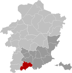 | |
| Coordinates: 50°45′N 05°17′E | |
| Country | Belgium |
| Community | Flemish Community |
| Region | Flemish Region |
| Province | Limburg |
| Arrondissement | Tongeren |
| Government | |
| • Mayor | Henri Dumont (VLDumont) |
| • Governing party/ies | VLDumont |
| Area | |
| • Total | 53.07 km2 (20.49 sq mi) |
| Population (2018-01-01)[1] | |
| • Total | 7,290 |
| • Density | 140/km2 (360/sq mi) |
| Postal codes | 3870 |
| Area codes | 011 |
| Website | www.heers.be |
References
- "Wettelijke Bevolking per gemeente op 1 januari 2018". Statbel. Retrieved 9 March 2019.
External links
 Media related to Heers at Wikimedia Commons
- Site (personal) on Heers – Description of and historical information about each of the parishes of Heers (in Dutch)
Places adjacent to Heers | ||||||||||||||||
|---|---|---|---|---|---|---|---|---|---|---|---|---|---|---|---|---|
| ||||||||||||||||
Municipalities in the province of Limburg, Flanders, Belgium | ||
|---|---|---|
| Hasselt |
|  |
| Maaseik |
| |
| Tongeren |
| |
| Authority control |
|
|---|
This Belgian Limburg location article is a stub. You can help Wikipedia by expanding it. |
Текст в блоке "Читать" взят с сайта "Википедия" и доступен по лицензии Creative Commons Attribution-ShareAlike; в отдельных случаях могут действовать дополнительные условия.
Другой контент может иметь иную лицензию. Перед использованием материалов сайта WikiSort.org внимательно изучите правила лицензирования конкретных элементов наполнения сайта.
Другой контент может иметь иную лицензию. Перед использованием материалов сайта WikiSort.org внимательно изучите правила лицензирования конкретных элементов наполнения сайта.
2019-2026
WikiSort.org - проект по пересортировке и дополнению контента Википедии
WikiSort.org - проект по пересортировке и дополнению контента Википедии