world.wikisort.org - Bangladesh
Shariatpur Sadar (Bengali: শরিয়তপুর সদর) is an upazila of Shariatpur District in the Division of Dhaka, Bangladesh. Shariatpur Thana was converted into an upazila in 1984.[3] The upazila takes its name from the district and the Bengali word sadar (headquarters). It is the subdistrict where the district headquarters, Shariatpur town, is located.
Shariatpur Sadar
শরিয়তপুর সদর | |
|---|---|
Upazila | |
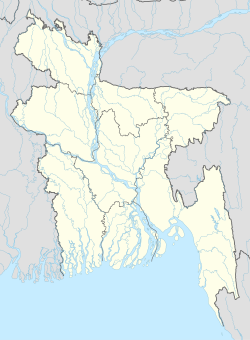  Shariatpur Sadar Location in Bangladesh | |
| Coordinates: 23°13′N 90°21′E | |
| Country |  Bangladesh Bangladesh |
| Division | Dhaka Division |
| District | Shariatpur District |
| Area | |
| • Total | 175.09 km2 (67.60 sq mi) |
| Population (2011 census)[2] | |
| • Total | 211,259 |
| • Density | 1,200/km2 (3,100/sq mi) |
| Time zone | UTC+6 (BST) |
| Postal code | 8000-8002 |
| Website | sadar |
Geography
Shariatpur Sadar Upazila has a total area of 175.09 square kilometres (67.60 sq mi).[1] It borders Zajira Upazila to the north, Naria and Bhedarganj upazilas to the east, Damudya Upazila to the southeast, and Madaripur District to the south and west.[3]
Demographics
| Year | Pop. (000) | ±% |
|---|---|---|
| 1981 | 145 | — |
| 1991 | 161 | +11.0% |
| 2001 | 199 | +23.6% |
| 2011 | 210 | +5.5% |
| Source: Bangladesh Bureau of Statistics[1] | ||
According to the 2011 Bangladesh census, Shariatpur Sadar Upazila had 45,883 households and a population of 210,259, 23.6% of whom lived in urban areas. 10.5% of the population was under the age of 5. The literacy rate (age 7 and over) was 51.2%, compared to the national average of 51.8%.[2][4]
Administration
Shariatpur Sadar Upazila is divided into Shariatpur Municipality and 11 union parishads: Angaria, Binodpur, Chandrapur, Chikandi, Chitalia, Domsar, Mahmudpur, Palong, Rudrakar, Shaul Para, and Tulasar. The union parishads are subdivided into 105 mauzas and 152 villages.
Shariatpur Municipality was established in 1990.[3] It is subdivided into 9 wards and 27 mahallas.[1]
Education
There are three colleges in the upazila. They include the public Shariatpur Government College.[1]
According to Banglapedia, Palong Tulasar Gurudas Government High School is a notable secondary school.[3]
The madrasa education system includes one fazil madrasa.[5]
There is a private university in this district named Z. H. Sikder University of science and technology http://www.zhsust.edu.bd/ in bhedorgonj upazila. One newly established private medical college is also in this area named Monowara sikder medical college and hospital http://sikderhospital.com/
See also
- Upazilas of Bangladesh
- Districts of Bangladesh
- Divisions of Bangladesh
References
- "District Statistics 2011: Shariatpur" (PDF). Bangladesh Bureau of Statistics. Archived from the original (PDF) on August 12, 2014. Retrieved July 25, 2014.
- "Community Report: Shariatpur" (PDF). Population & Housing Census 2011. Bangladesh Bureau of Statistics. Retrieved 2018-08-15.
- Khan, Md. Shajahan (2012). "Shariatpur Sadar Upazila". In Islam, Sirajul; Jamal, Ahmed A. (eds.). Banglapedia: National Encyclopedia of Bangladesh (Second ed.). Asiatic Society of Bangladesh.
- "Population and Housing Census 2011: Bangladesh at a Glance" (PDF). Bangladesh Bureau of Statistics. Archived from the original (PDF) on July 28, 2014. Retrieved July 21, 2014.
- "List of Institutions". Ministry of Education. Retrieved July 15, 2014.
Shariatpur District | ||
|---|---|---|
Capital: Shariatpur | ||
| Upazilas |
|  |
| Constituencies |
| |
| Sites and attractions |
| |
| Inhabited areas | ||
| Education |
| |
| History |
| |
| Rivers | ||
| Transport |
| |
| See also |
| |
| Upazilas of the Dhaka Division | ||
|---|---|---|
Headquarters: Dhaka | ||
| Dhaka District |
|  |
| Faridpur District |
| |
| Gazipur District |
| |
| Gopalganj District |
| |
| Kishoreganj District | ||
| Madaripur District | ||
| Manikganj District |
| |
| Munshiganj District |
| |
| Narayanganj District | ||
| Narsingdi District | ||
| Rajbari District | ||
| Shariatpur District |
| |
| Tangail District | ||
На других языках
- [en] Shariatpur Sadar Upazila
[ru] Шариатпур-Садар
Шариатпур-Садар (бенг. শরিয়তপুর সদর, англ. Shariatpur Sadar) — подокруг в центральной части Бангладеш. Входит в состав округа Шариатпур. Административный центр — город Шариатпур. Площадь подокруга — 175,08 км². По данным переписи 1991 года численность населения подокруга составляла 161 962 человека. Плотность населения равнялась 925 чел. на 1 км². Уровень грамотности населения составлял 25,3 %. Религиозный состав: мусульмане — 92,20 %, индуисты — 7,40 %, прочие — 0,40 %.Другой контент может иметь иную лицензию. Перед использованием материалов сайта WikiSort.org внимательно изучите правила лицензирования конкретных элементов наполнения сайта.
WikiSort.org - проект по пересортировке и дополнению контента Википедии