world.wikisort.org - Bangladesh
Brahmanpara (Bengali: ব্রাহ্মণপাড়া) is an upazila of Comilla District in the Division of Chittagong, Bangladesh.[1]
Brahmanpara
ব্রাহ্মণপাড়া | |
|---|---|
Upazila | |
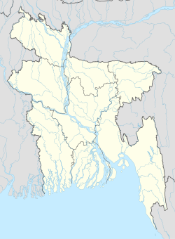  Brahmanpara Location in Bangladesh | |
| Coordinates: 23°37′N 91°6.5′E | |
| Country |  Bangladesh Bangladesh |
| Division | Chittagong Division |
| District | Comilla District |
| Area | |
| • Total | 128.9 km2 (49.8 sq mi) |
| Population (1991) | |
| • Total | 161,906 |
| • Density | 1,300/km2 (3,300/sq mi) |
| Time zone | UTC+6 (BST) |
| Website | Official Map of Brahmanpara |

Geography
It has a total area of 128.9 km2.
Demographics
According to the 1991 Bangladesh census, Brahmanpara It had a population of 161,906 living in 26,493 households. Males constituted 50.98% of the population and females 49.02%. The population of 18 and older was 72,500. Brahmanpara had an average literacy rate of 32.6% (7+ years), against the national average of 32.4%.[2]
Administration
Brahmanpara Upazila is divided into Brahmanpara Municipality and eight union parishads: Brahmanpara, Chandla, Dulalpur, Madhabpur, Malapara, Shahebabad, Shashidal, and Shidli. The union parishads are subdivided into 53 mauzas and 65 villages.[3]
The incumbent MP in this Thana is Abdul Matin Khasru, the former Law, Justice and parliamentary minister. The Upazila chairman is M A Zaher.
See also
- Upazilas of Bangladesh
- Districts of Bangladesh
- Divisions of Bangladesh
References
- Sattar, Md Abdus (2012). "Brahmanpara Upazila". In Islam, Sirajul; Jamal, Ahmed A. (eds.). Banglapedia: National Encyclopedia of Bangladesh (Second ed.). Asiatic Society of Bangladesh.
- "Population Census Wing, BBS". Archived from the original on 2005-03-27. Retrieved November 10, 2006.
- "District Statistics 2011: Comilla" (PDF). Bangladesh Bureau of Statistics. Archived from the original (PDF) on 13 November 2014. Retrieved 14 July 2014.
Comilla District | |||||
|---|---|---|---|---|---|
Capital: Comilla | |||||
| Upazilas |
|  | |||
| Constituencies |
| ||||
| Attractions and sites |
| ||||
| History |
| ||||
| Inhabited areas |
| ||||
| Rivers and transport |
| ||||
| Education |
| ||||
| Organisations/projects |
| ||||
| See also |
| ||||
| Upazilas of the Chattogram Division | ||
|---|---|---|
Capital: Chattogram | ||
| Bandarban District |
|  |
| Brahmanbaria District |
| |
| Chandpur District |
| |
| Chattogram District | ||
| Cumilla District |
| |
| Cox's Bazar District | ||
| Feni District |
| |
| Khagrachari District |
| |
| Lakshmipur District |
| |
| Noakhali District |
| |
| Rangamati District |
| |
 | This Chittagong Division location article is a stub. You can help Wikipedia by expanding it. |
Другой контент может иметь иную лицензию. Перед использованием материалов сайта WikiSort.org внимательно изучите правила лицензирования конкретных элементов наполнения сайта.
WikiSort.org - проект по пересортировке и дополнению контента Википедии