world.wikisort.org - Australia
Seymour (/ˈsiːmɔːr/)[2] is a historic railway township located in the Southern end of the Goulburn Valley in the Shire of Mitchell, Victoria, Australia and is located 104 kilometres (65 mi) north of Melbourne. At the 2021 census, Seymour had a population of 6,569.[1] The township services the surrounding agricultural industries (primarily equine, cattle, sheep and wine) as well as the nearby military base of Puckapunyal (population 1,176[3]), which is an important training centre for the Australian Army. Other important sectors of employment in Seymour include retail, light engineering, agricultural services support, medical services, and education.
| Seymour Victoria | |||||||||||||||
|---|---|---|---|---|---|---|---|---|---|---|---|---|---|---|---|
 Tallarook Street during Autumn | |||||||||||||||
 Seymour | |||||||||||||||
| Coordinates | 37°1′48″S 145°7′48″E | ||||||||||||||
| Population | 6,569 (2021)[1] | ||||||||||||||
| Established | 1839 | ||||||||||||||
| Postcode(s) | 3660 | ||||||||||||||
| Elevation | 148 m (486 ft) | ||||||||||||||
| Location |
| ||||||||||||||
| LGA(s) | Shire of Mitchell | ||||||||||||||
| State electorate(s) | Euroa | ||||||||||||||
| Federal division(s) | Nicholls | ||||||||||||||
| |||||||||||||||
| |||||||||||||||
History
The Taungurung people are the traditional owners and inhabitants of the area Seymour now occupies. Specifically, it is the land of the Buthera Balug clan who occupied the area when Europeans first settled the region in the early 1800s. In 1824, Hume and Hovell on their return from Port Phillip, camped by the Goulburn River not far upstream of Seymour. In 1836 Major Thomas Mitchell crossed the Goulburn at Mitchellstown and soon afterwards overlanders and other early settlers began to use this crossing place on the Melbourne–Sydney route (now known as the Hume Highway). The mail service between Melbourne and Sydney had been operating for just a year when it was found that a better route was available using the "New Crossing Place".
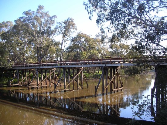
The Robert Burns Inn was operating there by the end of 1839. In 1841 the Government decided that the new crossing place was the likely spot for a town. Plans were laid before the Executive Council of NSW and Mitchell proposed the name Seymour which was approved on 21 December 1843. The town was named after Lord Seymour, the son of the 11th Duke of Somerset. The Post Office opened on 1 July 1844.[4] The railway arrived in 1872 along with substantial infrastructure to support it, establishing the town as an important rail hub for the Goulburn Valley, the Melbourne–Sydney railway and North Eastern Victoria. It was one of the first Victorian examples of the railway town phenomenon, in the heyday of the railway it employed 400 men and along with their families comprised one-third of the town, or 1500 people.[5] In 1871 the Shire of Seymour was established which also included the towns and localities of Avenel, Mangalore, Tallarook, Whiteheads Creek, Trawool, Hilldene and Northwood .It was proclaimed The Rural City of Seymour in 1993, in 1994 The Rural City of Seymour was abolished and incorporated into the Shire of Mitchell.
Puckapunyal Army base
The Australian Army first established a large training camp 4 kilometres (2.5 mi) east of the township during the First World War. During the Second World War, the eastern camp diminished in importance and a substantially larger and more permanent military township was established 10 kilometres (6.2 mi) to the west at Puckapunyal.[6] As of 2008[update] Puckapunyal is the centre for the Australian Army's Land Warfare Development Centre (LWDC)[7] and Headquarters Combined Arms Training Centre (HQ CATC),[8] with three of the Army's five Schools located on site. Additionally, there are smaller training centres and facilities as well as the Road Transport Wing of the Army Logistic Training Centre's Army School of Transport based in Puckapunyal.[7] The base is also home to the Royal Australian Armoured Corps Memorial and Army Tank Museum.[9]
Wine
Seymour is located at the southern end of the Goulburn Valley wine region. The main influencing factors in the Goulburn Valley wine region are the hills of the Great Dividing Range and the Goulburn River which mitigates lengthy and warm summers.
Top varieties: Shiraz, Chardonnay, Cabernet Sauvignon, Riesling and Marsanne
Soil types: sandy clay loams, clay loams and gritty, gravelly quartzose sands
There are several wineries in and near the township which include Wine x Sam, Tahbilk, Mitchelton Winery, Fowles Wines, Kensington Wines and several other boutique vineyards Box Grove vineyard, Brave Goose vineyard, Somerset Crossing vineyard, Vitto Oles Wines and Traawool Valley wines.
Each year Tastes of the Goulburn food and wine festival is hosted in Seymour, showcasing the best local produce from the Goulburn Valley.[10] Seymour also hosts the Victorian Wine Show.[11]
Education
Seymour College is the government school, providing classes from Prep to Year 12. The college was created in 2010 through a merger of Seymour Technical High School (STHS), Seymour Primary School (SPS) Seymour East Primary School (SEPS) and Seymour Special School (SSS) located in Loco Street.
St Mary's College is a Prep to Year 10 Catholic school located in High Street.
The Seymour campus of the Goulburn Ovens Institute of TAFE, opened in 1998, provides a variety of short courses and vocational education and training.
Transport

Seymour is located adjacent to the junction of the Hume and Goulburn Valley Highway. The Hume Highway crossed the Goulburn River and diverted all Melbourne-Sydney bound traffic though the township for over 100 years until a freeway bypass was opened routing all non-local and interstate traffic around the township in 1982.[citation needed]
Seymour station is served by regular V/Line hourly services to and from Melbourne Southern Cross station as well as services on the Albury and Shepparton lines. The station was once a major freight marshalling location and the home of a significant locomotive depot.
Victoria's electronic ticketing system, Myki, was implemented on rail services between Seymour and Melbourne on 24 June 2013.[12]
Community
Seymour is host to many community and service groups including Freemasonry (established in Seymour in 1883), Rotary, the Lions Club, Scouting, Apex Clubs of Australia and Probus. In addition, local advocacy groups include The Seymour We Want, locally based offices of statewide organisations including Berry Street and Closing The Health Gap (amongst others).
Sport
Seymour is well equipped with sporting facilities that include an indoor multi-purpose sports and aquatic centre, outdoor pool as well as a number of large playing fields for athletics, cricket and football. Seymour has a number of successful and well resourced sporting clubs including Cricket, Tennis, Football, Lawn Bowls, Kick Boxing, Basketball and Netball.
Seymour Cricket Club (est. 1859) has its club rooms and main ground located at Chittick Park, competes in the Seymour and District Cricket Association fielding 2 senior and 1 junior teams in the 2022/23 season
Eastern Hill Cricket Club whose home ground is at Kings Park, compete in the Seymour and District Cricket Association fielding 3 senior and 3 junior teams.
Seymour Football Club compete in the Goulburn Valley Football League.[13]
Seymour has a horse racing club, the Seymour Racing Club, which schedules around twenty race meetings a year including the Seymour Cup meeting in October.[14]
Golfers play at the course of the Seymour Golf Club on Yea Road.[15]
Media
- Seymour Telegraph
- North Central Review
- The Situation
Radio
FM
- 103.9 FM – Seymour-FM (Community Radio for Northern Mitchell Shire & Strathbogie Shire)
- 88.9 FM – UGFM Upper Goulburn / Murrindindi Radio (Yea translator/repeater)
- 87.6 FM – HIT RADIO (Youth / Top 40 / Dance / Features)
Shepparton radio heard in Seymour
- 93.7 FM – STAR FM (Flowerdale/Seymour Re-Transmission Site)
- 94.5 FM – ABC Triple J
- 95.3 FM – 3SR FM (3SSR) (Classic Hits – commercial radio)
- 96.1 FM – ABC Classic FM
- 96.9 FM – Star FM (Contemporary Hits commercial radio)
- 97.7 FM – ABC Local Radio (relay of 774 Melbourne)
- 98.5 FM – ONE FM Community Radio (Poor reception in Seymour)
- 1260 AM – Sport 927 (Relay of 927 AM Melbourne – Racing)
Melbourne radio heard in Seymour
- 621 AM – ABC Radio National
- 693 AM – 3AW (Talkback / Sport)
- 774 AM – ABC Metropolitan Radio
- 927 AM – Sport 927 (Racing)
Television
Local Free-to-Air TV channels in Seymour are available from Shepparton and broadcast from a relay transmitter located south of Seymour on West Falls Road at Meadows Hill. Viewers located on the outskirts of Seymour and nearby towns can receive reception from the Mount Major transmitter east of Shepparton or Bendigo via the Mount Alexander transmitter.
- ABC (plus ABC HD, ABC TV Plus, ABC Kids, ABC Me & ABC News)
- SBS (plus SBS HD, SBS Viceland, SBS World Movies, SBS Food & NITV)
- Prime7 (plus 7HD, 7TWO, 7mate & 7flix)
- WIN (plus 9HD, 9Gem, 9Go! & 9Life)
- Southern Cross 10 (plus 10 HD, 10 Bold, 10 Peach & 10 Shake)
References
- "2021 Seymour (Vic.), Census All persons QuickStats | Australian Bureau of Statistics".
- Macquarie Dictionary, Fourth Edition (2005). Melbourne, The Macquarie Library Pty Ltd. ISBN 1-876429-14-3
- Australian Bureau of Statistics (25 October 2007). "Community Profile Series : Puckapunyal (State Suburb)". 2006 Census of Population and Housing. Retrieved 27 June 2007.
- Phoenix Auctions History, Post Office List, retrieved 11 March 2021
- John C. Jennings and Robert K. Whitehead (July 2005), Seymour – A Railway Town, Seymour and District Historical Society, p. 3, ISBN 0-9751658-0-1
- Dennis et al. (eds.), The Oxford Companion to Australian Military History, p. 435
- Puckapunyal Redevelopment: Statement of Evidence to the Parliamentary Standing Committee on Public Works. Department of Defence. 2008. p. 1.
- "Australian Army skills at Arms Meet 2018". Media Releases. Department of Defence. 4 May 2018. Retrieved 7 June 2018.
- "RAAC Memorial & Army Tank Museum". Culture Victoria. Retrieved 10 February 2019.
- "Tastes of the Goulburn". Retrieved 12 September 2017.
- "Victorian Wine Show". Retrieved 12 September 2017.
- "Myki to start on VLine Commuter Services". Public Transport Victoria. Retrieved 7 August 2013.
- Full Points Footy, Seymour, archived from the original on 14 April 2008, retrieved 25 July 2008
- Country Racing Victoria, Seymour Racing Club, archived from the original on 19 July 2008, retrieved 7 May 2009
- Golf Select, Seymour, retrieved 11 May 2009
Further reading
- John C. Jennings and Robert K. Whitehead (July 2005), Seymour – A Railway Town, Seymour and District Historical Society, ISBN 0-9751658-0-1
External links
![]() Media related to Seymour, Victoria at Wikimedia Commons
Media related to Seymour, Victoria at Wikimedia Commons
На других языках
[de] Seymour (Victoria)
Seymour ist eine Stadt im australischen Bundesstaat Victoria 98 km nördlich Melbourne. Sie liegt in der Local Government Area Mitchell Shire und hat laut der letzten Volkszählung 2016 eine Einwohnerzahl von 6063.[1] Die Stadt dient als Mittelzentrum für die umliegende Landwirtschaft (hauptsächlich Pferde-, Rinder- und Schafzucht sowie Weinanbau) und die nahegelegene Militärbasis Puckapunyal (Bevölkerung: 1078[2]), auf der ein wichtiges Trainingszentrum der australischen Streitkräfte liegt. Weitere wichtige Wirtschaftszweige sind der Einzelhandel, der Leichtmaschinenbau, die Agrarindustrie, medizinische Dienste und Bildung.- [en] Seymour, Victoria
Другой контент может иметь иную лицензию. Перед использованием материалов сайта WikiSort.org внимательно изучите правила лицензирования конкретных элементов наполнения сайта.
WikiSort.org - проект по пересортировке и дополнению контента Википедии